1980s Maps of Bear Lake County, Idaho
Explore 6 historic maps of Bear Lake County from the 1980s. These maps offer a rare glimpse into what life looked like during the 1980s — showing old roads, neighborhoods, homes, and landmarks that have changed or disappeared over time.
Whether you're researching your family's past, planning a metal detecting trip, or studying how Bear Lake County's landscape evolved across the 1980s, these high-resolution maps are a powerful tool for exploring the history of this region.
- Focus on a specific era: All maps on this page are from the 1980s, giving you a focused view of this time period.
- See what’s changed: Compare century-old streets, trails, and buildings to today's modern landscape using overlays and satellite layers.
- Research with precision: Use these maps for genealogy, historical research, land use analysis, or educational projects.
- View, download, or print: Maps are fully viewable online in high resolution, and can be downloaded or printed for your own records.
Start exploring Bear Lake County's history through authentic maps from the 1980s. This is your window into the past.
Bear Lake County, ID maps
(6)- 1980 Map of Elk Valley
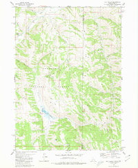 1980 Elk Valley1980 Print · USGSThe high ridges of the Gannett Hills straddle the Idaho and Wyoming border during the early eighties, marking a remote wilderness between two national forests. Researchers can trace historic backcountry routes like the Pack Trail past landmarks such as The Pinnacle and Clover Knoll.2 unique versions available
 - 1982 Map of Soda Peak
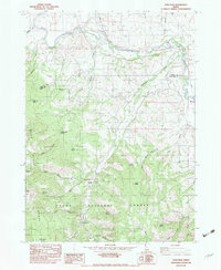 1982 Soda Peak1982 Print · USGSThe Bear River valley at the Idaho-Wyoming border appears here in the early eighties as a landscape of irrigation and mountain transit. Genealogists and historians can trace the Union Pacific corridor through Manson or locate backcountry sites like Camp Ho-Nok and the Eightmile FS Station.
 - 1982 Map of Soda Springs
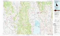
 1982 Soda Springs1982 Print · USGSSoutheast Idaho and the Wyoming borderlands come alive in the early eighties as a landscape of mountain ranges and industrial valleys. Genealogists and historians can locate remote family plots like Lund Cem or trace the early paths through Fivemile Meadows and the Fort Hall Indian Reservation.2 unique versions available
 - 1982 Map of Grace
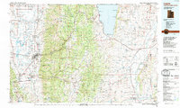
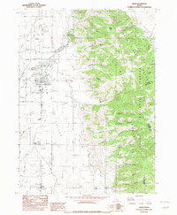 1982 Grace1982 Print · USGSGem Valley thrived in the early eighties as a hub of irrigation and agriculture along the Bear River. Genealogists and local historians can locate families near Grace, trace the Grace Cemetery, and find smaller landmarks like Niter and the High Sch.
 - 1983 Map of Preston
 1983 Preston1983 Print · USGSSoutheast Idaho and the tri-state border region thrived on a mix of mountain agriculture and rail transport in the early eighties. Genealogists and historians can trace the Union Pacific corridor through Preston or locate family landmarks in Mound Valley and Paris.
 - 1984 Map of Logan, 1985 Print
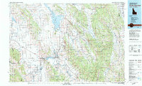
 1984 Logan1985 Print · USGSNorthern Utah and its borderlands with Idaho and Wyoming are shown here in the mid-1980s as the Cache Valley communities grew. Researchers can trace the Union Pacific rail lines and find legacy sites like College Ward, Pickleville, and Utah State University.3 unique versions available
End of results
Showing maps 1-6 of 6
Top cities of Bear Lake County
- Montpelier historical maps
- Paris historical maps
- Georgetown historical maps
- Bloomington historical maps
Frequently asked questions
- What are the different types of historical maps available for Bear Lake County?
- What is the oldest map of Bear Lake County?
- Where can I purchase historical maps of Bear Lake County for my home or office?
- Where can I download high-res historical maps of Bear Lake County?
- Are there historical topographic maps available for Bear Lake County?
- Is there historical aerial imagery available for Bear Lake County?
- Where are historical maps of Bear Lake County sourced from?