1970s Maps of Bear Lake Sands, Idaho
Explore 2 historic maps of Bear Lake Sands from the 1970s. These maps offer a rare glimpse into what life looked like during the 1970s — showing old roads, neighborhoods, homes, and landmarks that have changed or disappeared over time.
Whether you're researching your family's past, planning a metal detecting trip, or studying how Bear Lake Sands's landscape evolved across the 1970s, these high-resolution maps are a powerful tool for exploring the history of this region.
- Focus on a specific era: All maps on this page are from the 1970s, giving you a focused view of this time period.
- See what’s changed: Compare century-old streets, trails, and buildings to today's modern landscape using overlays and satellite layers.
- Research with precision: Use these maps for genealogy, historical research, land use analysis, or educational projects.
- View, download, or print: Maps are fully viewable online in high resolution, and can be downloaded or printed for your own records.
Start exploring Bear Lake Sands's history through authentic maps from the 1970s. This is your window into the past.
Bear Lake Sands, ID maps
(2)- 1970 Map of Bear Lake North, 1973 Print
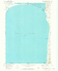 1970 Bear Lake North1973 Print · USGSThe northern reaches of the Idaho-Utah border come alive in the 1970s, centered on the diverse shorelines of Bear Lake. Trace the development of North Beach State Park and locate historic sites like Bear Lake Hot Springs and the settlement of Lifton.
 - 1977 Map of Bear Lake North, 1980 Print
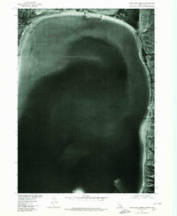 1977 Bear Lake North1980 Print · USGSThe northern shores of the Idaho-Utah border appear in sharp detail during the late seventies, showing the landscape just as modern recreational use was evolving. Researchers can trace the shoreline geography near Lifton, the marshy borders of Mud Lake, and the prominent Bear Lake Sands.
End of results
Showing maps 1-2 of 2
Top cities near Bear Lake Sands
Frequently asked questions
- What are the different types of historical maps available for Bear Lake Sands?
- What is the oldest map of Bear Lake Sands?
- Where can I purchase historical maps of Bear Lake Sands for my home or office?
- Where can I download high-res historical maps of Bear Lake Sands?
- Are there historical topographic maps available for Bear Lake Sands?
- Is there historical aerial imagery available for Bear Lake Sands?
- Where are historical maps of Bear Lake Sands sourced from?