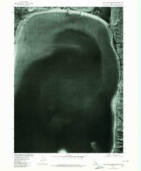
1977 Map of Bear Lake North
USGS Topo · Published 1980About this map
Bear Lake dominates this 1977 orthophotograph, captured during a period when the northern shoreline was defined by the intersection of natural hydrology and early engineering. The settlement of Lifton sits at a critical junction near the northern tip of the lake, adjacent to the marshy expanse of Mud Lake. This map, produced by the Geological Survey in cooperation with the Soil Conservation Service, provides a detailed visual record of the shoreline before modern development altered the northern reaches. The wide, distinctive arc of the Bear Lake Sands stretches along the eastern shore, illustrating the massive deposit of lake-bed material that has historically characterized this area. To the northwest, the small outlet of Little Creek feeds into the main body of water, marking a subtle transition in the otherwise vast aquatic landscape of the Idaho-Utah border region.
Find a feature on this map
5 named features on this map. Tap any name to fly to it.
Don’t see what you’re looking for? This feature index may not catch every label — zoom into the map to look around manually.
Map Details
Editions of this 1977 Bear Lake North Map
This is the sole edition of this map. No revisions or reprints were ever made.
Other maps of this area

1909 · Montpelier
USGS Topo · 1:125,000

1911 · Montpelier
USGS Topo · 1:125,000

1912 · Randolph
USGS Topo · 1:125,000

1954 · Ogden
USGS Topo · 1:250,000

1955 · Preston
USGS Topo · 1:250,000

1958 · Ogden
USGS Topo · 1:250,000

1958 · Preston
USGS Topo · 1:250,000

1960 · Ogden
USGS Topo · 1:250,000

1962 · Preston
USGS Topo · 1:250,000

1967 · Paris
USGS Topo · 1:24,000