1990s Maps of Boundary County, Idaho
Explore 31 historic maps of Boundary County from the 1990s. These maps offer a rare glimpse into what life looked like during the 1990s — showing old roads, neighborhoods, homes, and landmarks that have changed or disappeared over time.
Whether you're researching your family's past, planning a metal detecting trip, or studying how Boundary County's landscape evolved across the 1990s, these high-resolution maps are a powerful tool for exploring the history of this region.
- Focus on a specific era: All maps on this page are from the 1990s, giving you a focused view of this time period.
- See what’s changed: Compare century-old streets, trails, and buildings to today's modern landscape using overlays and satellite layers.
- Research with precision: Use these maps for genealogy, historical research, land use analysis, or educational projects.
- View, download, or print: Maps are fully viewable online in high resolution, and can be downloaded or printed for your own records.
Start exploring Boundary County's history through authentic maps from the 1990s. This is your window into the past.
Boundary County, ID maps
(31)- 1996 Map of Shorty Peak, 1999 Print
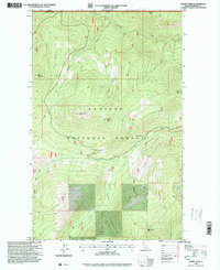 1996 Shorty Peak1999 Print · USGSThe international borderlands of northern Idaho appear in detail during the late nineties, showcasing a landscape of high summits and forest service outposts. Researchers can trace remote mountain access via 4WD routes to reach Shorty Peak Lookout, Red Top Lookout, and USFS Camp 126.
 - 1996 Map of Moravia, 1999 Print
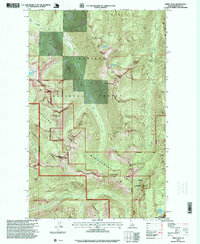
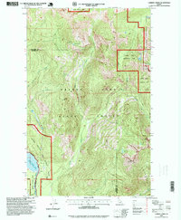
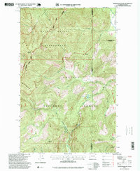
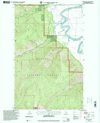
 1996 Moravia1999 Print · USGSBoundary County in the mid-1990s shows a landscape defined by the winding Kootenai River and the vast Kaniksu National Forest. Researchers can locate local landmarks like the Grange Hall in Burns and the technical sites near Moravia.
 - 1996 Map of Farnham Peak, 1999 Print
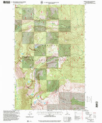
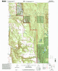
 1996 Farnham Peak1999 Print · USGSBoundary County in the mid-1990s shows a landscape of dramatic elevation changes where the Kootenai River valley meets the high ridges. Researchers can trace the agricultural infrastructure of Camp 5, identify the grain elevator, and locate mountain landmarks like Farnham Peak.
 - 1996 Map of Hall Mountain, 1999 Print
 1996 Hall Mountain1999 Print · USGSBoundary County at the northern edge of the Idaho panhandle shows a landscape of mountain mining and forestry in the mid-1990s. Researchers can trace historical extraction sites like the American Girl Mine and Tungsten Hill Mine, or locate the Mount Hall School.
 - 1996 Map of Roman Nose, 1999 Print
 1996 Roman Nose1999 Print · USGSNorthern Idaho's high Selkirk crest is captured here in the late nineties, showcasing a landscape of alpine lakes and dramatic ridges. Researchers can trace forest trails and peaks like Roman Nose, Bottleneck Peak, and Snow Ridge.
 - 1996 Map of Grass Mountain, 1999 Print
 1996 Grass Mountain1999 Print · USGSThe northern Idaho borderlands come into focus in the mid-1990s, where the international line meets the high peaks of the Selkirk region. Trace legacy land use and remote topography through features like the Parker Mine, Saddle Lake, and the summit of Grass Mountain.
 - 1996 Map of Priest Lake SE, 1999 Print
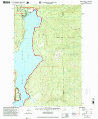
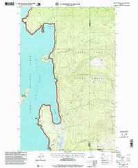 1996 Priest Lake SE1999 Print · USGSThe eastern shores of Priest Lake in the mid-1990s reveal a landscape shaped by national forests and lakefront settlements. Researchers can trace the layout of Fenton, find the Vinttler-Nelson Historical Cabin on its island, or locate the Cavanaugh Bay Airport.
 - 1996 Map of Meadow Creek, 1999 Print
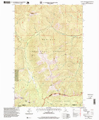
 1996 Meadow Creek1999 Print · USGSBoundary County in the late twentieth century remains a landscape defined by its river valleys and forest ridges. Researchers can trace historic access routes like Old Highway 2 and locate small settlements such as Meadow Creek and Eileen.
 - 1996 Map of Smith Peak, 1999 Print
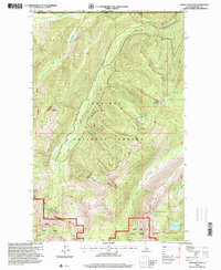
 1996 Smith Peak1999 Print · USGSBoundary County in the mid-1990s showcases a high-mountain wilderness where the Selkirk Crest and Kaniksu National Forest meet. Backcountry researchers can locate the West Fork Cabin and trace the boundaries of the Myrtle Creek State Game Preserve.
 - 1996 Map of Clifty Mountain, 1999 Print
 1996 Clifty Mountain1999 Print · USGSThe northern Idaho backcountry in the late nineties is detailed here, showing the intersection of two national forests. You can trace the Katka Trail or locate remote sites like the Boulder Mine and the shores of Divide Lake.
 - 1996 Map of Priest Lake NE, 1999 Print
 1996 Priest Lake NE1999 Print · USGSUpper Priest Lake and the surrounding Kaniksu National Forest are shown in the late nineties, documenting the shoreline before modern expansion. Trace backcountry routes along the Lakeshore Trail and locate sites like Camp Lodge and The Thorofare.
 - 1996 Map of Canuck Peak, 1999 Print
 1996 Canuck Peak1999 Print · USGSThe high mountain borderlands of Idaho, Montana, and British Columbia are charted here in the mid-1990s. Trace the remote trails and geography of the northern Rockies near Canuck Peak, identifying old mining Prospects and high-altitude crossings like Canuck Pass.
 - 1996 Map of Caribou Creek, 1999 Print
 1996 Caribou Creek1999 Print · USGSThe Idaho Panhandle during the late 1990s remained a stronghold of high-country wilderness and forest management. Researchers can trace the rugged topography of Bugle Ridge and locate remote landmarks like Lookout Mountain and Armstrong Meadows.
 - 1996 Map of Moyie Springs, 1999 Print
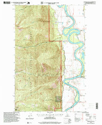
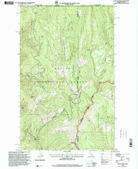
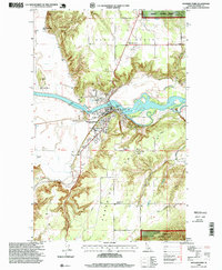
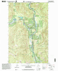
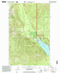
 1996 Moyie Springs1999 Print · USGSBoundary County at the close of the twentieth century shows a landscape shaped by timber and the powerful Kootenai River. Researchers can trace rural school locations like Sheridan School and industrial sites including the Sawmill and Katka siding.
 - 1996 Map of Bonners Ferry, 1999 Print
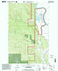
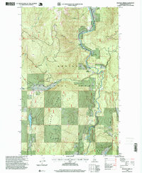
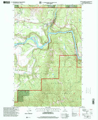
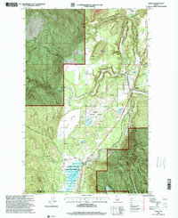
 1996 Bonners Ferry1999 Print · USGSBoundary County was transitioning at the close of the twentieth century as the lumber and rail industries shaped the Kootenai River valley. Genealogists and local historians can locate several family burial sites like Grandview Cemetery and early community hubs such as the Indian Mission and Allens Spur.
 - 1996 Map of Eastport, 1999 Print
 1996 Eastport1999 Print · USGSThe Idaho-British Columbia border comes alive in the late nineties as a rugged corridor of mining and transit. Trace the river valley settlements of Eastport and Good Grief, or locate high-country landmarks like the Queen Mine and Robinson Lake.
 - 1996 Map of Upper Priest Lake, 1999 Print
 1996 Upper Priest Lake1999 Print · USGSThe northern reaches of the Idaho Panhandle are captured here in the mid-nineties, showing the wild interface of state and national forests. Genealogists and historians can locate remote landmarks like the Hughes Meadows Lookout Station and early mining claims including Plowboy Mine and Mountain Chief Mine.
 - 1996 Map of Twentymile Creek, 1999 Print
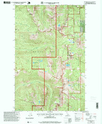
 1996 Twentymile Creek1999 Print · USGSBoundary and Bonner County mountain peaks and forest drainages are captured here in the mid-1990s as they appeared following decades of federal management. Researchers can trace the high-country routes through Twentymile Pass and Kelly Pass or locate landmarks like Beaver Lake and Jay Peak.
 - 1996 Map of Line Point, 1999 Print
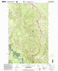 1996 Line Point1999 Print · USGSThe high divide between Idaho and Montana is captured here in the mid-1990s, where the national forests of both states converge. Researchers can trace the remote Buckhorn Mine, follow the path of Old Highway 2, and locate the historic Deer Ridge Lookout overlooking Solomon Lake.
 - 1996 Map of The Wigwams, 1999 Print
 1996 The Wigwams1999 Print · USGSHigh in the Idaho Panhandle during the late twentieth century, this area of the Selkirk Mountains remained a wilderness of granite peaks and glacial lakes. Hikers and researchers can locate established landmarks such as The Wigwams, Harrison Peak, and the remote Beehive Lakes.
 - 1996 Map of Naples, 1999 Print
 1996 Naples1999 Print · USGSNorthern Idaho in the late twentieth century reveals a landscape of forestry and rail-line settlements. Genealogists can locate family names and sites like McArthur Cemetery, the Highland Flats Community Hall, and the UNION PACIFIC rail corridor through Naples.
 - 1996 Map of Mount Roothaan, 1999 Print
 1996 Mount Roothaan1999 Print · USGSThe Idaho Panhandle backcountry comes alive in the mid-1990s as this survey documents the high ridges and alpine lakes of the Selkirk Mountains. Hikers and historians can trace routes between Mount Roothaan, Chimney Rock, and high-altitude waters like Fault Lake.
 - 1996 Map of Ritz, 1999 Print
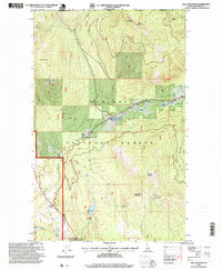
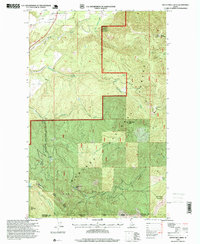
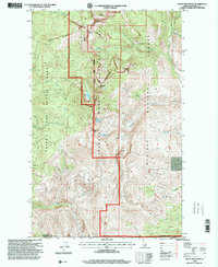
 1996 Ritz1999 Print · USGSBoundary County at the close of the nineties shows the intersection of high forest timberland and the agricultural North Bench. Local researchers can pinpoint the Regal Mine, the Deer Park Community Hall, and the small settlement of Ritz along the creek.
 - 1996 Map of Helmer Mountain, 1999 Print
 1996 Helmer Mountain1999 Print · USGSThe Washington-Idaho borderlands in the 1990s remained a vast wilderness of high peaks and ancient forests. Researchers can trace the protected Roosevelt Grove of Ancient Cedars, find remote Muskegon Lake, and locate Granite Falls.
 - 1996 Map of Smith Falls, 1999 Print
 1996 Smith Falls1999 Print · USGSNear the international border in the 1990s, this portion of Boundary County shows the river valley meeting the high Selkirks. Trace the remote settlement at Osburn Vista, locate Smith Falls, and find infrastructure like the Gravel Pit and Storage Bins.
Showing maps 1-25 of 31
Top cities of Boundary County
Frequently asked questions
- What are the different types of historical maps available for Boundary County?
- What is the oldest map of Boundary County?
- Where can I purchase historical maps of Boundary County for my home or office?
- Where can I download high-res historical maps of Boundary County?
- Are there historical topographic maps available for Boundary County?
- Is there historical aerial imagery available for Boundary County?
- Where are historical maps of Boundary County sourced from?