Old Maps of Boundary County, Idaho for Genealogy
Trace your family roots with 248 historic maps of Boundary County. These high-res maps reveal old neighborhoods, homesites, landmarks, and streets — helping you uncover where your ancestors lived and how the area evolved over time.
- Explore historic neighborhoods: Identify where your relatives may have lived in the 1800s or 1900s.
- Compare maps over time: Trace the changes in streets, buildings, and landmarks for multi-generational research.
- Perfect for genealogy & ancestry research: Used by family historians and researchers to map out lineage and migration.
These maps are an incredible resource for exploring your personal connection to Boundary County's past.
Boundary County, ID maps
(248)- 1911 Map of Priest Lake, 1954 Print
 1911 Priest Lake1954 Print · USGSThe Idaho Panhandle during the early 1900s was a landscape of deep lakes and high-altitude mining operations connected by new rail lines. Genealogists and historians can trace pioneer settlements like Port Hill and Coolin, or locate remote industrial sites such as the Queen Mine and Mountain Chief Mine.
 - 1913 Map of Priest Lake
 1913 Priest Lake1913 Print · USGSThe Idaho Panhandle was a rugged network of rail sidings and mining camps in the years before the Great War. Genealogists and historians can trace old homesteads and depots from Sandpoint up to the Continental Mine and the remote border crossing at Addie.3 unique versions available
 - 1934 Map of Metaline, 1959 Print
 1934 Metaline1959 Print · USGSThe Pend Oreille River valley was a hub of mining and rail activity in the 1930s as the railroad pushed north toward the Canadian border. Genealogists and historians can trace the foundations of Metaline Falls and Tiger or locate the Bunker Hill Mine and Lincoln Sch.
 - 1942 Map of Metaline
 1942 Metaline1942 Print · USGSThe Pend Oreille River valley and the surrounding Selkirk Mountains are shown here in the early 1940s, during a period of intense mining and timber activity. Genealogists and historians can trace rail-side settlements like Ione and Tiger or locate mining sites such as Josephine Mine and Bunker Hill Mines.3 unique versions available
 - 1958 Map of Sandpoint, 1966 Print
 1958 Sandpoint1966 Print · USGSThe Idaho Panhandle and Northeast Washington are shown here in the late fifties, when timber and hydroelectric power drove the local economy. Trace family roots in rail-side towns like Cusick or Metaline Falls, and locate landmarks like the Albeni Falls Dam or Falls Ranger Station.2 unique versions available
 - 1963 Map of Sandpoint
 1963 Sandpoint1963 Print · USGSNorthern Idaho and eastern Washington are shown in the early sixties as a high-country network of timber, mining, and rail. Genealogists and historians can trace the Great Northern line through Metaline Falls, Bonners Ferry, and past the Finch Mine.
 - 1965 Map of Curley Creek, 1967 Print
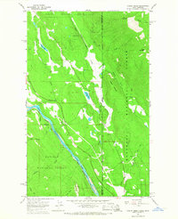 1965 Curley Creek1967 Print · USGSThe Idaho-Montana borderlands are captured here in the mid-sixties, a period when the river-and-rail corridor was central to the region's industry. Researchers can trace the path of the Great Northern railroad, locate the Homestake Mine, and find the remote Central Sch.3 unique versions available
 - 1965 Map of Meadow Creek, 1967 Print
 1965 Meadow Creek1967 Print · USGSBoundary County in the mid-1960s was a landscape defined by the rugged Cabinet Mountains and the vital Spokane International railroad line. Researchers can trace historic access routes like the Meadow Creek Road or locate early wilderness landmarks such as Dawson Lake and Queen Mtn.2 unique versions available
 - 1965 Map of Farnham Peak, 1967 Print
 1965 Farnham Peak1967 Print · USGSBoundary County’s high peaks and river bends are captured here in the mid-sixties, showing the transition from mountain wilderness to valley industry. Researchers can trace the path of the Great Northern railroad past Camp 5 or locate high-country landmarks like Farnham Peak and Burton Peak.2 unique versions available
 - 1965 Map of Leonia, 1967 Print
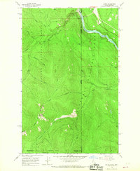 1965 Leonia1967 Print · USGSThe Idaho-Montana borderlands along the Kootenai River are detailed here during the mid-sixties, showing the intersection of heavy rail and mountain wilderness. Researchers can locate the Idamont Mine, trace the Great Northern tracks, and find the Boulder Creek Cem near Leonia.2 unique versions available
 - 1965 Map of Twentymile Creek, 1967 Print
 1965 Twentymile Creek1967 Print · USGSUpper Idaho during the mid-sixties reveals a landscape of high summits and working forest trails. You can trace early backcountry access routes like the Pack Trail near Black Mountain or find the remote Lookout Tower and Beaver Lake.
 - 1965 Map of Eastport, 1967 Print
 1965 Eastport1967 Print · USGSThe international border at the Moyie River crossing during the mid-1960s shows a landscape defined by mountain ridges and river-valley transport. Genealogists and historians can trace small outposts like Addie and Good Grief or locate the remote Tilley Mine and Queen Mine.
 - 1965 Map of Moravia, 1967 Print
 1965 Moravia1967 Print · USGSBoundary County in the mid-1960s was a place where busy rail lines like the Great Northern cut through the shadows of the Selkirk Mountains. Genealogists and historians can trace the community of Moravia, located near the Grange Hall and the Deep Creek (Siding).2 unique versions available
 - 1965 Map of Ritz, 1967 Print
 1965 Ritz1967 Print · USGSBoundary County in the mid-1960s was a landscape of mountain timber and rail-dependent agriculture. Genealogists and historians can trace rail sidings at De Voignes Spur and Watson Spur, or locate local landmarks like Ritz and the Regal Mine.3 unique versions available
 - 1965 Map of Line Point, 1967 Print
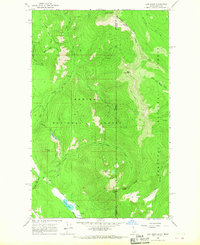 1965 Line Point1967 Print · USGSBoundary County and the northern Idaho panhandle were still a realm of high-elevation forestry and mining in the mid-sixties. Trace the steep terrain from the Buckhorn Mine down to Perkins Lake or locate the old Lookout Tower on Deer Ridge.2 unique versions available
 - 1965 Map of Copeland, 1967 Print
 1965 Copeland1967 Print · USGSThe northern Panhandle meets the Canadian border in the mid-1960s, where the winding Kootenai River dominates the valley floor. Family historians can trace local landmarks like Copeland Cem and rail sidings such as Houcks Spur and Harpers Spur.3 unique versions available
 - 1965 Map of Moyie Springs, 1967 Print
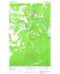 1965 Moyie Springs1967 Print · USGSBoundary County in the mid-sixties reveals a landscape of deep river canyons and vital rail corridors. Genealogists and historians can trace the foundations of Moyie Springs, locate the Sheridan School, or follow the Great Northern tracks past Katka.2 unique versions available
 - 1965 Map of Naples, 1967 Print
 1965 Naples1967 Print · USGSBoundary County in the 1960s was a hub of rail activity and forest management centered around the settlement of Naples. Genealogists and historians can trace old homestead sites near the Highland Flats Community Hall or follow the parallel tracks of the Great Northern and Spokane International railroads.2 unique versions available
 - 1965 Map of Canuck Peak, 1967 Print
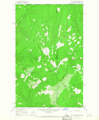 1965 Canuck Peak1967 Print · USGSThe high frontier of the Idaho-Montana panhandle is captured here in the mid-1960s at the junction of the KANIKSU NATIONAL FOREST and KOOTENAI NATIONAL FOREST. Researchers can trace remote pack trails and forest roads to landmarks like Canuck Pass, Copper Mtn, and the high-altitude Hidden Lake.2 unique versions available
 - 1965 Map of Clifty Mtn, 1967 Print
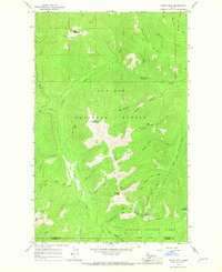 1965 Clifty Mtn1967 Print · USGSBoundary County in the 1960s was a landscape of steep timberland and remote mining prospects. Hikers and historians can trace the paths of the Kelly Poker Pass Trail and the Katka Peak Trail, or locate the site of the Boulder Mine.
 - 1965 Map of Hall Mountain, 1967 Print
 1965 Hall Mountain1967 Print · USGSBoundary County, Idaho, near the Canadian border, was a hub of high-country mining and timber work in the mid-1960s. Researchers can locate remote industrial sites like the American Girl Mine, find the Mt Hall Sch, and trace old routes like DEER PARK ROAD.2 unique versions available
 - 1965 Map of Bonners Ferry, 1967 Print
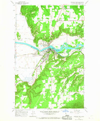 1965 Bonners Ferry1967 Print · USGSBonners Ferry was a bustling rail and river hub in the mid-1960s, serving as the gateway to the Kaniksu National Forest. Genealogists and local historians can locate Indian Mission, Moravia Cem, and old rail sidings like Allens Spur.2 unique versions available
 - 1967 Map of Priest Lake SE, 1971 Print
 1967 Priest Lake SE1971 Print · USGSPriest Lake's eastern shore in the late sixties was a landscape of remote mountain ridges and deep-water bays. Trace the development of backcountry access at Cavanaugh Bay Airport or locate family campsites at Indian Creek Campground and Sherwood Beach.3 unique versions available
 - 1967 Map of Priest Lake NE, 1971 Print
 1967 Priest Lake NE1971 Print · USGSThe northeastern reaches of Priest Lake are documented here in the late sixties, showcasing a landscape managed for forestry and recreation. You can trace early backcountry access via Pack Trails to landmarks like Klootch Mtn, Camp Dodge, and the Two Mouth Guard Station.2 unique versions available
 - 1967 Map of Salmo Mtn., 1971 Print
 1967 Salmo Mtn.1971 Print · USGSThe high Selkirk wilderness of the late sixties is documented here at the intersection of the Washington, Idaho, and Canadian borders. Trace historical access routes through the mountains via the Pack Trail system and locate the Lookout Tower atop Salmo Mountain.3 unique versions available
Showing maps 1-25 of 248
Top cities of Boundary County
Frequently asked questions
- What are the different types of historical maps available for Boundary County?
- What is the oldest map of Boundary County?
- Where can I purchase historical maps of Boundary County for my home or office?
- Where can I download high-res historical maps of Boundary County?
- Are there historical topographic maps available for Boundary County?
- Is there historical aerial imagery available for Boundary County?
- Where are historical maps of Boundary County sourced from?