1990s Maps of Clark County, Idaho
Explore 7 historic maps of Clark County from the 1990s. These maps offer a rare glimpse into what life looked like during the 1990s — showing old roads, neighborhoods, homes, and landmarks that have changed or disappeared over time.
Whether you're researching your family's past, planning a metal detecting trip, or studying how Clark County's landscape evolved across the 1990s, these high-resolution maps are a powerful tool for exploring the history of this region.
- Focus on a specific era: All maps on this page are from the 1990s, giving you a focused view of this time period.
- See what’s changed: Compare century-old streets, trails, and buildings to today's modern landscape using overlays and satellite layers.
- Research with precision: Use these maps for genealogy, historical research, land use analysis, or educational projects.
- View, download, or print: Maps are fully viewable online in high resolution, and can be downloaded or printed for your own records.
Start exploring Clark County's history through authentic maps from the 1990s. This is your window into the past.
Clark County, ID maps
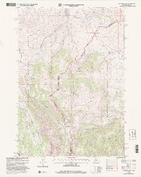
(7)- 1992 Map of Lima, 1993 Print
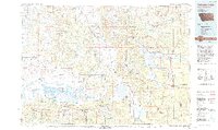
 1992 Lima1993 Print · USGSThe high Divide country of Beaverhead County comes into focus in the early nineties, centered on the rail-and-ranching corridor through the Tendoy Mountains. Genealogists and historians can trace the Union Pacific line through Lima, Dell, and Monida, or locate the Silver Queen Mine and Kidd along the historic valley routes.
 - 1993 Map of Hebgen Lake
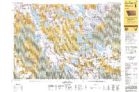
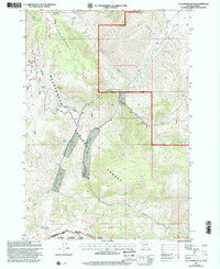
 1993 Hebgen Lake1993 Print · USGSThe high mountain passes and vast river basins of the Montana-Idaho border come into focus in the early nineties. Genealogists and historians can trace the remote settlement of Lakeview and the development of West Yellowstone near the Red Rock Lakes National Wildlife Refuge.2 unique versions available
 - 1997 Map of Edie Creek, 2002 Print
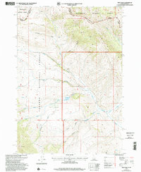
 1997 Edie Creek2002 Print · USGSThe high-altitude border between Idaho and Montana comes into sharp focus during the late 1990s as it traverses the Continental Divide. Researchers can trace the rugged headwaters of Medicine Lodge Creek and the remote high-country terrain around Horse Mountain and Middle Creek Butte.
 - 1997 Map of Mount Jefferson, 2002 Print
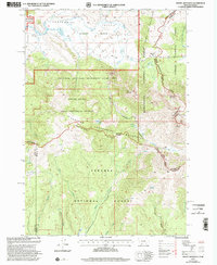 1997 Mount Jefferson2002 Print · USGSThe Montana and Idaho borderlands come into focus in the late nineties, centered on the high-altitude Centennial Mountains. Researchers can trace the path of the Continental Divide Scenic Trail across peaks like Mount Jefferson and Nemesis Mountain.
 - 1997 Map of Deadman Lake, 2002 Print
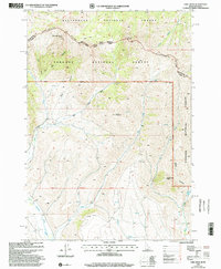
 1997 Deadman Lake2002 Print · USGSThe high Montana-Idaho border comes into focus in the late nineties, documenting the remote Bitterroot ridgelines and forest boundaries. Researchers can trace the high-country paths of the Continental Divide Scenic Trail and locate the historic Cow Camp (Site) near Bannack Pass.
 - 1997 Map of Gallagher Gulch, 2002 Print
 1997 Gallagher Gulch2002 Print · USGSThe Montana-Idaho border comes alive in the late nineties along the Continental Divide and the Beaverhead Mountains. Researchers can trace the drainage of Little Sheep Creek, locate remote Mines, and find historical water sources like Seybold Spring and Buffalo Spring.
 - 1997 Map of Fritz Peak, 2002 Print
 1997 Fritz Peak2002 Print · USGSThe Idaho-Montana border at the Continental Divide is documented here in the late twentieth century. Researchers can trace remote mining Prospects and high-country landmarks like Fritz Peak and the Continental Divide National Scenic Trail.
End of results
Showing maps 1-7 of 7
Top cities of Clark County
Frequently asked questions
- What are the different types of historical maps available for Clark County?
- What is the oldest map of Clark County?
- Where can I purchase historical maps of Clark County for my home or office?
- Where can I download high-res historical maps of Clark County?
- Are there historical topographic maps available for Clark County?
- Is there historical aerial imagery available for Clark County?
- Where are historical maps of Clark County sourced from?