1960s Maps of Clark County, Idaho
Explore 26 historic maps of Clark County from the 1960s. These maps offer a rare glimpse into what life looked like during the 1960s — showing old roads, neighborhoods, homes, and landmarks that have changed or disappeared over time.
Whether you're researching your family's past, planning a metal detecting trip, or studying how Clark County's landscape evolved across the 1960s, these high-resolution maps are a powerful tool for exploring the history of this region.
- Focus on a specific era: All maps on this page are from the 1960s, giving you a focused view of this time period.
- See what’s changed: Compare century-old streets, trails, and buildings to today's modern landscape using overlays and satellite layers.
- Research with precision: Use these maps for genealogy, historical research, land use analysis, or educational projects.
- View, download, or print: Maps are fully viewable online in high resolution, and can be downloaded or printed for your own records.
Start exploring Clark County's history through authentic maps from the 1960s. This is your window into the past.
Clark County, ID maps
(26)- 1960 Map of Ashton
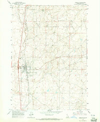
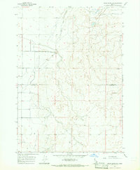
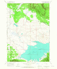
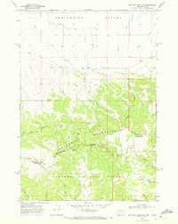
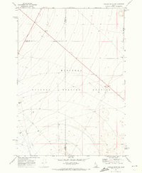
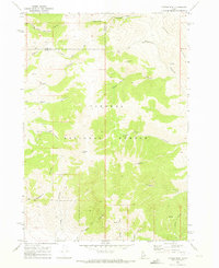
 1960 Ashton1960 Print · USGSThe Idaho-Montana-Wyoming borderlands at the dawn of the sixties show a landscape defined by the Continental Divide and early wilderness tourism. Genealogists and historians can trace rail-stop settlements like Trude Siding, old outposts like Warm River, and early lodging at Snowball Inn.
 - 1964 Map of Dubois NW, 1965 Print
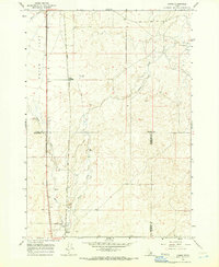
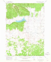
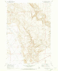
 1964 Dubois NW1965 Print · USGSDubois and the surrounding high plains of Clark County are captured here in the mid-sixties, dominated by the railroad and livestock industry. Genealogists and historians can trace the local Stockyards, the Cem, and the sprawling U S Sheep Experiment Station.
 - 1964 Map of Lone Butte, 1965 Print
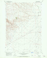
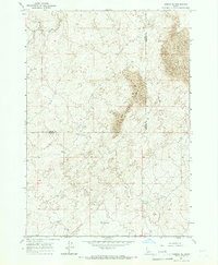
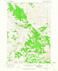
 1964 Lone Butte1965 Print · USGSEastern Idaho's high desert plateaus are captured here in the mid-1960s, showing a landscape defined by ranching and resource extraction. Researchers can trace land use patterns through isolated landmarks like Lone Butte and local infrastructure such as Borrow Pits and a Water Tank.2 unique versions available
 - 1964 Map of Small, 1965 Print
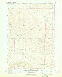
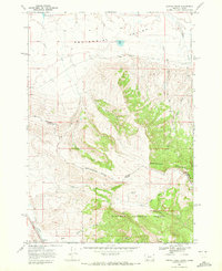
 1964 Small1965 Print · USGSClark County's high-desert landscape comes into focus in the mid-sixties, centered on the ranching community of Small. Researchers can trace early land use through a Prospect, the winding Medicine Lodge Creek, and high-altitude water sources like a named Spring.2 unique versions available
 - 1964 Map of Dubois NE, 1965 Print
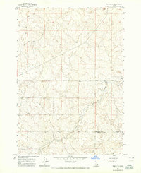 1964 Dubois NE1965 Print · USGSSoutheastern Clark County remains a high-desert expanse of ranching and creek drainages during the mid-1960s. Genealogists and local historians can locate the Jacoby Ranch and trace the winding course of Camas Creek near the county line.
 - 1964 Map of Cedar Butte SW, 1965 Print
 1964 Cedar Butte SW1965 Print · USGSRanchlands and high-desert water sources define this Idaho landscape in the mid-sixties. Researchers can trace the path of Medicine Lodge Creek and locate several scattered Well and Wells across the Clark Co and Jefferson Co line.
 - 1964 Map of Camas, 1966 Print
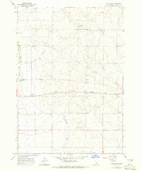
 1964 Camas1966 Print · USGSEastern Idaho's high-desert landscape comes into focus in the mid-1960s as a vital railroad and water corridor. Genealogists and historians can trace the Union Pacific line through Jones Crossing and locate early landmarks like the Cem and Gaging Station near the creek.2 unique versions available
 - 1964 Map of Dubois SE, 1966 Print
 1964 Dubois SE1966 Print · USGSFremont and Clark Counties are captured in the mid-1960s, showing a high-desert landscape defined by vast desert geography. Researchers can locate remote water sources like a Water Tank and follow the route of a primitive Jeep Trail through the Sand Dunes.
 - 1964 Map of Cedar Butte SE, 1966 Print
 1964 Cedar Butte SE1966 Print · USGSThe high desert border of Clark and Jefferson Counties is captured here in the mid-1960s, showing a landscape of volcanic buttes and vital water infrastructure. Researchers can locate the Jones Cem, trace the path of Beaver Creek, and identify remote landmarks like the Landing Strip.
 - 1965 Map of Icehouse Creek, 1967 Print
 1965 Icehouse Creek1967 Print · USGSFremont and Clark counties meet in this high-altitude landscape during the mid-1960s, where mountain streams feed the rising waters of the reservoir. Map collectors and hikers can trace remote routes like the Jeep Trail through Shotgun Valley and the banks of Icehouse Creek.
 - 1965 Map of Sheridan Reservoir, 1967 Print
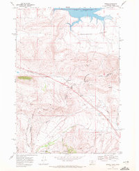
 1965 Sheridan Reservoir1967 Print · USGSTarghee National Forest and the headwaters of the Sheridan drainage are documented here in the mid-sixties. Local history researchers can trace high-country water sources and access routes including Sheridan Reservoir, Shotgun Well, and the Headquarters Trail.3 unique versions available
 - 1965 Map of Gallagher Gulch, 1968 Print
 1965 Gallagher Gulch1968 Print · USGSThe high Montana-Idaho borderlands are captured here in the mid-1960s, showing the intersection of the Continental Divide and the Beaverhead National Forest. Researchers can trace old mountain routes like the Pack Trail to remote mines, prospects, and named watering holes like Seybold Spring.2 unique versions available
 - 1968 Map of Corral Creek, 1972 Print
 1968 Corral Creek1972 Print · USGSThe high mountain frontier of the Montana-Idaho border comes into focus in the late sixties, where the Continental Divide splits the wilderness. Researchers can trace the Union Pacific rail line near Humphrey and locate remote water sources like Boatman Spring and Mud Lake.2 unique versions available
 - 1968 Map of Big Table Mountain, 1972 Print
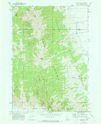
 1968 Big Table Mountain1972 Print · USGSThe high Montana-Idaho border comes alive in this late 1960s survey of the Continental Divide. Local historians and hunters can trace high-country routes like Price Peet Road or locate historic landmarks such as Jones Ranch and Big Table Mountain.3 unique versions available
 - 1968 Map of Monida, 1972 Print
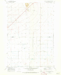
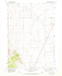
 1968 Monida1972 Print · USGSHigh-altitude transit and ranching define this Montana-Idaho border crossing in the late sixties. Trace the Union Pacific rail line through Monida Pass and locate local landmarks like the Airway Beacon and Monida settlement.2 unique versions available
 - 1969 Map of Shamrock Gulch, 1973 Print
 1969 Shamrock Gulch1973 Print · USGSThe high range of Clark County is captured here in the late sixties, showing the remote drainages of the Targhee National Forest. Researchers can locate isolated landmarks like Graves, Devils Gap, and essential water sources at Upper Crystal Spring.
 - 1969 Map of Lidy Hot Springs SE, 1973 Print
 1969 Lidy Hot Springs SE1973 Print · USGSThe Clark and Jefferson county line marks this high Idaho rangeland in the late sixties, where agricultural expansion meets the desert. Researchers can trace land development through infrastructure like the Substation, Storage Bins, and the path of Warm Springs Creek.
 - 1969 Map of Circular Butte NW, 1973 Print
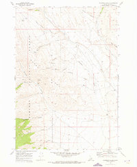
 1969 Circular Butte NW1973 Print · USGSThe high desert of eastern Idaho was undergoing a period of specialized development in the late sixties as scientific testing expanded. Researchers can trace the boundaries of the National Reactor Testing Station and locate early infrastructure like Birch Creek and the Gravel Pit.
 - 1969 Map of Eightmile Canyon, 1973 Print
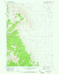 1969 Eightmile Canyon1973 Print · USGSThe eastern front of the Lemhi Range meets the Birch Creek Valley in this late-sixties Idaho survey. Local historians and researchers can locate the Indian Massacre Historical Monument and trace the historic route of the Mormon Trail.
 - 1969 Map of Richard Butte, 1973 Print
 1969 Richard Butte1973 Print · USGSThe high desert of Butte County during the late sixties shows the intersection of federal research and the volcanic landscape. Trace family history at Goddard Cem or explore the boundaries of the National Reactor Testing Station near Richard Butte.
 - 1969 Map of Tyler Peak, 1973 Print
 1969 Tyler Peak1973 Print · USGSThe high ridges of the Lemhi Range are captured here in the late sixties, marking the intersection of Butte and Clark counties. Hikers and historians can trace the high-mountain topography around Tyler Peak, locating isolated points like Kyle Spring and the winding Jeep Tr.2 unique versions available
 - 1969 Map of Copper Mtn, 1973 Print
 1969 Copper Mtn1973 Print · USGSThe high country of Clark and Lemhi counties is captured here during the late 1960s mining and ranching era. Local history researchers can trace old Mine locations and Trails through Skull Canyon and near the summit of Copper Mtn.
 - 1969 Map of Lidy Hot Springs, 1973 Print
 1969 Lidy Hot Springs1973 Print · USGSHigh-altitude Clark County during the late sixties shows a landscape of geothermal activity and early settlement sites. Genealogists and historians can locate the Winsper townsite and trace the drainage of Warm Springs Creek past numerous named Springs.
 - 1969 Map of Blue Dome, 1973 Print
 1969 Blue Dome1973 Print · USGSBirch Creek Valley at the end of the sixties was a landscape of remote outposts and high-country canyon drainages. Researchers can locate the John Day Grave, identify old forest service sites like Kaufman Guard Station, and trace trails through Skull Canyon.
 - 1969 Map of Scott Butte, 1973 Print
 1969 Scott Butte1973 Print · USGSBirch Creek Valley in the late sixties reveals the unique intersection of the National Forest and the atomic-era National Reactor Testing Station. Researchers can trace early water management along the Reno Ditch or locate landmarks like Scott Butte and the Radio Tower.
Showing maps 1-25 of 26
Top cities of Clark County
Frequently asked questions
- What are the different types of historical maps available for Clark County?
- What is the oldest map of Clark County?
- Where can I purchase historical maps of Clark County for my home or office?
- Where can I download high-res historical maps of Clark County?
- Are there historical topographic maps available for Clark County?
- Is there historical aerial imagery available for Clark County?
- Where are historical maps of Clark County sourced from?