
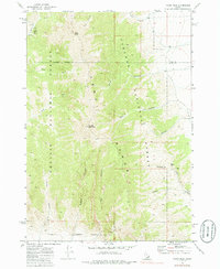
1969 Map of Tyler Peak
USGS Topo · Published 1973About this map
Tyler Peak and Saddle Mountain dominate this high-altitude section of the Lemhi Range, where the steep drainages of the Challis National Forest and Targhee National Forest meet. This late 1960s survey documents a rugged, high-desert mountain landscape defined by deep incisions like Tyler Canyon and Bartel Canyon. Human presence is minimal, represented primarily by a Jeep Tr winding through the northern canyons and the Butte Co Clark Co line that bisects the peaks. Water sources are critical identifiers in this environment, with names such as Kyle Spring and Camp Creek marking the rare points of hydration in the watershed of the Kyle Canyon. The terrain reflects the transition from forest to the arid basins of eastern Idaho, captured just as aerial photogrammetry began to refine the mapping of these remote ranges.
Find a feature on this map
25 named features on this map. Tap any name to fly to it.
Don’t see what you’re looking for? This feature index may not catch every label — zoom into the map to look around manually.
Map Details
Editions of this 1969 Tyler Peak Map
2 editions found
Other maps of this area

1955 · Dubois
USGS Topo · 1:250,000

1955 · Idaho Falls
USGS Topo · 1:250,000

1957 · Diamond Peak
USGS Topo · 1:62,500

1958 · Dubois
USGS Topo · 1:250,000

1958 · Idaho Falls
USGS Topo · 1:250,000

1969 · Little Lost River Sinks
USGS Topo · 1:24,000

1969 · Eightmile Canyon
USGS Topo · 1:24,000

1969 · Richard Butte
USGS Topo · 1:24,000

1969 · Howe
USGS Topo · 1:24,000

1969 · Howe NE
USGS Topo · 1:24,000