Old Maps of Clark County, Idaho for Academic Research
Study the evolution of Clark County with 317 high-resolution historic maps. Whether you're teaching, researching, or modeling changes in land use, these maps provide essential visual documentation of urban, environmental, and geographic change.
- Analyze long-term change: Track patterns in development, transportation, and natural features.
- Ideal for environmental or urban studies: Support academic projects with primary historical map data.
- Use in the classroom or lab: Educators and researchers rely on these maps to bring historical context to life.
These maps are a powerful tool for teaching, research, and visualizing how Clark County has changed over the decades.
Clark County, ID maps
(317)- 1950 Map of Lower Red Rock Lake, 1954 Print
 1950 Lower Red Rock Lake1954 Print · USGSThe high Centennial Valley comes to life in the early fifties, where ranching and conservation meet along the Continental Divide. Genealogists and historians can trace family locations like the Goble Ranch, the Doyle School, and the remote Landon Camp.5 unique versions available
 - 1950 Map of Upper Red Rock Lake, 1954 Print
 1950 Upper Red Rock Lake1954 Print · USGSThe Centennial Valley and the Continental Divide are documented here in the early fifties, featuring the expansive Upper Red Rock Lake. Researchers can trace old family holdings like the Hanson Ranch and Cook Sheep Ranch or locate the Selby Resort and early forest campgrounds.3 unique versions available
 - 1955 Map of Dubois
 1955 Dubois1955 Print · USGSThe high desert and mountain passes of eastern Idaho and western Montana are captured here during the mid-fifties. Researchers can trace the Union Pacific rail line through Dubois or locate the National Reactor Testing Station.4 unique versions available
 - 1955 Map of Idaho Falls, 1963 Print
 1955 Idaho Falls1963 Print · USGSThe Snake River Plain and its surrounding volcanic peaks are captured in the late fifties, showing the region's unique mix of nuclear research and high-desert ranching. Trace the industrial footprint of the National Reactor Testing Station or find old mining sites like Empire Mine.5 unique versions available
 - 1955 Map of Ashton, 1967 Print
 1955 Ashton1967 Print · USGSThe Greater Yellowstone ecosystem is captured here during the mid-1950s, showing the high plateaus and remote gateway towns of Idaho and Montana. Researchers can trace the Union Pacific line to Ashton or locate small settlements like Squirrel and Grainville.4 unique versions available
 - 1957 Map of Paul Reservoir, 1959 Print
 1957 Paul Reservoir1959 Print · USGSThe high peaks of the Beaverhead Mountains meet the Idaho-Montana border in the late fifties, showcasing a landscape defined by the Continental Divide. Researchers can trace remote ranching outposts like Gleed Cow Camp. and find local landmarks such as Paul Reservoir and the solitary Coal Mine.2 unique versions available
 - 1957 Map of Scott Peak, 1959 Print
 1957 Scott Peak1959 Print · USGSThe high Beaverhead Mountains along the Idaho-Montana border are shown here in the late fifties, featuring the dramatic Continental Divide. Researchers can locate the settlement of Nicholia, a local Cem, and old mining activity near Smelter Gulch.3 unique versions available
 - 1957 Map of Edie Ranch, 1959 Print
 1957 Edie Ranch1959 Print · USGSThe Idaho-Montana borderlands come alive in this mid-century survey of the high Divide. Researchers can trace the remote Edie Ranch and find mountain landmarks like Heart Mtn and the Warm Sprs. Ranger Sta.4 unique versions available
 - 1958 Map of Dubois
 1958 Dubois1958 Print · USGSThe high divide between Idaho and Montana comes alive in this mid-century survey, from the mining camps of the Lemhi Range to the ranchlands of Centennial Valley. Trace historic operations at the Copper Queen Mine, the route of the Union Pacific RR, and the scientific work at the Sheep experimental station.2 unique versions available
 - 1958 Map of Idaho Falls
 1958 Idaho Falls1958 Print · USGSEastern Idaho in the late fifties showcases the rapid expansion of agricultural and scientific outposts across its volcanic plains. Researchers can locate remote sites like Atomic City, mineral interests at White Knob Mine, and the cultural grounds of St Marys Mission.2 unique versions available
 - 1958 Map of Ashton
 1958 Ashton1958 Print · USGSGreater Yellowstone and the eastern Idaho borderlands appear here in the mid-1950s as rail and road networks connected remote mountain basins. Trace the Union Pacific route through Ashton or locate early outposts like Last Chance, Squirrel, and West Yellowstone.
 - 1960 Map of Ashton
 1960 Ashton1960 Print · USGSThe Idaho-Montana-Wyoming borderlands at the dawn of the sixties show a landscape defined by the Continental Divide and early wilderness tourism. Genealogists and historians can trace rail-stop settlements like Trude Siding, old outposts like Warm River, and early lodging at Snowball Inn.
 - 1964 Map of Dubois NW, 1965 Print
 1964 Dubois NW1965 Print · USGSDubois and the surrounding high plains of Clark County are captured here in the mid-sixties, dominated by the railroad and livestock industry. Genealogists and historians can trace the local Stockyards, the Cem, and the sprawling U S Sheep Experiment Station.
 - 1964 Map of Lone Butte, 1965 Print
 1964 Lone Butte1965 Print · USGSEastern Idaho's high desert plateaus are captured here in the mid-1960s, showing a landscape defined by ranching and resource extraction. Researchers can trace land use patterns through isolated landmarks like Lone Butte and local infrastructure such as Borrow Pits and a Water Tank.2 unique versions available
 - 1964 Map of Small, 1965 Print
 1964 Small1965 Print · USGSClark County's high-desert landscape comes into focus in the mid-sixties, centered on the ranching community of Small. Researchers can trace early land use through a Prospect, the winding Medicine Lodge Creek, and high-altitude water sources like a named Spring.2 unique versions available
 - 1964 Map of Dubois NE, 1965 Print
 1964 Dubois NE1965 Print · USGSSoutheastern Clark County remains a high-desert expanse of ranching and creek drainages during the mid-1960s. Genealogists and local historians can locate the Jacoby Ranch and trace the winding course of Camas Creek near the county line.
 - 1964 Map of Cedar Butte SW, 1965 Print
 1964 Cedar Butte SW1965 Print · USGSRanchlands and high-desert water sources define this Idaho landscape in the mid-sixties. Researchers can trace the path of Medicine Lodge Creek and locate several scattered Well and Wells across the Clark Co and Jefferson Co line.
 - 1964 Map of Camas, 1966 Print
 1964 Camas1966 Print · USGSEastern Idaho's high-desert landscape comes into focus in the mid-1960s as a vital railroad and water corridor. Genealogists and historians can trace the Union Pacific line through Jones Crossing and locate early landmarks like the Cem and Gaging Station near the creek.2 unique versions available
 - 1964 Map of Dubois SE, 1966 Print
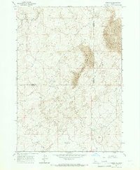 1964 Dubois SE1966 Print · USGSFremont and Clark Counties are captured in the mid-1960s, showing a high-desert landscape defined by vast desert geography. Researchers can locate remote water sources like a Water Tank and follow the route of a primitive Jeep Trail through the Sand Dunes.
 - 1964 Map of Cedar Butte SE, 1966 Print
 1964 Cedar Butte SE1966 Print · USGSThe high desert border of Clark and Jefferson Counties is captured here in the mid-1960s, showing a landscape of volcanic buttes and vital water infrastructure. Researchers can locate the Jones Cem, trace the path of Beaver Creek, and identify remote landmarks like the Landing Strip.
 - 1965 Map of Icehouse Creek, 1967 Print
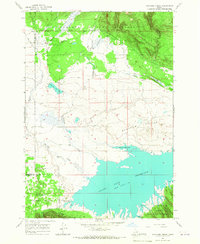 1965 Icehouse Creek1967 Print · USGSFremont and Clark counties meet in this high-altitude landscape during the mid-1960s, where mountain streams feed the rising waters of the reservoir. Map collectors and hikers can trace remote routes like the Jeep Trail through Shotgun Valley and the banks of Icehouse Creek.
 - 1965 Map of Sheridan Reservoir, 1967 Print
 1965 Sheridan Reservoir1967 Print · USGSTarghee National Forest and the headwaters of the Sheridan drainage are documented here in the mid-sixties. Local history researchers can trace high-country water sources and access routes including Sheridan Reservoir, Shotgun Well, and the Headquarters Trail.3 unique versions available
 - 1965 Map of Gallagher Gulch, 1968 Print
 1965 Gallagher Gulch1968 Print · USGSThe high Montana-Idaho borderlands are captured here in the mid-1960s, showing the intersection of the Continental Divide and the Beaverhead National Forest. Researchers can trace old mountain routes like the Pack Trail to remote mines, prospects, and named watering holes like Seybold Spring.2 unique versions available
 - 1968 Map of Corral Creek, 1972 Print
 1968 Corral Creek1972 Print · USGSThe high mountain frontier of the Montana-Idaho border comes into focus in the late sixties, where the Continental Divide splits the wilderness. Researchers can trace the Union Pacific rail line near Humphrey and locate remote water sources like Boatman Spring and Mud Lake.2 unique versions available
 - 1968 Map of Big Table Mountain, 1972 Print
 1968 Big Table Mountain1972 Print · USGSThe high Montana-Idaho border comes alive in this late 1960s survey of the Continental Divide. Local historians and hunters can trace high-country routes like Price Peet Road or locate historic landmarks such as Jones Ranch and Big Table Mountain.3 unique versions available
Showing maps 1-25 of 317
Top cities of Clark County
Frequently asked questions
- What are the different types of historical maps available for Clark County?
- What is the oldest map of Clark County?
- Where can I purchase historical maps of Clark County for my home or office?
- Where can I download high-res historical maps of Clark County?
- Are there historical topographic maps available for Clark County?
- Is there historical aerial imagery available for Clark County?
- Where are historical maps of Clark County sourced from?