Old Maps of Glenns Ferry, Idaho for Academic Research
Study the evolution of Glenns Ferry with 13 high-resolution historic maps. Whether you're teaching, researching, or modeling changes in land use, these maps provide essential visual documentation of urban, environmental, and geographic change.
- Analyze long-term change: Track patterns in development, transportation, and natural features.
- Ideal for environmental or urban studies: Support academic projects with primary historical map data.
- Use in the classroom or lab: Educators and researchers rely on these maps to bring historical context to life.
These maps are a powerful tool for teaching, research, and visualizing how Glenns Ferry has changed over the decades.
Glenns Ferry, ID maps
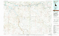
(13)- 1947 Map of Glenns Ferry, 1968 Print
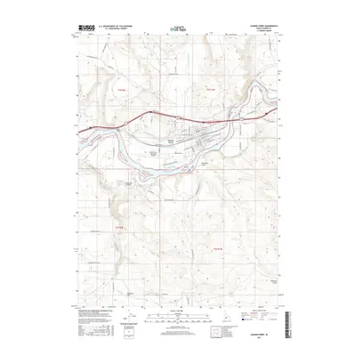
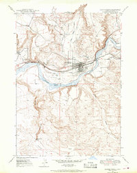 1947 Glenns Ferry1968 Print · USGSGlenns Ferry and the Snake River valley are captured in the late 1940s, highlighting a landscape defined by historic emigrant paths and rail infrastructure. You can trace the route of the Oregon Trail as it meets the Snake River at Three Island Crossing.2 unique versions available
 - 1948 Map of Glenns Ferry
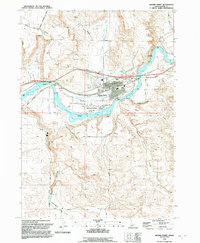
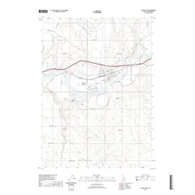
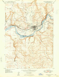 1948 Glenns Ferry1948 Print · USGSGlenns Ferry is captured here in the late 1940s as a critical river crossing where the railroad meets pioneering history. Trace the path of the Old Oregon Trail and locate local landmarks like Slick Bridge, Three Island Crossing, and the Landing Field.
 - 1948 Map of Glenns Ferry, 1966 Print
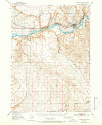 1948 Glenns Ferry1966 Print · USGSElmore and Owyhee counties are captured during the mid-century as the Snake River valley supported both ranching and transit. Researchers can trace the Oregon Trail alongside the Union Pacific and locate landmarks like Three Island Crossing and the McGuinness Ranch.2 unique versions available
 - 1951 Map of Glenns Ferry
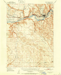 1951 Glenns Ferry1951 Print · USGSThe Snake River valley in the early fifties was a vital corridor of rail and river history. Genealogists and historians can trace the legacy of the Oregon Short Line and locate landmarks like Three Island Crossing and McGinness Ranch.
 - 1955 Map of Twin Falls, 1963 Print
 1955 Twin Falls1963 Print · USGSThe Magic Valley flourished in the mid-1950s as a sophisticated network of irrigation and rail lines connected high-desert outposts. Researchers can trace the engineering of the Milner-Gooding Canal, the remote Murphy Hot Springs, and the Union Pacific rail network.3 unique versions available
 - 1958 Map of Twin Falls
 1958 Twin Falls1958 Print · USGSThe Magic Valley and Snake River Plain are captured here in the late fifties, showcasing a region defined by transformative irrigation projects and desert military ranges. Researchers can trace the Union Pacific rail lines and locate small outlying settlements like Wickahoney, Rogerson, and Hollister.2 unique versions available
 - 1992 Map of Glenns Ferry
 1992 Glenns Ferry1992 Print · USGSThe Snake River valley in the early nineties remains a landscape of pioneer paths and modern military ranges. Genealogists and historians can trace the EMIGRANT TRAIL past Glenns Ferry or locate remote desert landmarks like Broken Wagon Flat and the community of Clover.
 - 1992 Map of Glenns Ferry
 1992 Glenns Ferry1992 Print · USGSGlenns Ferry is shown at a crossroads of migration and modern infrastructure in the early nineties. Researchers can trace the Oregon Trail as it meets the Snake River near Three Island Crossing and the Union Pacific rail lines.
 - 2010 Map of Glenns Ferry, 2010 Print
 2010 Glenns Ferry2010 Print · USGSCovers Glenns Ferry, including Elmore County, United States, and other nearby areas
 - 2013 Map of Glenns Ferry, 2013 Print
 2013 Glenns Ferry2013 Print · USGSCovers Glenns Ferry, including Elmore County, United States, and other nearby areas
 - 2017 Map of Glenns Ferry, 2017 Print
 2017 Glenns Ferry2017 Print · USGSCovers Glenns Ferry, including Elmore County, United States, and other nearby areas
 - 2020 Map of Glenns Ferry, 2020 Print
 2020 Glenns Ferry2020 Print · USGSCovers Glenns Ferry, including Elmore County, United States, and other nearby areas
 - 2024 Map of Glenns Ferry, 2024 Print
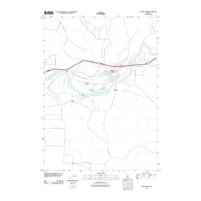
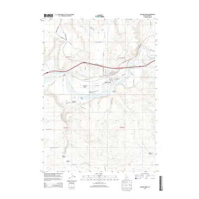
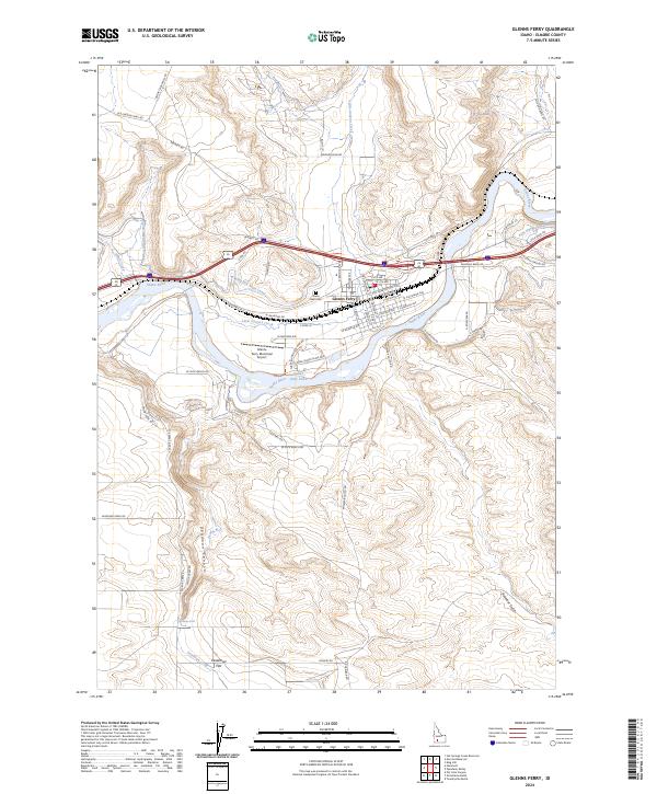 2024 Glenns Ferry2024 Print · USGSGlenns Ferry sits at a legendary Snake River crossing where early pioneer routes and modern irrigation meet. Researchers can trace the path of the Old Oregon Trail Rd, locate the Glenn Rest Cem, or explore the canyon geography of Deadman Falls.
End of results
Showing maps 1-13 of 13
Frequently asked questions
- What are the different types of historical maps available for Glenns Ferry?
- What is the oldest map of Glenns Ferry?
- Where can I purchase historical maps of Glenns Ferry for my home or office?
- Where can I download high-res historical maps of Glenns Ferry?
- Are there historical topographic maps available for Glenns Ferry?
- Is there historical aerial imagery available for Glenns Ferry?
- Where are historical maps of Glenns Ferry sourced from?