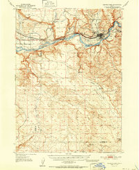
1951 Map of Glenns Ferry
USGS Topo · Published 1951About this map
The Snake River carves through this Idaho landscape, defining the character of Glenns Ferry and Hammett in the early 1950s. This survey records a critical corridor of migration and transport, featuring the historic Three Island Crossing and the Oregon Short Line (Union Pacific) Railroad as it follows the river's path. The map details the infrastructure of a high-desert agricultural economy, including the Main Canal, a Siphon, and several Gravel Pits.
Find a feature on this map
33 named features on this map. Tap any name to fly to it.
Don’t see what you’re looking for? This feature index may not catch every label — zoom into the map to look around manually.
Map Details
Editions of this 1951 Glenns Ferry Map
This is the sole edition of this map. No revisions or reprints were ever made.
Other maps of this area

1892 · Mountain Home
USGS Topo · 1:125,000

1892 · Camas Prairie
USGS Topo · 1:125,000

1893 · Mountain Home
USGS Topo · 1:125,000

1893 · Camas Prairie
USGS Topo · 1:125,000

1947 · Indian Cove
USGS Topo · 1:24,000

1947 · Hammett
USGS Topo · 1:24,000

1947 · Glenns Ferry
USGS Topo · 1:24,000

1947 · Pasadena Valley
USGS Topo · 1:24,000

1948 · Pasadena Valley
USGS Topo · 1:24,000

1948 · Hammett
USGS Topo · 1:24,000