1950s Maps of Latah County, Idaho
Explore 6 historic maps of Latah County from the 1950s. These maps offer a rare glimpse into what life looked like during the 1950s — showing old roads, neighborhoods, homes, and landmarks that have changed or disappeared over time.
Whether you're researching your family's past, planning a metal detecting trip, or studying how Latah County's landscape evolved across the 1950s, these high-resolution maps are a powerful tool for exploring the history of this region.
- Focus on a specific era: All maps on this page are from the 1950s, giving you a focused view of this time period.
- See what’s changed: Compare century-old streets, trails, and buildings to today's modern landscape using overlays and satellite layers.
- Research with precision: Use these maps for genealogy, historical research, land use analysis, or educational projects.
- View, download, or print: Maps are fully viewable online in high resolution, and can be downloaded or printed for your own records.
Start exploring Latah County's history through authentic maps from the 1950s. This is your window into the past.
Latah County, ID maps
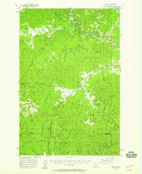
(6)- 1955 Map of Pullman, 1963 Print
 1955 Pullman1963 Print · USGSThe Palouse and Clearwater regions are captured here in the mid-1950s, showing the height of the rail-and-river economy. Genealogists and historians can trace rail lines like the Camas Prairie RR, find local landmarks like Whitman County Memorial Cem, and locate early academic centers at Washington State University and the University of Idaho.3 unique versions available
 - 1955 Map of Spokane, 1965 Print
 1955 Spokane1965 Print · USGSInland Empire life in the fifties and sixties centers on the growth of Spokane and the heavy mining industry of northern Idaho. Trace mid-century landmarks like Fairchild Air Force Base, the Bunker Hill Mine, and early campuses such as Gonzaga University.2 unique versions available
 - 1957 Map of Emida, 1959 Print
 1957 Emida1959 Print · USGSIn the late 1950s, the St Maries River valley was a corridor of timber and rail operations near the Latah and Benewah county line. Genealogists and historians can trace the Milwaukee Road through Emida, Lotus, and the Hollywood townsite.3 unique versions available
 - 1957 Map of Tensed, 1959 Print
 1957 Tensed1959 Print · USGSNorthern Idaho's timber and reservation lands come alive in this mid-century survey of the Benewah and Latah county line. Researchers can trace rural landmarks like the De Smet Mission (Indian School), Mtn Home School, and the settlement of Sanders.2 unique versions available
 - 1958 Map of Spokane
 1958 Spokane1958 Print · USGSThe Inland Empire is shown at a mid-century peak of industrial and military activity, from the rail hubs of Spokane to the deep silver mines of northern Idaho. Researchers can trace the sprawling rail lines of the Union Pacific RR or locate landmarks like Fairchild Air Force Base and the Bunker Hill Smelter & Mine.
 - 1958 Map of Pullman
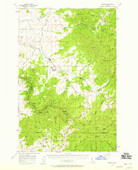
 1958 Pullman1958 Print · USGSThe Palouse and Clearwater regions are captured here in the late fifties, showing the vital river-and-rail connection between eastern Washington and northern Idaho. Local historians can trace the paths of the Camas Prairie RR and Union Pacific RR as they serve towns like Colfax, Kamiah, and Nezperce.2 unique versions available
End of results
Showing maps 1-6 of 6
Top cities of Latah County
- Moscow historical maps
- Genesee historical maps
- Troy historical maps
- Potlatch historical maps
- Juliaetta historical maps
- Deary historical maps
See more
Frequently asked questions
- What are the different types of historical maps available for Latah County?
- What is the oldest map of Latah County?
- Where can I purchase historical maps of Latah County for my home or office?
- Where can I download high-res historical maps of Latah County?
- Are there historical topographic maps available for Latah County?
- Is there historical aerial imagery available for Latah County?
- Where are historical maps of Latah County sourced from?