1970s Maps of Oneida County, Idaho
Explore 14 historic maps of Oneida County from the 1970s. These maps offer a rare glimpse into what life looked like during the 1970s — showing old roads, neighborhoods, homes, and landmarks that have changed or disappeared over time.
Whether you're researching your family's past, planning a metal detecting trip, or studying how Oneida County's landscape evolved across the 1970s, these high-resolution maps are a powerful tool for exploring the history of this region.
- Focus on a specific era: All maps on this page are from the 1970s, giving you a focused view of this time period.
- See what’s changed: Compare century-old streets, trails, and buildings to today's modern landscape using overlays and satellite layers.
- Research with precision: Use these maps for genealogy, historical research, land use analysis, or educational projects.
- View, download, or print: Maps are fully viewable online in high resolution, and can be downloaded or printed for your own records.
Start exploring Oneida County's history through authentic maps from the 1970s. This is your window into the past.
Oneida County, ID maps
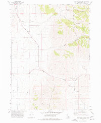
(14)- 1973 Map of Juniper, 1976 Print
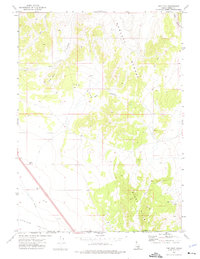
 1973 Juniper1976 Print · USGSJuniper, Idaho, was a vital rural outpost in the early 1970s, where high desert ranching met mountain terrain. Researchers can locate the Juniper Cem, the local Landing Strip, and seasonal water sources like Glen Canyon Spring.
 - 1973 Map of The Cove, 1976 Print
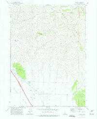
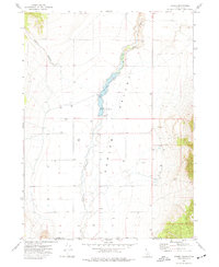
 1973 The Cove1976 Print · USGSThe high Idaho-Utah borderlands come alive in this early 1970s survey of the Sublett Range and Curlew Valley. Researchers can track mountain landmarks like Table Mtn and remote infrastructure including a pipeline and several borrow pits.2 unique versions available
 - 1973 Map of Sublett Troughs, 1976 Print
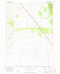
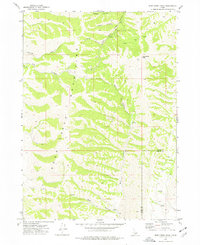
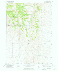
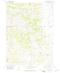 1973 Sublett Troughs1976 Print · USGSOneida County's high country is preserved here in the 1970s, showing a landscape of state bird sanctuaries and national forest lands. Local historians can trace old routes through Summit Springs Pass and locate remote sites like the Sublett Forest Service Station and Pine Creek Reservoir.
 - 1973 Map of Arbon, 1977 Print
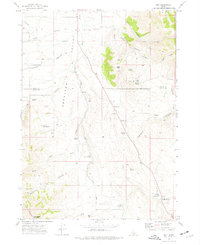
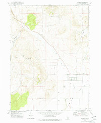
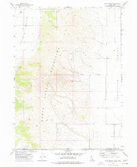
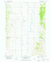 1973 Arbon1977 Print · USGSArbon Valley in the early 1970s remains a landscape of quiet homesteads and high-country springs along the Power and Oneida County line. Researchers can locate the Arbon PO, trace family names at the Arbon Cem, and follow the path of Bannock Creek.
 - 1973 Map of Roy, 1977 Print
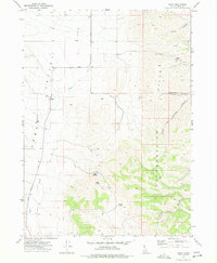
 1973 Roy1977 Print · USGSOneida County ranching and pioneer history are preserved in this mid-seventies survey of the high desert. Researchers can locate the Hudspeth Cutoff Historical Marker and trace early routes and ranch sites like Hansen Ranch and the isolated settlement of Roy.
 - 1973 Map of Black Pine, 1977 Print
 1973 Black Pine1977 Print · USGSOneida County at the Idaho-Utah border in the early seventies shows a landscape centered on water rights and transit. Researchers can locate the Black Pine (Site) and its Cem, alongside named desert waters like Anderson Spring and Higley Spring.
 - 1973 Map of Stone, 1977 Print
 1973 Stone1977 Print · USGSThe Idaho-Utah borderlands come into focus in the early seventies, centered on the ranching community of Stone. Genealogists and local historians can trace the water-rights and land-use patterns through the Stone Reservoir, Curlew Campground, and numerous named wells.
 - 1973 Map of Badger Hole Spring, 1977 Print
 1973 Badger Hole Spring1977 Print · USGSOneida County's high desert ranching lands are captured in the early seventies, detailing the vital water sources and grazing camps of the Sublett Range. You can trace remote livestock outposts like Salyer Cow Camp and find isolated water points such as Badger Hole Spring and Huffman Well.
 - 1973 Map of Sheep Creek Spring, 1977 Print
 1973 Sheep Creek Spring1977 Print · USGSOneida County's high-desert rangeland is captured here in the early 1970s, revealing a landscape defined by cattle ranching and mountain springs. Genealogists and historians can trace the essential water sources of the era, from Sheep Creek Spring to Well sites across Arbon Valley.
 - 1973 Map of Deep Creek Peak, 1977 Print
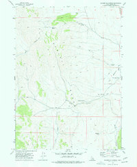
 1973 Deep Creek Peak1977 Print · USGSThe Deep Creek Mountains are captured here in the early 1970s, showcasing the high-altitude topography at the border of Power and Oneida counties. Researchers can trace remote routes and natural landmarks like Deep Creek Peak, Sawmill Canyon, and the Jeep Trail.
 - 1973 Map of Holbrook, 1977 Print
 1973 Holbrook1977 Print · USGSOneida County's high-desert ranching landscape is captured here in the early seventies, centered on the small community of Holbrook. Researchers can locate family landmarks such as Rock House Ranch, the Holbrook Cem, and remote paths leading toward Lookout Mtn.
 - 1973 Map of Buist, 1977 Print
 1973 Buist1977 Print · USGSThe Arbon Valley of southeastern Idaho is captured here in the early 1970s, showcasing a rural landscape defined by its high ridges and vital water sources. Genealogists and local historians can trace family-named landmarks like Pettit Spring and Jensen Pass or follow the route of the Old Sublette Road.
 - 1973 Map of Cedarhill, 1977 Print
 1973 Cedarhill1977 Print · USGSOneida County's high-desert terrain is captured here in the early 1970s, showcasing the high-elevation livestock and mining landscape. Local history buffs can trace the rugged Jeep Trail and locate rural landmarks like the Gravel Pit and Cedarhill settlement.
 - 1973 Map of Co-op Spring, 1977 Print
 1973 Co-op Spring1977 Print · USGSThe Idaho-Utah borderlands near the North Hansel Mountains are captured here in the early 1970s. Genealogists and local historians can trace the remote geography of the Pocatello Valley and identify local landmarks like Co-op Spring and Lynx.
End of results
Showing maps 1-14 of 14
Top cities of Oneida County
Frequently asked questions
- What are the different types of historical maps available for Oneida County?
- What is the oldest map of Oneida County?
- Where can I purchase historical maps of Oneida County for my home or office?
- Where can I download high-res historical maps of Oneida County?
- Are there historical topographic maps available for Oneida County?
- Is there historical aerial imagery available for Oneida County?
- Where are historical maps of Oneida County sourced from?