Old Maps of Oneida County, Idaho for Hiking & Exploration
Hike through history with 252 historic maps of Oneida County. Explore old trails, ghost towns, and forgotten backroads — perfect for outdoor adventurers and local explorers.
- Rediscover forgotten places: Map out old mining camps, roads, and footpaths that no longer exist on modern maps.
- Layer with modern tools: Combine with LiDAR or satellite views to plan hikes through historical terrain.
- Made for exploration: Popular among hikers, overlanders, and local history lovers.
Use these maps to find adventure and explore the hidden past of Oneida County.
Oneida County, ID maps
(252)- 1954 Map of Pocatello, 1963 Print
 1954 Pocatello1963 Print · USGSSoutheast Idaho in the mid-1950s reveals a landscape shaped by massive water reclamation and mountain forests. Researchers can trace the development of the Fort Hall Indian Reservation or locate specific landmarks like the Arbon P O and Emerson School.4 unique versions available
 - 1954 Map of Brigham City, 1968 Print
 1954 Brigham City1968 Print · USGSNorthern Utah and the edges of the Great Salt Lake are captured here during the mid-fifties, showing the region's transition from pioneer rail hubs to modern military ranges. Researchers can find old sidings like Lemay Siding, the Golden Spike Monument, and settlements like Washakie.4 unique versions available
 - 1958 Map of Pocatello
 1958 Pocatello1958 Print · USGSSoutheastern Idaho in the late fifties was a landscape of expanding reservoirs and historic trails. Genealogists and historians can trace the Old Oregon Trail, locate the Bannock Creek Indian Day School, and study the many Union Pacific rail sidings.2 unique versions available
 - 1958 Map of Brigham City
 1958 Brigham City1958 Print · USGSNorthern Utah in the late fifties shows a landscape of extremes, from the salt flats to the bustling Bear River Valley. Trace historical routes like the Old Immigrant Trail and locate local landmarks such as the Brigham Sugar Mill and Booth Valley School.
 - 1958 Map of Sublett, 1960 Print
 1958 Sublett1960 Print · USGSThe high country of Cassia County is captured here in the late fifties, showing the interplay between national forest lands and remote ranching. Researchers can locate named water sources like Moonshine Spring and trace the Van Camp Trail past Broken Circle Ranch.2 unique versions available
 - 1959 Map of Strevell, 1960 Print
 1959 Strevell1960 Print · USGSThe high ridges and mineral-rich canyons of southern Idaho come into focus in the late fifties. Genealogists and historians can trace mining activity at the Ruth Mine and Silver Hills Mine or locate the remote Gunnell Guard Station near the Utah border.
 - 1959 Map of Kelton Pass, 1960 Print
 1959 Kelton Pass1960 Print · USGSThe high desert of Box Elder County is captured here in the late fifties, showcasing a network of family ranches and historical travel routes. Genealogists can locate named homesteads like the Vern Steeds Ranch or trace the Cedar Creek (Old Stage Station) at Kelton Pass.
 - 1962 Map of Brigham City
 1962 Brigham City1962 Print · USGSNorthern Utah in the early sixties reveals a landscape of vast salt flats and growing towns along the Wasatch Front. Researchers can trace the Southern Pacific line past the Golden Spike Monument or locate landmarks like Indian Cave and Donner-Reed Pass.
 - 1963 Map of Daniels, 1993 Print
 1963 Daniels1993 Print · USGSOneida County's high-country ranching and water infrastructure are captured here in the late 1960s. Researchers can trace historic routes like the Old Sublette Road and Jensen Pass Road, or find isolated landmarks such as a lone Grave and the Daniels Dam.
 - 1964 Map of Clarkston, 1966 Print
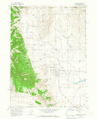 1964 Clarkston1966 Print · USGSSettled at the foot of the western mountains in the 1960s, this area around Clarkston shows a transition from high forest to fertile valley floor. Genealogists and historians can locate the local Cem, the Gravel Pit, and family-named landmarks like Myler Grove and Archibald Hollow.2 unique versions available
 - 1964 Map of Portage, 1966 Print
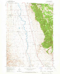 1964 Portage1966 Print · USGSThe Idaho-Utah borderlands are captured here in the mid-1960s, showing the agricultural valley floor set against the peaks of the Cache National Forest. Local researchers can trace family sites in Portage and Washakie, or locate the Washakie Cem and Plymouth Cem.2 unique versions available
 - 1968 Map of Ireland Springs, 1971 Print
 1968 Ireland Springs1971 Print · USGSOneida County's high-country terrain is captured here in the late sixties as a network of canyons and high summits. Researchers can trace the early transit routes through Holbrook Summit, locate family landmarks like John Evans Canyon, and find the remote Ireland Springs.
 - 1968 Map of Grover Canyon, 1971 Print
 1968 Grover Canyon1971 Print · USGSThe high Idaho-Utah borderlands come into focus in this late-sixties survey of the Samaria Mountains and the adjacent Pocatello Valley. Researchers can trace the remote outpost of Ridgedale and find isolated water sources like Anderson Spring and Dry Pine Spring.2 unique versions available
 - 1968 Map of Samaria, 1971 Print
 1968 Samaria1971 Print · USGSThe settlement of Samaria and the surrounding Malad Valley are captured here in the late sixties as the high desert landscape met industrial water needs. Trace family-named landmarks like Thomas Davis Springs or locate the path of the Samaria Lake Canal and the Malad River.
 - 1968 Map of Daniels, 1971 Print
 1968 Daniels1971 Print · USGSOneida County's high-country watershed is captured here in the late sixties as the Little Malad River is managed by Daniels Dam. Researchers can locate specific historical markers like a lone Grave near Wright Hill or trace the early paths of the Old Sublette Road.
 - 1968 Map of Malad Summit, 1971 Print
 1968 Malad Summit1971 Print · USGSThe high pass at Malad Summit served as a vital corridor through the Idaho mountains during the late 1960s. Researchers can locate remote resource sites like a Mill and Mine, and trace old routes through the Caribou National Forest via a pack trail.2 unique versions available
 - 1968 Map of Oxford, 1971 Print
 1968 Oxford1971 Print · USGSThe Marsh Valley corridor comes to life in this late 1960s survey, showing the vital transit and water networks of southern Idaho. Trace family roots at the Oxford Cem and explore the historic geography of Red Rock Pass and Swanlake.
 - 1968 Map of Dairy Creek, 1971 Print
 1968 Dairy Creek1971 Print · USGSOneida County's high country is captured here in the late sixties as a landscape of cattle-range canyons and mountain springs. Genealogists and historians can trace family-named landmarks like Harold Johns Canyon, the waters of Indian Mill Creek, and early routes like the Pack Trail.
 - 1968 Map of Malad City West, 1971 Print
 1968 Malad City West1971 Print · USGSOneida County's agricultural heartland is captured here in the late sixties as the irrigation networks of the valley matured. Genealogists and local historians can trace the homesteads around St Johns, the rail corridor of the Union Pacific, and landmarks like Pleasantview Warm Springs.
 - 1968 Map of Malad City East, 1971 Print
 1968 Malad City East1971 Print · USGSOneida County at the end of the 1960s shows a landscape of mountain reservoirs and the critical Union Pacific rail corridor. Trace local landmarks like the Malad City Cem, County Fairgrounds, and the high boundaries of the Caribou National Forest.2 unique versions available
 - 1968 Map of Henderson Creek, 1971 Print
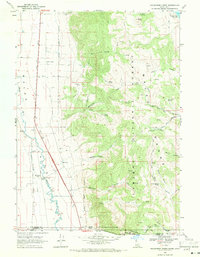 1968 Henderson Creek1971 Print · USGSThe Idaho-Utah borderlands come alive in this late sixties survey of the Malad River valley and its mountain backdrop. Genealogists and hikers can trace the historic Hanson State Boundary Survey or locate the remote Dry Creek Campground and Woodruff siding.2 unique versions available
 - 1968 Map of Wakley Peak, 1971 Print
 1968 Wakley Peak1971 Print · USGSHigh ridges along the Oneida and Bannock County border appear here as they were in the late sixties. Researchers can trace the legacy of resource extraction and ranching through several Mines, Shrives Road, and family-named landmarks like Perry Canyon.2 unique versions available
 - 1968 Map of Clifton, 1971 Print
 1968 Clifton1971 Print · USGSIn the late sixties, the ranching country near Clifton remained a world of mountain basins and complex water rights. Genealogists and local historians can trace the paths of the Pack Trail through North Fork Mine Hollow or locate high-elevation landmarks like Weston Peak and Davis Basin.3 unique versions available
 - 1968 Map of Weston Canyon, 1971 Print
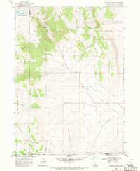 1968 Weston Canyon1971 Print · USGSFranklin and Oneida counties meet in this late-1960s survey of the Idaho-Utah borderlands, where mountain canyons give way to high-desert flats. Genealogists and historians can locate remote landmarks like Standing Rock, Weston Creek Reservoir, and the Washboards.2 unique versions available
 - 1968 Map of Elkhorn Peak, 1971 Print
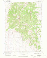 1968 Elkhorn Peak1971 Print · USGSThe high country of Oneida County is captured here in the late sixties, showcasing the rugged drainage systems above the Malad Valley. Researchers can trace old forest service routes and water works like the Summit Guard Sta, Secret Spring Aqueduct, and Birch Spring.
Showing maps 1-25 of 252
Top cities of Oneida County
Frequently asked questions
- What are the different types of historical maps available for Oneida County?
- What is the oldest map of Oneida County?
- Where can I purchase historical maps of Oneida County for my home or office?
- Where can I download high-res historical maps of Oneida County?
- Are there historical topographic maps available for Oneida County?
- Is there historical aerial imagery available for Oneida County?
- Where are historical maps of Oneida County sourced from?