1930s Maps of Bureau County, Illinois
Explore 6 historic maps of Bureau County from the 1930s. These maps offer a rare glimpse into what life looked like during the 1930s — showing old roads, neighborhoods, homes, and landmarks that have changed or disappeared over time.
Whether you're researching your family's past, planning a metal detecting trip, or studying how Bureau County's landscape evolved across the 1930s, these high-resolution maps are a powerful tool for exploring the history of this region.
- Focus on a specific era: All maps on this page are from the 1930s, giving you a focused view of this time period.
- See what’s changed: Compare century-old streets, trails, and buildings to today's modern landscape using overlays and satellite layers.
- Research with precision: Use these maps for genealogy, historical research, land use analysis, or educational projects.
- View, download, or print: Maps are fully viewable online in high resolution, and can be downloaded or printed for your own records.
Start exploring Bureau County's history through authentic maps from the 1930s. This is your window into the past.
Bureau County, IL maps
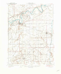
(6)- 1932 Map of Prophetstown
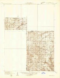
 1932 Prophetstown1932 Print · USGSProphetstown and the Rock River valley are depicted here in the early 1930s, showing a rural landscape crisscrossed by an extensive system of drainage ditches and canals. Researchers can locate dozens of small schools and local landmarks, including Hamilton Grave Sch, the Lyndon Cemetery, and Denrock Station.
 - 1932 Map of Annawan
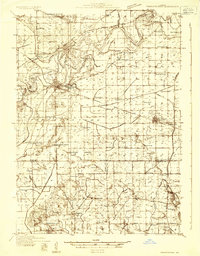
 1932 Annawan1932 Print · USGSHenry and Bureau counties are captured here in the early thirties, showing a landscape shaped by the Illinois and Mississippi Canal. Genealogists can locate dozens of rural landmarks, from Brandenburg Corners to schools like Kuster Sch and Fairview Ch.
 - 1933 Map of Lacon
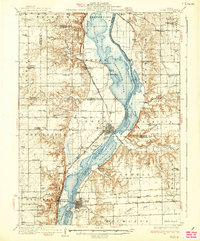
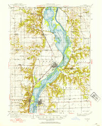 1933 Lacon1933 Print · USGSThe Illinois River valley in the early 1930s reveals a complex network of backwater lakes and rail-dependent towns. Researchers can locate family landmarks like St Joseph Cem, the Whitefield Town Hall, and dozens of rural schoolhouses such as Brush College Sch.3 unique versions available
 - 1933 Map of Camp Grove
 1933 Camp Grove1933 Print · USGSThe Illinois prairie between Bradford and Camp Grove in the 1930s reveals a landscape of vanished rural schools and early rail lines. Genealogists can trace family footprints at St Johns Cem, Union Ch, or the small settlement of Red Town.
 - 1936 Map of Prophetstown
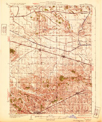
 1936 Prophetstown1936 Print · USGSWhiteside and Henry counties are shown in the mid-1930s, defined by the Rock River and a dense network of prairie schoolhouses. Trace the Hooppole Yorktown and Tampico RR or find local landmarks like Thunderbolt Hill and St Marys Ch.3 unique versions available
 - 1937 Map of Lacon
 1937 Lacon1937 Print · USGSMid-century life along the Illinois River valley reveals a landscape of thriving river towns and rural school districts in the 1930s. Trace the vanished local footprints of Whitefield Town Hall, the Alton RR corridor, and family-named sites like Bonham Cem.2 unique versions available
End of results
Showing maps 1-6 of 6
Top cities of Bureau County
- Princeton historical maps
- Spring Valley historical maps
- Walnut historical maps
- Ladd historical maps
- Sheffield historical maps
- Wyanet historical maps
See more
Frequently asked questions
- What are the different types of historical maps available for Bureau County?
- What is the oldest map of Bureau County?
- Where can I purchase historical maps of Bureau County for my home or office?
- Where can I download high-res historical maps of Bureau County?
- Are there historical topographic maps available for Bureau County?
- Is there historical aerial imagery available for Bureau County?
- Where are historical maps of Bureau County sourced from?