1980s Maps of Bureau County, Illinois
Explore 17 historic maps of Bureau County from the 1980s. These maps offer a rare glimpse into what life looked like during the 1980s — showing old roads, neighborhoods, homes, and landmarks that have changed or disappeared over time.
Whether you're researching your family's past, planning a metal detecting trip, or studying how Bureau County's landscape evolved across the 1980s, these high-resolution maps are a powerful tool for exploring the history of this region.
- Focus on a specific era: All maps on this page are from the 1980s, giving you a focused view of this time period.
- See what’s changed: Compare century-old streets, trails, and buildings to today's modern landscape using overlays and satellite layers.
- Research with precision: Use these maps for genealogy, historical research, land use analysis, or educational projects.
- View, download, or print: Maps are fully viewable online in high resolution, and can be downloaded or printed for your own records.
Start exploring Bureau County's history through authentic maps from the 1980s. This is your window into the past.
Bureau County, IL maps
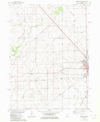
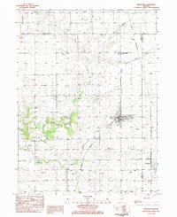
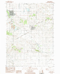
(17)- 1982 Map of New Bedford
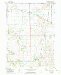 1982 New Bedford1982 Print · USGSThe Illinois prairie of the early 1980s is captured here, showing the rural intersection of Bureau and Whiteside counties. Genealogists can locate family sites near Fairfield Greenville Cem, while the Indian Treaty Boundary offers a glimpse into early land division.
 - 1982 Map of Ohio
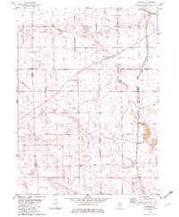
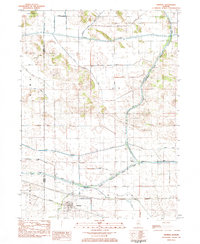
 1982 Ohio1982 Print · USGSThe Illinois prairie near the Bureau and Lee County line is captured in the early eighties as a landscape of grid-roads and rail. Genealogists and local historians can trace the Old Indian Treaty Boundary and find family sites at St Marys Cem or North Prairie Cem.
 - 1982 Map of Walnut
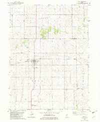
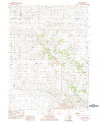
 1982 Walnut1982 Print · USGSThe village of Walnut and its surrounding townships are shown here in the early eighties, defined by the local rail lines and long-standing territorial lines. Genealogists and local historians can locate the Red Oak Ch, the Old Indian Treaty Boundary, and the small settlement of Smith.
 - 1982 Map of La Moille
 1982 La Moille1982 Print · USGSLa Moille and the Bureau County countryside appear here in the early 1980s, revealing a landscape defined by the Burlington Northern and the Old Indian Treaty Boundary. Genealogists and researchers can locate landmarks like Bache Memorial Chapel, Union Cem, and the small settlement of Van Orin.
 - 1982 Map of Mendota West
 1982 Mendota West1982 Print · USGSThe crossroads of the Bureau and La Salle county lines come alive in the early 1980s, showcasing the intersection of the Illinois Central Gulf and Burlington Northern railroads. Genealogists can trace family roots through Erbes Cem and Hetzler Cem, or locate landmarks like Blackstone Sch.
 - 1982 Map of Yorktown
 1982 Yorktown1982 Print · USGSIn the early eighties, this portion of Bureau County remained a landscape of historic boundaries and prairie agriculture. Genealogists and researchers can trace local roots through the Fairfield Ch cemetery and rural settlements like Yorktown and Thomas.
 - 1983 Map of Buda NE, 1984 Print
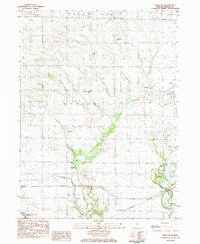 1983 Buda NE1984 Print · USGSBureau County’s rural townships are documented here in the early 1980s, showing a landscape shaped by drainage creeks and family homesteads. Researchers can locate several burial sites like Heatons Point Cem and Corso Cem or trace the path of the Burlington Northern.
 - 1983 Map of Neponset, 1984 Print
 1983 Neponset1984 Print · USGSThe village of Neponset sits at a railway crossroads in the early 1980s, surrounded by coal operations and fertile prairie. Researchers can trace the industrial footprint of the Strip Mine or locate family roots at Floral Hill Cem and Neponset Cem.
 - 1983 Map of Bradford, 1984 Print
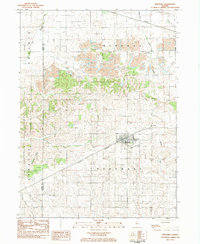
 1983 Bradford1984 Print · USGSStark County and Bureau County agriculture and rail networks are well-defined in the early 1980s. Researchers can trace family history through sites like St Johns Cem and Smith Cem or explore the rail hubs of Bradford and Lombardville.2 unique versions available
 - 1983 Map of Wyanet, 1984 Print
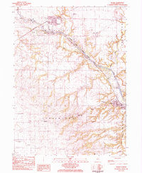 1983 Wyanet1984 Print · USGSBureau County during the early 1980s reveals a landscape defined by the Hennepin Canal and its intricate lock system. Genealogists can trace family roots through numerous local burial sites like Forest Hill Cem, Triplett Cem, and Mt Bloom Cem.
 - 1983 Map of Whitefield, 1984 Print
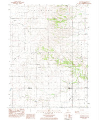 1983 Whitefield1984 Print · USGSNorth-Central Illinois farm country is captured here in the early eighties as rural townships like Milo and Wheatland remained deeply tied to the land. Genealogists can locate family landmarks such as Boyds Grove Cem and Willow Springs Ch.
 - 1983 Map of Manlius, 1984 Print
 1983 Manlius1984 Print · USGSThe agricultural plains of Bureau County come into sharp focus in the early eighties, centered on the rail-side settlement of Manlius. Researchers can trace old family burial grounds at Follett Cem or explore the historic waterworks of the Hennepin Canal.
 - 1983 Map of Buda, 1984 Print
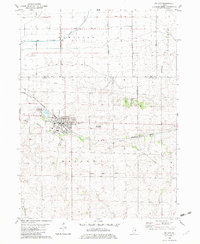
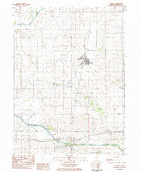
 1983 Buda1984 Print · USGSBuda and Sheffield were bustling rail junctions in the early 1980s, serving the productive farm townships of Bureau County. Genealogists can trace family names through numerous rural sites like Wood Cem, Walnut Grove Cem, and Bunker Hill Ch.
 - 1983 Map of Mineral, 1984 Print
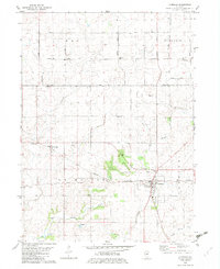
 1983 Mineral1984 Print · USGSIn the early 1980s, the Illinois prairie around the Bureau and Henry county line was a landscape of rail-and-water commerce. Trace the path of the Iowa Railroad through Mineral or explore the historic infrastructure of Lock No 22 along the Hennepin Canal.
 - 1983 Map of Elmira, 1984 Print
 1983 Elmira1984 Print · USGSStark County's agricultural and mining landscape is captured here in the early eighties as rural life centered around the Spoon River. Researchers can locate ancestral sites at Osceola Cem and trace the small-town footprints of Elmira and Modena.
 - 1985 Map of Kewanee
 1985 Kewanee1985 Print · USGSNorth-central Illinois in the mid-eighties shows a landscape of river-valley industry and prairie transit. Researchers can trace family roots through Evergreen Memory Garden or follow the historic Hennepin Canal past Tiskilwa and Wyanet.2 unique versions available
 - 1985 Map of Dixon
 1985 Dixon1985 Print · USGSNorth-central Illinois in the mid-eighties was a land of river cities and expansive prairies defined by rail lines and private airfields. Researchers can locate family landmarks like Oakwood Cem, the Sword Landing Strip, and Sauk Valley College while tracing the C & N W railroad.2 unique versions available
End of results
Showing maps 1-17 of 17
Top cities of Bureau County
- Princeton historical maps
- Spring Valley historical maps
- Walnut historical maps
- Ladd historical maps
- Sheffield historical maps
- Wyanet historical maps
See more
Frequently asked questions
- What are the different types of historical maps available for Bureau County?
- What is the oldest map of Bureau County?
- Where can I purchase historical maps of Bureau County for my home or office?
- Where can I download high-res historical maps of Bureau County?
- Are there historical topographic maps available for Bureau County?
- Is there historical aerial imagery available for Bureau County?
- Where are historical maps of Bureau County sourced from?