Old Maps of Bureau County, Illinois for Metal Detecting
Plan your next treasure hunt with 165 historic maps of Bureau County. Find old homesites, ghost towns, trails, and gathering spots that may be lost to time — perfect for identifying promising metal detecting locations.
- Locate forgotten sites: Uncover places like long-lost settlements, abandoned rail lines, or gathering spots.
- Plan better hunts: Use map overlays combined with LiDAR or satellite views to narrow in on historically rich areas.
- Made for detectorists: Thousands of hobbyists use these maps to discover relics, coins, and hidden history.
Use these historic maps to boost your research and find new opportunities beneath the surface of Bureau County.
Bureau County, IL maps
(165)- 1893 Map of Lacon
 1893 Lacon1893 Print · USGSThe Illinois River valley in the early 1890s reveals a landscape of river-port towns and sprawling backwater lakes. Genealogists and local historians can trace the early rail corridors of the Chicago and Alton Railroad and find long-established river settlements like Henry and Sparland.4 unique versions available
 - 1893 Map of Hennepin
 1893 Hennepin1893 Print · USGSBureau County and the Illinois River valley are captured here in the late nineteenth century as the rail network reached its peak. Genealogists and historians can trace the early footprints of Princeton, Bureau Junction, and Tiskilwa along the major trunk lines of the era.2 unique versions available
 - 1893 Map of Lasalle
 1893 Lasalle1893 Print · USGSThe Illinois River valley was a powerhouse of nineteenth-century industry and transport where the canal era met the railroad boom. Researchers can trace the early street grids of Peru and La Salle or locate vanished stops along the North Western Railway and the Illinois and Michigan Canal.4 unique versions available
 - 1909 Map of Hennepin
 1909 Hennepin1909 Print · USGSNorth-central Illinois at the height of the railroad era is displayed here, centered on the river valleys of Putnam and Bureau counties. Genealogists can locate family landmarks such as the County Farm, Berean Church, and schools like Highland School.
 - 1911 Map of La Salle
 1911 La Salle1911 Print · USGSThe Illinois River valley thrived as a hub of rail and river commerce in the early twentieth century. Researchers can trace the development of industrial centers like La Salle and Oglesby, or locate vanished post offices and rural landmarks like Standard Taft PO and St Bedes College.
 - 1911 Map of Hennepin
 1911 Hennepin1911 Print · USGSThe Illinois River valley and the railroad hub of Princeton are captured here at the height of the steam era. Genealogists and historians can trace family locations near the Highland School, Berean Church, and early village sites like Tiskilwa and Hallowayville.2 unique versions available
 - 1913 Map of La Salle
 1913 La Salle1913 Print · USGSThe industrial heart of the Illinois River valley thrives in the early twentieth century, showing the intersection of heavy rail and river trade. Genealogists can trace family homes near St Bedes College or find old post offices like Standard Taft PO and rural stops at Hicks Corners.4 unique versions available
 - 1921 Map of Buda, 1959 Print
 1921 Buda1959 Print · USGSBureau County’s rail-and-water corridors are in full bloom in the 1920s, showing the intersection of heavy industry and small-town life. Trace family roots through dozens of local landmarks like the County Farm, Old Manlius Church, and the Illinois and Mississippi Canal.
 - 1923 Map of Buda
 1923 Buda1923 Print · USGSBureau County’s agricultural heartland is captured here in the 1920s, defined by its intensive network of railroads and the Illinois and Mississippi Canal. Genealogists and historians can locate scores of one-room schoolhouses like Hickory Grove School and family-named landmarks such as Cedar Bluff.2 unique versions available
 - 1929 Map of Annawan, 1966 Print
 1929 Annawan1966 Print · USGSHenry and Bureau County life in the late 1920s was shaped by the engineering of the Illinois and Mississippi Canal and busy rail corridors. Researchers can trace dozens of rural schoolhouses and family sites like Brandenburg Corners, Kedron, and Francis Park.2 unique versions available
 - 1932 Map of Prophetstown
 1932 Prophetstown1932 Print · USGSProphetstown and the Rock River valley are depicted here in the early 1930s, showing a rural landscape crisscrossed by an extensive system of drainage ditches and canals. Researchers can locate dozens of small schools and local landmarks, including Hamilton Grave Sch, the Lyndon Cemetery, and Denrock Station.
 - 1932 Map of Annawan
 1932 Annawan1932 Print · USGSHenry and Bureau counties are captured here in the early thirties, showing a landscape shaped by the Illinois and Mississippi Canal. Genealogists can locate dozens of rural landmarks, from Brandenburg Corners to schools like Kuster Sch and Fairview Ch.
 - 1933 Map of Lacon
 1933 Lacon1933 Print · USGSThe Illinois River valley in the early 1930s reveals a complex network of backwater lakes and rail-dependent towns. Researchers can locate family landmarks like St Joseph Cem, the Whitefield Town Hall, and dozens of rural schoolhouses such as Brush College Sch.3 unique versions available
 - 1933 Map of Camp Grove
 1933 Camp Grove1933 Print · USGSThe Illinois prairie between Bradford and Camp Grove in the 1930s reveals a landscape of vanished rural schools and early rail lines. Genealogists can trace family footprints at St Johns Cem, Union Ch, or the small settlement of Red Town.
 - 1936 Map of Prophetstown
 1936 Prophetstown1936 Print · USGSWhiteside and Henry counties are shown in the mid-1930s, defined by the Rock River and a dense network of prairie schoolhouses. Trace the Hooppole Yorktown and Tampico RR or find local landmarks like Thunderbolt Hill and St Marys Ch.3 unique versions available
 - 1937 Map of Lacon
 1937 Lacon1937 Print · USGSMid-century life along the Illinois River valley reveals a landscape of thriving river towns and rural school districts in the 1930s. Trace the vanished local footprints of Whitefield Town Hall, the Alton RR corridor, and family-named sites like Bonham Cem.2 unique versions available
 - 1944 Map of Kewanee
 1944 Kewanee1944 Print · USGSHenry and Stark Counties in the 1940s show a landscape of thriving rail towns and closely spaced country schoolhouses. Genealogists can locate family-named landmarks like Cavanagh Cem and Bumble Bee Sch along the Spoon River valley.3 unique versions available
 - 1945 Map of Bradford
 1945 Bradford1945 Print · USGSSettlement and agriculture in Stark and Bureau Counties reached a peak of rural infrastructure in the mid-1940s. Genealogists can trace family footprints across dozens of country school sites like Osceola Center Sch and churches such as Willow Springs Ch.3 unique versions available
 - 1947 Map of La Salle, 1958 Print
 1947 La Salle1958 Print · USGSLa Salle and the Illinois River valley are shown here in the years following the war, as the rail-to-river economy remained in full swing. Local historians can trace the transition from rail to road while locating St Bedes College, Matthiessen Park, and Spring Valley.2 unique versions available
 - 1949 Map of Walnut
 1949 Walnut1949 Print · USGSThe rural landscapes of Bureau and Lee counties are captured in the late 1940s, a time when one-room schools and small rail towns anchored the prairie. Genealogists can trace family landmarks like Bowen Cem, Sturtz Sch, and the community of New Bedford along the Green River.3 unique versions available
 - 1951 Map of Amboy, 1952 Print
 1951 Amboy1952 Print · USGSNorthern Illinois during the early fifties reveals a landscape shaped by military industry and rail transport. Genealogists can locate family landmarks like Woodside Cem, Perkins Grove Ch, and the sprawling Green River Ordnance Plant.3 unique versions available
 - 1952 Map of Mendota, 1954 Print
 1952 Mendota1954 Print · USGSMendota was a bustling railroad crossroads in the 1950s at the junction of three major lines. Genealogists can trace family roots through numerous country burial grounds and schoolhouses like Holy Cross Cem, Restland Cem, and Schlesinger Sch.3 unique versions available
 - 1958 Map of Aurora, 1969 Print
 1958 Aurora1969 Print · USGSNorthern Illinois in the late fifties shows a landscape of powerful river industry and expanding transport corridors. Genealogists and historians can trace the development of Aurora and Joliet or locate sites like the Elwood Ordnance Plant and Starved Rock.3 unique versions available
 - 1961 Map of Aurora
 1961 Aurora1961 Print · USGSNorthern Illinois at the height of the post-war era reveals a landscape of massive industrial works and thriving river towns. Genealogists and historians can trace the paths of the Lincoln Highway or locate long-standing landmarks like the Green River Ordnance Plant and Starved Rock State Park.
 - 1966 Map of Malden, 1967 Print
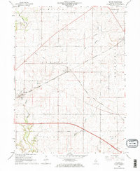 1966 Malden1967 Print · USGSBureau County at the height of the mid-sixties reveals a landscape defined by industrial rail lines and small prairie villages. Genealogists and historians can trace family-named lands near Berean Cem, the village of Malden, and the Old Railroad Grade.2 unique versions available
Showing maps 1-25 of 165
Top cities of Bureau County
- Princeton historical maps
- Spring Valley historical maps
- Walnut historical maps
- Ladd historical maps
- Sheffield historical maps
- Wyanet historical maps
See more
Frequently asked questions
- What are the different types of historical maps available for Bureau County?
- What is the oldest map of Bureau County?
- Where can I purchase historical maps of Bureau County for my home or office?
- Where can I download high-res historical maps of Bureau County?
- Are there historical topographic maps available for Bureau County?
- Is there historical aerial imagery available for Bureau County?
- Where are historical maps of Bureau County sourced from?