1940s Maps of Carroll County, Illinois
Explore 8 historic maps of Carroll County from the 1940s. These maps offer a rare glimpse into what life looked like during the 1940s — showing old roads, neighborhoods, homes, and landmarks that have changed or disappeared over time.
Whether you're researching your family's past, planning a metal detecting trip, or studying how Carroll County's landscape evolved across the 1940s, these high-resolution maps are a powerful tool for exploring the history of this region.
- Focus on a specific era: All maps on this page are from the 1940s, giving you a focused view of this time period.
- See what’s changed: Compare century-old streets, trails, and buildings to today's modern landscape using overlays and satellite layers.
- Research with precision: Use these maps for genealogy, historical research, land use analysis, or educational projects.
- View, download, or print: Maps are fully viewable online in high resolution, and can be downloaded or printed for your own records.
Start exploring Carroll County's history through authentic maps from the 1940s. This is your window into the past.
Carroll County, IL maps
(8)- 1940 Map of Morrison
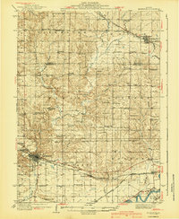 1940 Morrison1940 Print · USGSWhiteside and Carroll counties thrive as a robust agricultural landscape during the late 1930s, defined by the twin engines of the Rock River and major rail lines. Genealogists can locate dozens of country schools like Ideal Sch and old cemeteries including Clyde Cem and Bethel Cem.2 unique versions available
 - 1941 Map of Miles
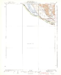 1941 Miles1941 Print · USGSThe Mississippi River borderlands come alive in this pre-war survey, documenting the small settlements and rail lines that defined the Jo Daviess and Carroll County line. Researchers can trace the river's complex island system or find local landmarks like Whitton, Lost Mound, and the Lost Mound Sch.2 unique versions available
 - 1942 Map of Mt Carroll, 1959 Print
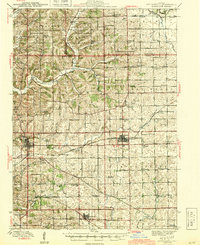
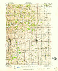 1942 Mt Carroll1959 Print · USGSNorthwest Illinois farmland is mapped here just after the start of the war, showing a landscape tightly connected by rail and rural schools. Genealogists can locate family landmarks like Sabin Ch, the Spring Valley Cem, or rail stops at Ashdale Junc and Kittredge.2 unique versions available
 - 1942 Map of Forreston, 1965 Print
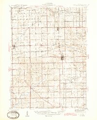
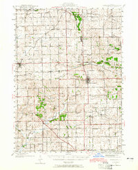 1942 Forreston1965 Print · USGSForreston and the surrounding Ogle County prairie are shown during a height of rail activity in the 1940s. Genealogists can trace family roots through numerous country schools like White Oak Sch and rural landmarks such as Prairie Dell Ch and Shelly Cem.2 unique versions available
 - 1944 Map of Mt Carroll
 1944 Mt Carroll1944 Print · USGSThe Carroll County landscape during the mid-1940s was defined by a dense network of country schools and the vital crossroads of the Milwaukee Road. Genealogists and historians can trace old homesteads near St Wendelin Cem, Ashdale Junc, and Loran.2 unique versions available
 - 1945 Map of Forreston
 1945 Forreston1945 Print · USGSIn the mid-1940s, the rural landscapes of Ogle and Stephenson counties were defined by a sprawling network of one-room schoolhouses and busy rail lines. Genealogists and historians can trace family roots at West Grove Ch, Maryland, and schools like Wall Sch or Good Sch.2 unique versions available
 - 1946 Map of Sterling, 1969 Print
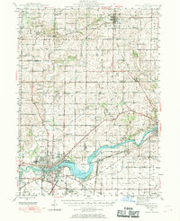 1946 Sterling1969 Print · USGSThe Rock River corridor in the mid-1940s is captured here, showing the industrial heart of the region alongside its deep agricultural roots. Researchers can find dozens of country schools and cemeteries, including Buffalo Grove Sch, Zion Cem, and Oak Knoll Mem Park Cem.
 - 1948 Map of Sterling
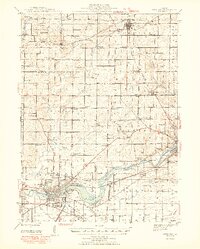 1948 Sterling1948 Print · USGSMid-century Sterling and Rock Falls are captured here during a time of robust rail and river activity. Genealogists can trace family roots through dozens of rural landmarks, including the Prairieville settlement, West Science Ridge Ch, and Hitt Cem.2 unique versions available
End of results
Showing maps 1-8 of 8
Top cities of Carroll County
- Savanna historical maps
- Mount Carroll historical maps
- Lanark historical maps
- Milledgeville historical maps
- Shannon historical maps
- Thomson historical maps
See more
Frequently asked questions
- What are the different types of historical maps available for Carroll County?
- What is the oldest map of Carroll County?
- Where can I purchase historical maps of Carroll County for my home or office?
- Where can I download high-res historical maps of Carroll County?
- Are there historical topographic maps available for Carroll County?
- Is there historical aerial imagery available for Carroll County?
- Where are historical maps of Carroll County sourced from?