1990s Maps of Crawford County, Illinois
Explore 6 historic maps of Crawford County from the 1990s. These maps offer a rare glimpse into what life looked like during the 1990s — showing old roads, neighborhoods, homes, and landmarks that have changed or disappeared over time.
Whether you're researching your family's past, planning a metal detecting trip, or studying how Crawford County's landscape evolved across the 1990s, these high-resolution maps are a powerful tool for exploring the history of this region.
- Focus on a specific era: All maps on this page are from the 1990s, giving you a focused view of this time period.
- See what’s changed: Compare century-old streets, trails, and buildings to today's modern landscape using overlays and satellite layers.
- Research with precision: Use these maps for genealogy, historical research, land use analysis, or educational projects.
- View, download, or print: Maps are fully viewable online in high resolution, and can be downloaded or printed for your own records.
Start exploring Crawford County's history through authentic maps from the 1990s. This is your window into the past.
Crawford County, IL maps
(6)- 1998 Map of Moriah, 2002 Print
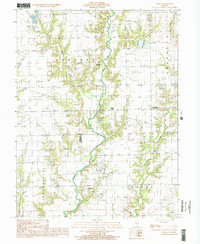 1998 Moriah2002 Print · USGSSoutheastern Illinois farm and oil country comes to life in this late twentieth-century survey of the Clark and Crawford county line. Genealogists and researchers can trace rural homesteads and local landmarks like Moriah, Moonshine, and the Oil Fields along the North Fork Embarras River.
 - 1998 Map of Merom, 2002 Print
 1998 Merom2002 Print · USGSThe Wabash River valley comes to life in this survey, showing the river winding between Indiana and Illinois at the end of the century. Genealogists and historians can trace family locations near Merom, Graysville, and rural landmarks like Old French Cem or Big Springs Ch.
 - 1998 Map of West Union, 2002 Print
 1998 West Union2002 Print · USGSThe Illinois-Indiana border along the Wabash River highlights this rural landscape in the late 1990s. Researchers can trace family history through numerous country burial sites like Bradbury Cem and Harrison Cem, or locate the old landing at York.
 - 1998 Map of Porterville, 2002 Print
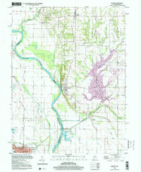
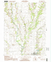
 1998 Porterville2002 Print · USGSCrawford County, Illinois, is seen here in the late 1990s as a landscape defined by industrial extraction and historic boundaries. Researchers can trace the Indian Treaty Boundary and locate numerous Oil Fields near Porterville (Eaton).
 - 1998 Map of Annapolis, 2002 Print
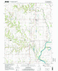
 1998 Annapolis2002 Print · USGSCrawford County at the close of the twentieth century reveals a landscape shaped by petroleum extraction and prairie farming. Researchers can trace land tracts near Annapolis, locate family Cem sites, or map the Oil Field near Melrose.
 - 1998 Map of Oblong North, 2002 Print
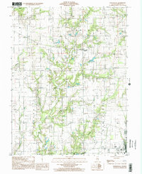
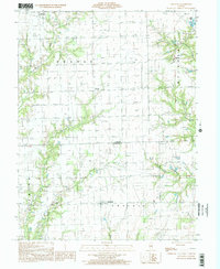
 1998 Oblong North2002 Print · USGSThe rural landscape of eastern Illinois at the turn of the millennium was defined by the North Fork Embarras River and its oil-rich fields. Genealogists and historians can trace the development of Oblong, find the small settlement of Kibbie, and locate rural landmarks like a hilltop Cem.
End of results
Showing maps 1-6 of 6
Top cities of Crawford County
- Robinson historical maps
- Oblong historical maps
- Palestine historical maps
- Hutsonville historical maps
- Flat Rock historical maps
- Stoy historical maps
Frequently asked questions
- What are the different types of historical maps available for Crawford County?
- What is the oldest map of Crawford County?
- Where can I purchase historical maps of Crawford County for my home or office?
- Where can I download high-res historical maps of Crawford County?
- Are there historical topographic maps available for Crawford County?
- Is there historical aerial imagery available for Crawford County?
- Where are historical maps of Crawford County sourced from?