1960s Maps of DeKalb County, Illinois
Explore 14 historic maps of DeKalb County from the 1960s. These maps offer a rare glimpse into what life looked like during the 1960s — showing old roads, neighborhoods, homes, and landmarks that have changed or disappeared over time.
Whether you're researching your family's past, planning a metal detecting trip, or studying how DeKalb County's landscape evolved across the 1960s, these high-resolution maps are a powerful tool for exploring the history of this region.
- Focus on a specific era: All maps on this page are from the 1960s, giving you a focused view of this time period.
- See what’s changed: Compare century-old streets, trails, and buildings to today's modern landscape using overlays and satellite layers.
- Research with precision: Use these maps for genealogy, historical research, land use analysis, or educational projects.
- View, download, or print: Maps are fully viewable online in high resolution, and can be downloaded or printed for your own records.
Start exploring DeKalb County's history through authentic maps from the 1960s. This is your window into the past.
DeKalb County, IL maps
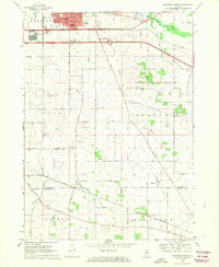
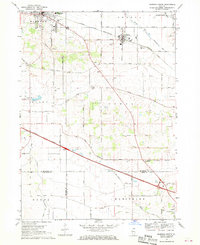
(14)- 1961 Map of Aurora
 1961 Aurora1961 Print · USGSNorthern Illinois at the height of the post-war era reveals a landscape of massive industrial works and thriving river towns. Genealogists and historians can trace the paths of the Lincoln Highway or locate long-standing landmarks like the Green River Ordnance Plant and Starved Rock State Park.
 - 1963 Map of Rockford
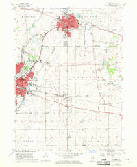
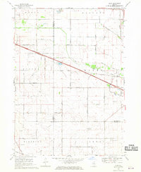
 1963 Rockford1963 Print · USGSThe mid-century industrial corridor along the Rock River is shown here during a period of rapid post-war growth. Researchers can trace the extensive rail lines of the Chicago and North Western or locate local landmarks like the Rockford Ordnance Depot and Holy Hill.
 - 1968 Map of Belvidere South, 1970 Print
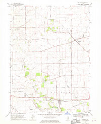
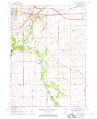
 1968 Belvidere South1970 Print · USGSThe Boone and De Kalb County line comes alive in this late 1960s record of rural Illinois agriculture and evolving transportation. Genealogists and local historians can trace family ties at Bloods Point Cem, locate the old Grange Hall, and follow the Illinois Central rail line through Herbert.3 unique versions available
 - 1968 Map of Genoa, 1970 Print
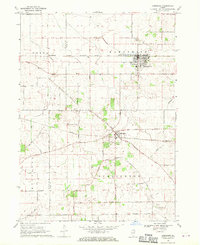
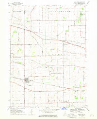
 1968 Genoa1970 Print · USGSDeKalb County farmland and growing railroad towns are captured here in the late sixties as the region maintained its agricultural roots. Genealogists can locate family sites near Kingston Cem and Charter Grove or trace the busy Illinois Central rail line.2 unique versions available
 - 1968 Map of Sycamore, 1970 Print
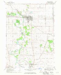
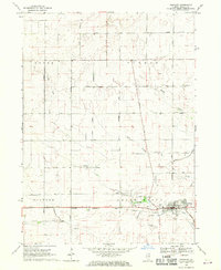
 1968 Sycamore1970 Print · USGSDeKalb and Sycamore are shown during a period of mid-century growth along the Kishwaukee River corridor. Genealogists and researchers can trace family landmarks like Mt Carmel Cem, Bethany Ch, and the Ohio Grove Grange across the prairie.2 unique versions available
 - 1968 Map of Kirkland, 1970 Print
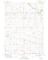
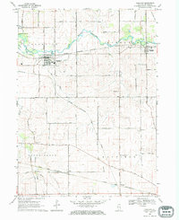 1968 Kirkland1970 Print · USGSDeKalb County farmland is captured here in the late sixties, showing the active rail hubs of Kirkland and Kingston along the Kishwaukee River. Researchers can trace old family footprints at Maple Cem, locate the Mayfield Ch, or follow the Old RR Grade.
 - 1968 Map of Big Rock, 1970 Print
 1968 Big Rock1970 Print · USGSThe Kane and DeKalb County borderlands are seen here in the late sixties, showcasing a landscape of section-line farms and quiet rural crossroads. Genealogists can trace family names at the West Big Rock Cem or follow the Chicago Burlington and Quincy rail line through Big Rock.2 unique versions available
 - 1968 Map of Hinckley, 1970 Print
 1968 Hinckley1970 Print · USGSThe village of Hinckley and the surrounding Illinois prairie are documented here during the late 1960s. Researchers can trace the path of the Chicago Burlington and Quincy railroad or locate local landmarks like Immanuel Ch and Miller Cem.
 - 1968 Map of Hampshire, 1970 Print
 1968 Hampshire1970 Print · USGSKane and De Kalb counties are captured here in the late sixties as the rural landscape centered on rail-town life. Researchers can trace ancestral farmsteads along Plank Road or locate family plots at Hampshire Center Cem and Burlington Union Cem.2 unique versions available
 - 1968 Map of Fairdale, 1970 Print
 1968 Fairdale1970 Print · USGSDeKalb and Ogle Counties are captured in the late sixties as an active agricultural and transport corridor. Local researchers can trace family names and landmarks like Hicks Mills Cem, the small settlement of Fairdale, and the path of the Chicago and North Western railroad.2 unique versions available
 - 1968 Map of Marengo South, 1970 Print
 1968 Marengo South1970 Print · USGSIn the late sixties, the rural borderlands of McHenry, DeKalb, and Kane Counties were undergoing change as modern highways intersected old rail lines. Genealogists and local historians can trace family-named roads and sites like Coral Cem, Union Ch, and the Tollgate near Harmony.2 unique versions available
 - 1968 Map of Riley, 1970 Print
 1968 Riley1970 Print · USGSIn the late sixties, this agricultural landscape at the junction of three counties remained centered on family farms and country roads. Researchers can locate specific sites like the No 10 School, Barber Cem, and the Grange Hall near the village of Riley.2 unique versions available
 - 1968 Map of Cherry Valley, 1970 Print
 1968 Cherry Valley1970 Print · USGSNorthern Illinois agriculture meets the growing industrial corridors of Winnebago and Boone counties in the late sixties. Genealogists and local historians can trace family-named routes and landmarks like Arlington Memorial Park Cem, Flora Ch, and the rail stops at Irene or Perryville.3 unique versions available
 - 1968 Map of Maple Park, 1970 Print
 1968 Maple Park1970 Print · USGSThe DeKalb and Kane County borderlands appear in the late sixties as a thriving rail-and-farm landscape. Researchers can trace family history through numerous rural landmarks like South Burlington Cem, SS Peter and Paul Sch, and the small siding at Richardson.2 unique versions available
End of results
Showing maps 1-14 of 14
Top cities of DeKalb County
Frequently asked questions
- What are the different types of historical maps available for DeKalb County?
- What is the oldest map of DeKalb County?
- Where can I purchase historical maps of DeKalb County for my home or office?
- Where can I download high-res historical maps of DeKalb County?
- Are there historical topographic maps available for DeKalb County?
- Is there historical aerial imagery available for DeKalb County?
- Where are historical maps of DeKalb County sourced from?