1950s Maps of Gallatin County, Illinois
Explore 14 historic maps of Gallatin County from the 1950s. These maps offer a rare glimpse into what life looked like during the 1950s — showing old roads, neighborhoods, homes, and landmarks that have changed or disappeared over time.
Whether you're researching your family's past, planning a metal detecting trip, or studying how Gallatin County's landscape evolved across the 1950s, these high-resolution maps are a powerful tool for exploring the history of this region.
- Focus on a specific era: All maps on this page are from the 1950s, giving you a focused view of this time period.
- See what’s changed: Compare century-old streets, trails, and buildings to today's modern landscape using overlays and satellite layers.
- Research with precision: Use these maps for genealogy, historical research, land use analysis, or educational projects.
- View, download, or print: Maps are fully viewable online in high resolution, and can be downloaded or printed for your own records.
Start exploring Gallatin County's history through authentic maps from the 1950s. This is your window into the past.
Gallatin County, IL maps
(14)- 1950 Map of Paducah
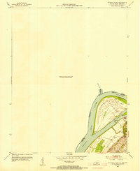
 1950 Paducah1950 Print · USGSThe confluence of the great midwestern rivers defines this mid-century landscape at the intersection of Illinois, Kentucky, and Missouri. Genealogists and historians can trace the rail-and-river economy through the hubs of Paducah, Cairo, and Metropolis or locate family roots near the Wildcat Hills.
 - 1953 Map of Wabash Island
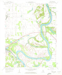
 1953 Wabash Island1953 Print · USGSThe tri-state confluence of Illinois, Indiana, and Kentucky is captured here in the early fifties at a time when river transport and local industry intersected. Genealogists and researchers can locate the Reburn Ch, a Pvt Ferry crossing, and an active Oil Well on Wabash Island.2 unique versions available
 - 1953 Map of Grove Center, 1954 Print
 1953 Grove Center1954 Print · USGSUnion County, Kentucky, was a landscape of river-fed bottomlands and rising hills in the early fifties. Genealogists and local historians can trace the paths to Spring Grove Ch, locate Oil Wells in the eastern hills, or follow the Illinois Central through Grove Center.
 - 1954 Map of Paducah
 1954 Paducah1954 Print · USGSSouthern Illinois and Western Kentucky intersect at the great river confluences during this mid-century era of rail and river industry. Genealogists and historians can trace family roots and commerce through river towns like Cairo, Metropolis, and Golconda, or along the tracks of the Illinois Central Railroad.2 unique versions available
 - 1958 Map of Emma, 1959 Print
 1958 Emma1959 Print · USGSThe river border between Illinois and Indiana is captured here in the late fifties, showcasing a landscape of oxbow lakes and winding channels. Genealogists can trace family roots through sites like Emma Concord Ch, Abshire Cem, and the riverfront at Rising Sun.
 - 1958 Map of Wabash Island, 1959 Print
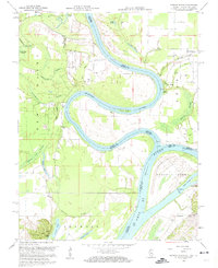 1958 Wabash Island1959 Print · USGSThe confluence of the Ohio and Wabash Rivers is captured in the late 1950s, revealing a dynamic tri-state river landscape. Researchers can trace the riverbank life of the era through features like Pet Ferry, the Black Sch, and the riverside site of Bone Bank.2 unique versions available
 - 1959 Map of Herod, 1960 Print
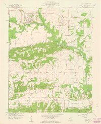
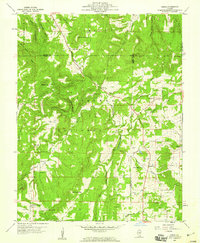 1959 Herod1960 Print · USGSSouthern Illinois in the late fifties is captured here at the intersection of industry and the Shawnee National Forest. Researchers can trace old family names at Wallace Cem, locate forgotten sites like Empire Mine, or find rural landmarks such as One Horse Gap.3 unique versions available
 - 1959 Map of Shawneetown, 1960 Print
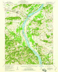 1959 Shawneetown1960 Print · USGSSouthern Illinois and western Kentucky meet along the Ohio River in the late 1950s, a period defined by river commerce and coal mining. Researchers can trace the dual centers of Old Shawneetown and New Shawneetown or locate family sites like Zion Ch and Saline Mines.2 unique versions available
 - 1959 Map of Saline Mines, 1960 Print
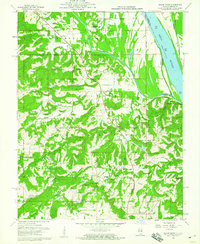 1959 Saline Mines1960 Print · USGSSouthern Illinois during the late fifties reveals a landscape shaped by river commerce and intensive mineral extraction. Researchers can trace dozens of family-named cemeteries and rural sites like the Hole Mine, Saline Landing, and Shewmaker Sch.3 unique versions available
 - 1959 Map of Equality, 1960 Print
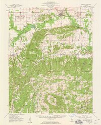 1959 Equality1960 Print · USGSSouthern Illinois during the late fifties reveals a landscape of transition between the industrial river valleys and the wooded heights of the Shawnee National Forest. Researchers can locate deep-rooted community sites like Equality, the Salt Wells, and remote locations such as One Horse Gap.2 unique versions available
 - 1959 Map of Equality, 1960 Print
 1959 Equality1960 Print · USGSSouthern Illinois at the end of the fifties reveals a landscape shaped by river transport and the early salt trade. Local historians can trace rail lines and mineral sites like the Negro Spring Salt Well, Berkel Mine, and the village of Equality.3 unique versions available
 - 1959 Map of Shawneetown, 1960 Print
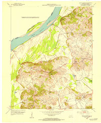
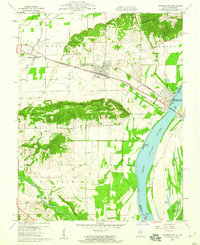 1959 Shawneetown1960 Print · USGSGallatin County and the Ohio River shoreline appear here in the late fifties during a period of transition for the local settlements. Researchers can trace the dual sites of Old Shawneetown and Shawneetown, alongside historic rural sites like Ringold Ch and Kanady Cem.3 unique versions available
 - 1959 Map of Grove Center, 1960 Print
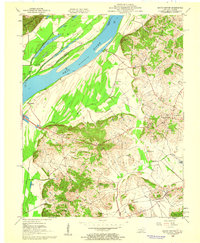 1959 Grove Center1960 Print · USGSThe Ohio River border between Illinois and Kentucky comes alive in this mid-century survey of Union County. Local historians can trace family roots through rural landmarks like Grove Center, Zion Ch, and the many Oil Wells dotting the Dyer Hills.2 unique versions available
 - 1959 Map of Karbers Ridge, 1960 Print
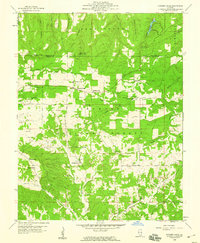 1959 Karbers Ridge1960 Print · USGSSouthern Illinois at the end of the fifties reveals a landscape of high timber and scattered upland farms within the Shawnee National Forest. Genealogists and hikers can trace the paths to Hicks Dome, the Lookout Tower at High Knob, and more than a dozen family cemeteries like Sneed Cem.3 unique versions available
End of results
Showing maps 1-14 of 14
Top cities of Gallatin County
- Shawneetown historical maps
- Ridgway historical maps
- Equality historical maps
- New Haven historical maps
- Omaha historical maps
- Junction historical maps
See more
Frequently asked questions
- What are the different types of historical maps available for Gallatin County?
- What is the oldest map of Gallatin County?
- Where can I purchase historical maps of Gallatin County for my home or office?
- Where can I download high-res historical maps of Gallatin County?
- Are there historical topographic maps available for Gallatin County?
- Is there historical aerial imagery available for Gallatin County?
- Where are historical maps of Gallatin County sourced from?