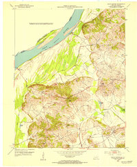
1953 Map of Grove Center
USGS Topo · Published 1954About this map
The Ohio River flows along the northwestern edge of this Kentucky-Illinois borderland, defining a landscape where river bottomlands meet the rising topography of the Dyer Hills. In the early 1950s, the region's rural character is marked by a network of small churches that served as local anchors, including Zion Ch, Spring Grove Ch, and Mt Olive Ch. The Illinois Central railroad cuts through the southern terrain, connecting the settlement at Grove Center to the wider region. Systematic drainage is evident through the Goose Pond Ditch, which reclaimed land near the riverbank. Scattered Oil Wells across the eastern hills point to the era's active resource extraction, while landmarks like The Rocks and Bald Hill provide distinct navigational points above the river's normal pool elevation.
Find a feature on this map
34 named features on this map. Tap any name to fly to it.
Don’t see what you’re looking for? This feature index may not catch every label — zoom into the map to look around manually.
Map Details
Editions of this 1953 Grove Center Map
This is the sole edition of this map. No revisions or reprints were ever made.
Other maps of this area

1905 · New Haven
USGS Topo · 1:62,500

1906 · New Haven
USGS Topo · 1:62,500

1907 · Morganfield
USGS Topo · 1:62,500

1916 · Shawneetown
USGS Topo · 1:62,500

1917 · Uniontown
USGS Topo · 1:62,500

1949 · Paducah
USGS Topo · 1:250,000

1949 · New Haven
USGS Topo · 1:62,500

1949 · Morganfield
USGS Topo · 1:24,000

1950 · Paducah
USGS Topo · 1:250,000

1951 · Sturgis
USGS Topo · 1:24,000