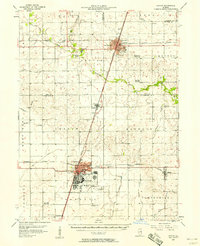
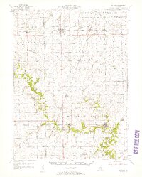
1950s Maps of Iroquois County, Illinois
Explore 9 historic maps of Iroquois County from the 1950s. These maps offer a rare glimpse into what life looked like during the 1950s — showing old roads, neighborhoods, homes, and landmarks that have changed or disappeared over time.
Whether you're researching your family's past, planning a metal detecting trip, or studying how Iroquois County's landscape evolved across the 1950s, these high-resolution maps are a powerful tool for exploring the history of this region.
- Focus on a specific era: All maps on this page are from the 1950s, giving you a focused view of this time period.
- See what’s changed: Compare century-old streets, trails, and buildings to today's modern landscape using overlays and satellite layers.
- Research with precision: Use these maps for genealogy, historical research, land use analysis, or educational projects.
- View, download, or print: Maps are fully viewable online in high resolution, and can be downloaded or printed for your own records.
Start exploring Iroquois County's history through authentic maps from the 1950s. This is your window into the past.
Iroquois County, IL maps
(9)- 1953 Map of Chicago, 1964 Print
 1953 Chicago1964 Print · USGSThe southern Lake Michigan shoreline was rapidly modernizing in the mid-fifties, balancing heavy industry with its famous academic centers. Researchers can trace the footprints of Notre Dame University or locate vanished sites like the Kingsbury Ordnance Plant and Meigs Field.5 unique versions available
 - 1953 Map of Danville, 1965 Print
 1953 Danville1965 Print · USGSIndiana and Illinois crossroads come to life in this mid-century survey as the interstate era begins to reshape the river-and-rail landscape. Genealogists and collectors can trace the historic paths of the Nickel Plate railroad or locate smaller communities like Veedersburg, Goodland, and Bismarck.3 unique versions available
 - 1955 Map of Danville
 1955 Danville1955 Print · USGSThe Indiana-Illinois borderlands during the mid-fifties reveal a landscape of thriving rail hubs and university towns. Researchers can trace the legacy of Purdue University, the Tippecanoe Battlefield, and the path of the Pennsylvania RR.
 - 1956 Map of Danville
 1956 Danville1956 Print · USGSMid-century Indiana and Illinois are captured here as the river-and-rail economy evolved into the modern highway era. Researchers can trace ancestral roots and old transport lines through Logansport, Battle Ground, and the dams at Lake Shafer.
 - 1957 Map of Chicago
 1957 Chicago1957 Print · USGSThe industrial heartland and southern Great Lakes shoreline are captured here during the peak of mid-century growth. Researchers can trace the massive Gary Steel Works, the grounds of the University of Notre Dame, and the early paths of the Tri-State Tollway.
 - 1957 Map of Paxton, 1958 Print
 1957 Paxton1958 Print · USGSPost-war central Illinois thrives along the rail lines and at Chanute Air Force Base. Researchers can trace family roots at St Alfreds Chapel or locate several abandoned country schools like Moffett Sch (Abandoned).2 unique versions available
 - 1957 Map of Potomac, 1958 Print
 1957 Potomac1958 Print · USGSVermilion County rural life is captured here in the late fifties, showing a landscape defined by rail lines and river crossings. Trace family history through dozens of landmarks like St Lawrence Cem, Selsor Ford, and the Science Hill Sch.2 unique versions available
 - 1958 Map of Aurora, 1969 Print
 1958 Aurora1969 Print · USGSNorthern Illinois in the late fifties shows a landscape of powerful river industry and expanding transport corridors. Genealogists and historians can trace the development of Aurora and Joliet or locate sites like the Elwood Ordnance Plant and Starved Rock.3 unique versions available
 - 1958 Map of Peoria, 1969 Print
 1958 Peoria1969 Print · USGSCentral Illinois thrived as a hub of education and transport during the late sixties, as the new interstate system began to reshape the prairie. Genealogists and historians can trace local landmarks like Springdale Cem, Bradley University, and the sprawling grounds of Chanute AFB.4 unique versions available
End of results
Showing maps 1-9 of 9
Top cities of Iroquois County
- Watseka historical maps
- Gilman historical maps
- Onarga historical maps
- Milford historical maps
- Clifton historical maps
- Sheldon historical maps
See more
Frequently asked questions
- What are the different types of historical maps available for Iroquois County?
- What is the oldest map of Iroquois County?
- Where can I purchase historical maps of Iroquois County for my home or office?
- Where can I download high-res historical maps of Iroquois County?
- Are there historical topographic maps available for Iroquois County?
- Is there historical aerial imagery available for Iroquois County?
- Where are historical maps of Iroquois County sourced from?