1960s Maps of Iroquois County, Illinois
Explore 17 historic maps of Iroquois County from the 1960s. These maps offer a rare glimpse into what life looked like during the 1960s — showing old roads, neighborhoods, homes, and landmarks that have changed or disappeared over time.
Whether you're researching your family's past, planning a metal detecting trip, or studying how Iroquois County's landscape evolved across the 1960s, these high-resolution maps are a powerful tool for exploring the history of this region.
- Focus on a specific era: All maps on this page are from the 1960s, giving you a focused view of this time period.
- See what’s changed: Compare century-old streets, trails, and buildings to today's modern landscape using overlays and satellite layers.
- Research with precision: Use these maps for genealogy, historical research, land use analysis, or educational projects.
- View, download, or print: Maps are fully viewable online in high resolution, and can be downloaded or printed for your own records.
Start exploring Iroquois County's history through authentic maps from the 1960s. This is your window into the past.
Iroquois County, IL maps
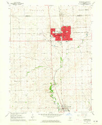
(17)- 1961 Map of Aurora
 1961 Aurora1961 Print · USGSNorthern Illinois at the height of the post-war era reveals a landscape of massive industrial works and thriving river towns. Genealogists and historians can trace the paths of the Lincoln Highway or locate long-standing landmarks like the Green River Ordnance Plant and Starved Rock State Park.
 - 1961 Map of Peoria
 1961 Peoria1961 Print · USGSCentral Illinois thrived at the intersection of river trade and rail power during the late fifties. Genealogists and local historians can trace the rail networks of the Illinois Central and Wabash, alongside landmarks like Chanute AFB and Weldon Springs State Park.
 - 1963 Map of Peoria
 1963 Peoria1963 Print · USGSCentral Illinois thrived as a rail and highway crossroads during the early sixties, centered on the bustling Illinois River valley. Genealogists and historians can trace the mid-century layout of Peoria, locate the grounds of Chanute Air Force Base, and follow historic lines like the Toledo Peoria and Western Railway.
 - 1963 Map of Leesville, 1965 Print
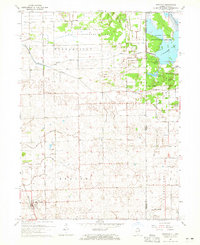
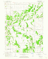 1963 Leesville1965 Print · USGSThe Illinois-Indiana borderland is captured here in the early 1960s, showing a landscape of drainage ditches and remote rural settlements. Genealogists and historians can locate Morgan Cem, the Pembroke Sch, and small community centers like Hopkins Park and Leesville.3 unique versions available
 - 1964 Map of Darrow, 1965 Print
 1964 Darrow1965 Print · USGSThe Illinois-Indiana borderlands are captured here in the mid-1960s, showing the quiet rail-and-river geography of Iroquois County. Researchers can trace the Milwaukee Road through Darrow or locate the Blue Ridge Cem near the state line.2 unique versions available
 - 1964 Map of St. Anne, 1965 Print
 1964 St. Anne1965 Print · USGSSt. Anne and the surrounding Kankakee County prairie are shown here in the mid-sixties at a peak of rail-driven agriculture. Researchers can trace historic family names through St Annes Cemetery, locate the community at Wichert, or find the old Claypits at Brickkiln.2 unique versions available
 - 1964 Map of Watseka, 1965 Print
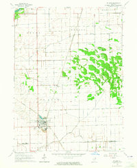
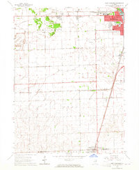
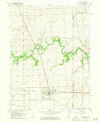
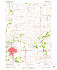 1964 Watseka1965 Print · USGSWatseka sits at a strategic river confluence in the mid-1960s, serving as a vital rail junction for the Chicago and Eastern Illinois. Local historians can trace family plots at Oak Hill Cemetery and locate vanished rural landmarks like Prairie Dell Ch.
 - 1964 Map of Hoopeston, 1965 Print
 1964 Hoopeston1965 Print · USGSHoopeston and the surrounding Vermilion County prairie are captured here in the mid-sixties, showcasing a landscape defined by rail intersections and small-town growth. Genealogists and local historians can trace the foundations of Rossville, the grounds of Floral Hill Cem, and local landmarks like Mc Ferren Park.
 - 1964 Map of Wellington, 1965 Print
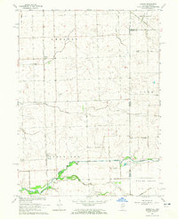
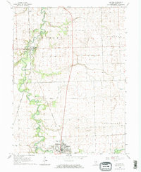
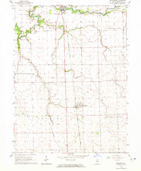 1964 Wellington1965 Print · USGSIroquois County in the mid-1960s shows a landscape of productive prairie townships and vital rail connections. Researchers can trace the Chicago and Eastern Illinois line through Wellington or locate the Sugar Creek Chapel and Alonzo.2 unique versions available
 - 1964 Map of Stockland, 1965 Print
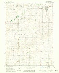
 1964 Stockland1965 Print · USGSIroquois County farm country meets the Indiana border in the early sixties, centered on the railroad corridor and drainage networks. Researchers can locate the Totheroh Cem, the Prairie Green Sch, and small centers like Stockland and Hallock.
 - 1964 Map of Beaverville, 1965 Print
 1964 Beaverville1965 Print · USGSIroquois County agricultural lands are shown in the 1960s as a hub of rail transit and water management. Genealogists and local historians can trace the tracks of the New York Central, locate St Joseph Ch, or find family plots at Oak Ridge Cem.2 unique versions available
 - 1964 Map of Donovan, 1965 Print
 1964 Donovan1965 Print · USGSDonovan and the eastern edge of Iroquois County appear in the mid-1960s as a productive agricultural landscape bisected by two major railroads. Genealogists and local historians can trace family locations near Beaver Ch, Beaver Cem, and the rail stops at Hooper or North Hooper.
 - 1964 Map of Milford, 1965 Print
 1964 Milford1965 Print · USGSIroquois County agricultural life in the mid-1960s is centered on the Sugar Creek valley and the Chicago and Eastern Illinois rail line. Researchers can trace local lineage through Body Cem and Vennum Cem or locate old aviation sites like Newman Landing Strip.2 unique versions available
 - 1964 Map of Ambia, 1965 Print
 1964 Ambia1965 Print · USGSThe Illinois-Indiana borderlands of the mid-1960s are captured here during a period of active rail transit and rural agriculture. Genealogists and local historians can trace family roots through settlements like Cheneyville, Powley Corners, and the rural Antioch Ch.
 - 1964 Map of West Kankakee, 1965 Print
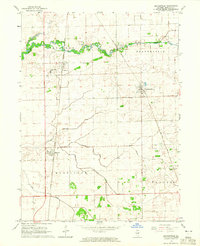
 1964 West Kankakee1965 Print · USGSThe Kankakee outskirts and surrounding townships are shown here during the mid-sixties as the region's rail and aviation hubs expanded. Researchers can trace the Illinois Central line through Chebanse, find St James Cem, or locate the Kankakee Airport.3 unique versions available
 - 1964 Map of Sheldon, 1965 Print
 1964 Sheldon1965 Print · USGSEastern Illinois and the Indiana borderlands are captured here in the mid-sixties, showing a landscape defined by rail junctions and prairie drainage. Genealogists can locate family landmarks like Gaffield Cemetery and Morris Chapel, or trace the paths of the Pennsylvania and New York Central railroads.3 unique versions available
 - 1964 Map of Kankakee, 1965 Print
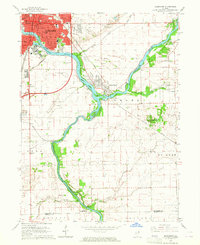 1964 Kankakee1965 Print · USGSKankakee and its riverfront neighborhoods come to life in this mid-century survey as the city expanded southward toward Aroma Park. Genealogists and historians can trace the grounds of the Kankakee State Hospital, the New York Central rail corridor, and local landmarks like Mt Langham.2 unique versions available
End of results
Showing maps 1-17 of 17
Top cities of Iroquois County
- Watseka historical maps
- Gilman historical maps
- Onarga historical maps
- Milford historical maps
- Clifton historical maps
- Sheldon historical maps
See more
Frequently asked questions
- What are the different types of historical maps available for Iroquois County?
- What is the oldest map of Iroquois County?
- Where can I purchase historical maps of Iroquois County for my home or office?
- Where can I download high-res historical maps of Iroquois County?
- Are there historical topographic maps available for Iroquois County?
- Is there historical aerial imagery available for Iroquois County?
- Where are historical maps of Iroquois County sourced from?