1990s Maps of Jackson County, Illinois
Explore 12 historic maps of Jackson County from the 1990s. These maps offer a rare glimpse into what life looked like during the 1990s — showing old roads, neighborhoods, homes, and landmarks that have changed or disappeared over time.
Whether you're researching your family's past, planning a metal detecting trip, or studying how Jackson County's landscape evolved across the 1990s, these high-resolution maps are a powerful tool for exploring the history of this region.
- Focus on a specific era: All maps on this page are from the 1990s, giving you a focused view of this time period.
- See what’s changed: Compare century-old streets, trails, and buildings to today's modern landscape using overlays and satellite layers.
- Research with precision: Use these maps for genealogy, historical research, land use analysis, or educational projects.
- View, download, or print: Maps are fully viewable online in high resolution, and can be downloaded or printed for your own records.
Start exploring Jackson County's history through authentic maps from the 1990s. This is your window into the past.
Jackson County, IL maps
(12)- 1993 Map of Crosstown, 1996 Print
 1993 Crosstown1996 Print · USGSSoutheast Missouri’s river hills are captured here in the 1990s, showing the rural communities of Perry County along the Mississippi River. Genealogists can trace local landmarks in Crosstown, Brazeau, and Farrar, including secluded hilltop cemeteries.
 - 1993 Map of Neelys Landing, 1996 Print
 1993 Neelys Landing1996 Print · USGSThe riverfront bluffs and bottomlands of Cape Girardeau County are captured here in the early nineties as the landscape remained largely rural. Genealogists and historians can trace old river connections at Neelys Landing and Hines Landing or locate family sites near New Wells.
 - 1994 Map of Altenburg, 1996 Print
 1994 Altenburg1996 Print · USGSPerry County and the Mississippi River bottoms are shown in high detail during the 1990s, capturing a landscape defined by historic river landings and blufftop towns. Genealogists and historians can trace family roots through Altenburg, Frohna, and the Neunert Cem, or locate old river points like Seventysix.2 unique versions available
 - 1994 Map of Raddle, 1996 Print
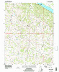
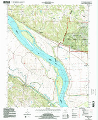
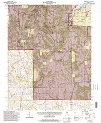
 1994 Raddle1996 Print · USGSJackson County during the mid-nineties shows a landscape of deep timber and river bottomlands within the Shawnee National Forest. Genealogists and local historians can locate several family burial grounds, including McCormick Cemetery and Lee Cemetery, alongside the small communities of Raddle and Glenn.2 unique versions available
 - 1994 Map of Wolf Lake, 1996 Print
 1994 Wolf Lake1996 Print · USGSIn the mid-1990s, the Mississippi bottomlands south of Grand Tower reveal a landscape shaped by drainage projects and river navigation. Genealogists and local historians can trace legacy sites like Aldridge, Kings Ferry, and the landing near Wolf Lake.
 - 1994 Map of Rockwood, 1996 Print
 1994 Rockwood1996 Print · USGSThe riverfront communities of Randolph and Jackson counties come into focus during the 1990s as they navigate the shifting Mississippi River bottomlands. Genealogists can trace numerous family burial sites like Woods Cemetery and Hindman Cemetery near Rockwood.2 unique versions available
 - 1994 Map of Gorham, 1996 Print
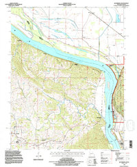
 1994 Gorham1996 Print · USGSSouthern Illinois river life and rail history converge near Gorham in the mid-1990s. Researchers can trace the winding Big Muddy River oxbows and locate historic burial grounds like Goodbread Cemetery or landmarks like Rattlesnake Ferry.2 unique versions available
 - 1996 Map of Cobden, 1998 Print
 1996 Cobden1998 Print · USGSSouthern Illinois in the mid-nineties shows a landscape shaped by forest conservation and the Illinois Central Gulf railroad. Trace family sites like Mount Tabor Cem or the rural community of Alto Pass near Bald Knob.
 - 1996 Map of Oraville, 1998 Print
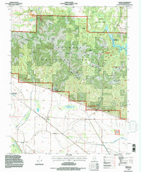
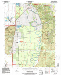
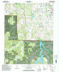
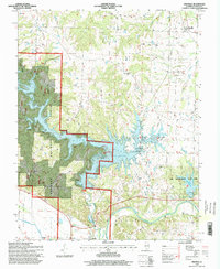 1996 Oraville1998 Print · USGSJackson County is defined by the expansive waters of Kinkaid Lake and the dense woodlands of the Shawnee National Forest during the mid-1990s. Researchers can trace local heritage through numerous family sites like Lone Oak Cem, Bartlett Cem, and Camp Creek Ch.
 - 1996 Map of Carbondale, 1998 Print
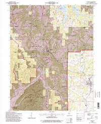
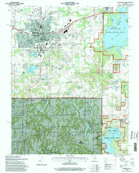 1996 Carbondale1998 Print · USGSSouthern Illinois at the close of the twentieth century shows the expanding footprint of the university alongside its surrounding wildlands. Local historians can trace the Illinois Central Railroad through Boskydell and Makanda, or locate landmarks like Oakland Cem and Attucks Sch.
 - 1996 Map of Pomona, 1998 Print
 1996 Pomona1998 Print · USGSSouthern Illinois in the mid-nineties shows a landscape of deep forests and rural outposts nestled between growing regional hubs. Researchers can locate family landmarks like the Worthen Sch Cem, trace the Illinois Central Railroad, or find the Pomona Natural Bridge.
 - 1996 Map of Makanda, 1998 Print
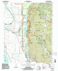
 1996 Makanda1998 Print · USGSSouthern Illinois in the mid-nineties shows a landscape deeply defined by conservation and recreation within the Shawnee National Forest. Researchers can trace rural lineages through numerous family sites like Kelley Cem and Evergreen Cem or locate the historic Stone Fort.
End of results
Showing maps 1-12 of 12
Top cities of Jackson County
- Carbondale historical maps
- Murphysboro historical maps
- De Soto historical maps
- Elkville historical maps
- Pomona historical maps
- Sand Ridge historical maps
See more
Frequently asked questions
- What are the different types of historical maps available for Jackson County?
- What is the oldest map of Jackson County?
- Where can I purchase historical maps of Jackson County for my home or office?
- Where can I download high-res historical maps of Jackson County?
- Are there historical topographic maps available for Jackson County?
- Is there historical aerial imagery available for Jackson County?
- Where are historical maps of Jackson County sourced from?