1960s Maps of Jackson County, Illinois
Explore 14 historic maps of Jackson County from the 1960s. These maps offer a rare glimpse into what life looked like during the 1960s — showing old roads, neighborhoods, homes, and landmarks that have changed or disappeared over time.
Whether you're researching your family's past, planning a metal detecting trip, or studying how Jackson County's landscape evolved across the 1960s, these high-resolution maps are a powerful tool for exploring the history of this region.
- Focus on a specific era: All maps on this page are from the 1960s, giving you a focused view of this time period.
- See what’s changed: Compare century-old streets, trails, and buildings to today's modern landscape using overlays and satellite layers.
- Research with precision: Use these maps for genealogy, historical research, land use analysis, or educational projects.
- View, download, or print: Maps are fully viewable online in high resolution, and can be downloaded or printed for your own records.
Start exploring Jackson County's history through authentic maps from the 1960s. This is your window into the past.
Jackson County, IL maps
(14)- 1961 Map of Paducah
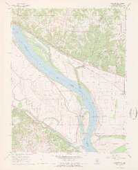
 1961 Paducah1961 Print · USGSThe Lower Ohio Valley at mid-century is a landscape defined by its great rivers and newly formed reservoirs. Researchers can trace the riverfronts of Paducah and Metropolis, or locate smaller settlements like Old Shawneetown and Cave in Rock along the banks.2 unique versions available
 - 1964 Map of Paducah
 1964 Paducah1964 Print · USGSThe river-and-rail corridor of Southern Illinois and Western Kentucky is captured here during the height of the mid-century industrial era. Genealogists and researchers can trace local landmarks across several counties, from the rail yards of Paducah to the waters of Crab Orchard Lake and Kentucky Reservoir.2 unique versions available
 - 1966 Map of Carbondale, 1967 Print
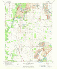
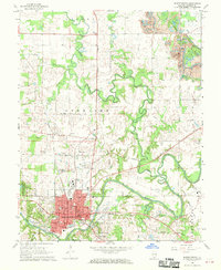
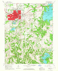 1966 Carbondale1967 Print · USGSCarbondale and its surrounding forests and lakes are captured here in the mid-sixties as the university and recreation areas expanded. Genealogists can trace family names at Snider Hill Cem or locate historic sites like Attucks Sch and Boskydell.4 unique versions available
 - 1966 Map of Makanda, 1967 Print
 1966 Makanda1967 Print · USGSSouthern Illinois at the height of the mid-century shows a landscape of dense forests and rural settlements at the edge of the Ozarks. Trace family history through dozens of landmarks like Evergreen Cem, Water Valley, and the Stone Fort at Giant City State Park.3 unique versions available
 - 1968 Map of Rockwood, 1969 Print
 1968 Rockwood1969 Print · USGSThe Mississippi River borderlands of Illinois and Missouri are captured here in the late sixties. Trace the many family burial sites like Woods Cem and Hindman Cem, or the rail lines of the Missouri Pacific near Rockwood.3 unique versions available
 - 1968 Map of Elkville, 1969 Print
 1968 Elkville1969 Print · USGSSouthern Illinois coal and rail communities are captured here in the late sixties, showing the transition between rural farmland and industrial mining. Genealogists can locate family burial sites like Old Du Quoin Cem and Greer Cem, or trace the rail corridors through Dowell and Hallidayboro.2 unique versions available
 - 1968 Map of Oraville, 1970 Print
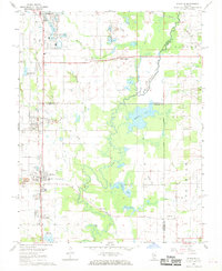
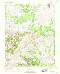
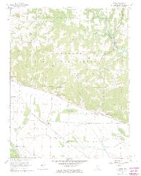
 1968 Oraville1970 Print · USGSJackson County is captured during a period of transition in the late sixties as the Big Muddy River bottomlands meet the rising waters of a new reservoir. Researchers can trace rural lineages at Williamson Cem or Pleasant Hill Ch and locate the Crisenberry Dam while it was still under construction.3 unique versions available
 - 1968 Map of Willisville, 1970 Print
 1968 Willisville1970 Print · USGSWillisville and Campbell Hill sat at the intersection of rail and resource extraction during the late sixties. Genealogists and local historians can trace family burial grounds at St Lukes Cem and Barrow Cem or locate the Gulf Mobile and Ohio rail line.2 unique versions available
 - 1968 Map of Ava, 1970 Print
 1968 Ava1970 Print · USGSSouthwestern Illinois in the late sixties reveals a landscape of coal-rich hills and quiet rail towns along the Gulf Mobile and Ohio tracks. Researchers can trace family history through numerous rural cemeteries like Evergreen Cem or explore the terrain around Sato and Tater Hill.2 unique versions available
 - 1968 Map of Vergennes, 1970 Print
 1968 Vergennes1970 Print · USGSSouthern Illinois at the end of the sixties shows a landscape shaped by coal extraction and the rail lines of the Illinois Central. Genealogists can trace family landmarks like Parrish Cem and Tuthill Cem near the village of Vergennes.
 - 1968 Map of De Soto, 1970 Print
 1968 De Soto1970 Print · USGSSouthern Illinois at the end of the 1960s reveals a complex network of river valleys and railroad junctions between Jackson and Williamson counties. Genealogists and historians can trace family-named sites like Howard Cem and Reeds Station alongside the active tracks of the MISSOURI PACIFIC RAILROAD.2 unique versions available
 - 1968 Map of Murphysboro, 1970 Print
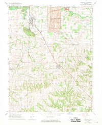
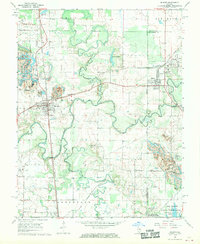
 1968 Murphysboro1970 Print · USGSJackson County, Illinois, is captured here in the late sixties as the regional rail and river networks converge at the seat of MURPHYSBORO. Genealogists and local historians can trace rural landmarks like McElvain Sch, Zion Cem, and the old Harrison settlement.3 unique versions available
 - 1968 Map of Raddle, 1970 Print
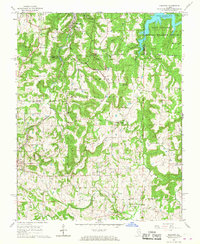
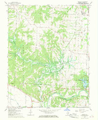
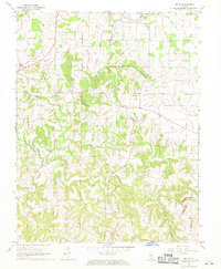
 1968 Raddle1970 Print · USGSSouthern Jackson County is captured here in the late sixties as the valley of Kinkaid Creek prepared for the creation of Kinkaid Lake. You can locate family burial sites like McBride Cem, the settlement of Raddle, and the Indian Mound near Worthen Bayou.3 unique versions available
 - 1968 Map of Welge, 1970 Print
 1968 Welge1970 Print · USGSIn the late sixties, the rural communities of southern Illinois remained centered around family farms and country churches. Genealogists can trace local history through numerous landmarks like Paradise Cem, St Johns Ch, and the settlement of Welge.
End of results
Showing maps 1-14 of 14
Top cities of Jackson County
- Carbondale historical maps
- Murphysboro historical maps
- De Soto historical maps
- Elkville historical maps
- Pomona historical maps
- Sand Ridge historical maps
See more
Frequently asked questions
- What are the different types of historical maps available for Jackson County?
- What is the oldest map of Jackson County?
- Where can I purchase historical maps of Jackson County for my home or office?
- Where can I download high-res historical maps of Jackson County?
- Are there historical topographic maps available for Jackson County?
- Is there historical aerial imagery available for Jackson County?
- Where are historical maps of Jackson County sourced from?