Old Maps of Oraville, Illinois for Hiking & Exploration
Hike through history with 17 historic maps of Oraville. Explore old trails, ghost towns, and forgotten backroads — perfect for outdoor adventurers and local explorers.
- Rediscover forgotten places: Map out old mining camps, roads, and footpaths that no longer exist on modern maps.
- Layer with modern tools: Combine with LiDAR or satellite views to plan hikes through historical terrain.
- Made for exploration: Popular among hikers, overlanders, and local history lovers.
Use these maps to find adventure and explore the hidden past of Oraville.
Oraville, IL maps
(17)- 1910 Map of Murphysboro
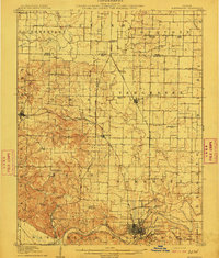 1910 Murphysboro1910 Print · USGSSouthern Illinois at the turn of the century shows a landscape of busy rail junctions and tight-knit rural school districts. Genealogists can trace family footprints at Sutter Church, Sodom School, and the early township centers of Oraville and Vergennes.2 unique versions available
 - 1938 Map of Murphysboro, 1958 Print
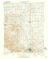 1938 Murphysboro1958 Print · USGSSouthern Illinois in the late thirties is defined here by the busy rail hubs and river bends of the Jackson and Perry county line. Researchers can trace rural lineages through numerous country schoolhouses like Sugar Hill School and Woodward School or old rail junctions at Oraville and Texas Junction.
 - 1949 Map of Paducah
 1949 Paducah1949 Print · USGSThe confluence of the Ohio, Mississippi, Tennessee, and Cumberland rivers at the close of the 1940s reveals a region bound by water and rail. Researchers can trace historic river landings, timberlands in the Shawnee National Forest, and the coal-mining infrastructure around West Frankfort and Herrin.2 unique versions available
 - 1950 Map of Paducah
 1950 Paducah1950 Print · USGSThe confluence of the great midwestern rivers defines this mid-century landscape at the intersection of Illinois, Kentucky, and Missouri. Genealogists and historians can trace the rail-and-river economy through the hubs of Paducah, Cairo, and Metropolis or locate family roots near the Wildcat Hills.
 - 1954 Map of Paducah
 1954 Paducah1954 Print · USGSSouthern Illinois and Western Kentucky intersect at the great river confluences during this mid-century era of rail and river industry. Genealogists and historians can trace family roots and commerce through river towns like Cairo, Metropolis, and Golconda, or along the tracks of the Illinois Central Railroad.2 unique versions available
 - 1961 Map of Paducah
 1961 Paducah1961 Print · USGSThe Lower Ohio Valley at mid-century is a landscape defined by its great rivers and newly formed reservoirs. Researchers can trace the riverfronts of Paducah and Metropolis, or locate smaller settlements like Old Shawneetown and Cave in Rock along the banks.2 unique versions available
 - 1964 Map of Paducah
 1964 Paducah1964 Print · USGSThe river-and-rail corridor of Southern Illinois and Western Kentucky is captured here during the height of the mid-century industrial era. Genealogists and researchers can trace local landmarks across several counties, from the rail yards of Paducah to the waters of Crab Orchard Lake and Kentucky Reservoir.2 unique versions available
 - 1968 Map of Oraville, 1970 Print
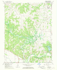 1968 Oraville1970 Print · USGSJackson County is captured during a period of transition in the late sixties as the Big Muddy River bottomlands meet the rising waters of a new reservoir. Researchers can trace rural lineages at Williamson Cem or Pleasant Hill Ch and locate the Crisenberry Dam while it was still under construction.3 unique versions available
 - 1984 Map of Carbondale, 1985 Print
 1984 Carbondale1985 Print · USGSSouthern Illinois in the mid-1980s was a crossroads of major rail lines and vast conservation lands centered on Carbondale. Local researchers can trace the development of Southern Illinois University, the Menard Correctional Center, and the many shorelines of Crab Orchard Lake.
 - 1986 Map of Carbondale
 1986 Carbondale1986 Print · USGSSouthern Illinois and the Mississippi River valley are captured in the mid-eighties as a landscape of diverse water systems and conservation lands. Researchers can trace the development of Southern Illinois University or locate landmarks like Fort Gage and St Marys Seminary.
 - 1987 Map of Paducah, 1988 Print
 1987 Paducah1988 Print · USGSThe Lower Ohio Valley and the Illinois Ozarks come alive in this late twentieth-century regional survey. Genealogists and local historians can trace river-town roots and state park landmarks from Metropolis to Cape Girardeau and Trail of Tears State Park.
 - 1996 Map of Oraville, 1998 Print
 1996 Oraville1998 Print · USGSJackson County is defined by the expansive waters of Kinkaid Lake and the dense woodlands of the Shawnee National Forest during the mid-1990s. Researchers can trace local heritage through numerous family sites like Lone Oak Cem, Bartlett Cem, and Camp Creek Ch.
 - 2012 Map of Oraville, 2012 Print
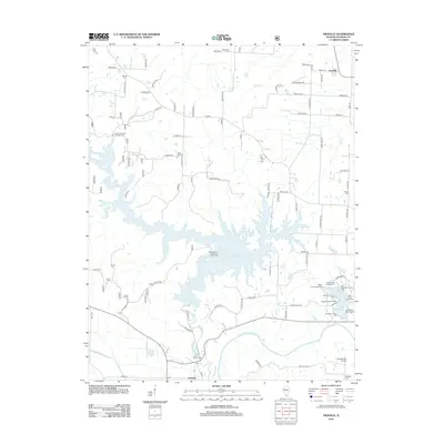 2012 Oraville2012 Print · USGSCovers Oraville, including Grimsby, Jackson County, and other nearby areas
 - 2015 Map of Oraville, 2015 Print
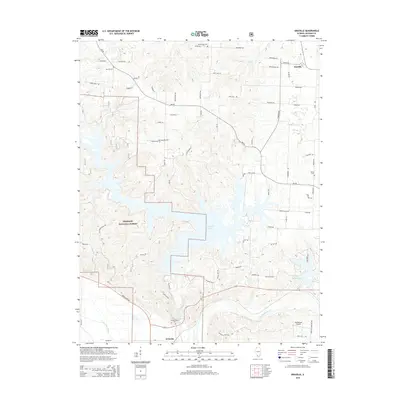 2015 Oraville2015 Print · USGSCovers Oraville, including Grimsby, Jackson County, and other nearby areas
 - 2018 Map of Oraville, 2018 Print
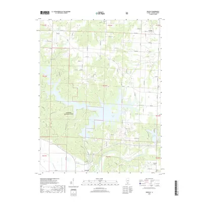 2018 Oraville2018 Print · USGSCovers Oraville, including Grimsby, Jackson County, and other nearby areas
 - 2021 Map of Oraville, 2021 Print
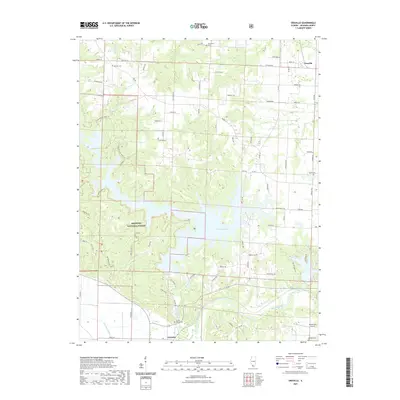 2021 Oraville2021 Print · USGSCovers Oraville, including Grimsby, Jackson County, and other nearby areas
 - 2024 Map of Oraville, 2024 Print
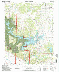
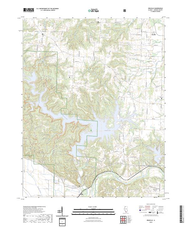 2024 Oraville2024 Print · USGSJackson County's hills and bottomlands are shown in modern detail as of 2024, centered on the expansive waters of Kinkaid Lake. Genealogists and local historians can trace rural family sites like Lone Oak Cem, the small settlement of Grimsby, and landmarks such as Rendleman Airport.
End of results
Showing maps 1-17 of 17
Top cities near Oraville
- Carbondale historical maps
- Murphysboro historical maps
- Du Quoin historical maps
- Pinckneyville historical maps
- De Soto historical maps
- Percy historical maps
See more
Frequently asked questions
- What are the different types of historical maps available for Oraville?
- What is the oldest map of Oraville?
- Where can I purchase historical maps of Oraville for my home or office?
- Where can I download high-res historical maps of Oraville?
- Are there historical topographic maps available for Oraville?
- Is there historical aerial imagery available for Oraville?
- Where are historical maps of Oraville sourced from?