1900s (20th Century) Maps of Jo Daviess County, Illinois
Explore 57 historic maps of Jo Daviess County from the 1900s (20th Century). These maps offer a rare glimpse into what life looked like during the 1900s — showing old roads, neighborhoods, homes, and landmarks that have changed or disappeared over time.
Whether you're researching your family's past, planning a metal detecting trip, or studying how Jo Daviess County's landscape evolved across the 1900s, these high-resolution maps are a powerful tool for exploring the history of this region.
- Focus on a specific era: All maps on this page are from the 1900s, giving you a focused view of this time period.
- See what’s changed: Compare century-old streets, trails, and buildings to today's modern landscape using overlays and satellite layers.
- Research with precision: Use these maps for genealogy, historical research, land use analysis, or educational projects.
- View, download, or print: Maps are fully viewable online in high resolution, and can be downloaded or printed for your own records.
Start exploring Jo Daviess County's history through authentic maps from the 1900s. This is your window into the past.
Jo Daviess County, IL maps
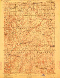
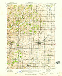
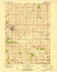
(57)- 1900 Map of Lancaster
 1900 Lancaster1900 Print · USGSGrant County and the Mississippi River bluffs are captured at the close of the nineteenth century, showing a landscape of river towns and ridge-top farms. Researchers can trace the early rail corridors and vanished river landings from Cassville and Potosi to the county seat at Lancaster.
 - 1901 Map of Peosta
 1901 Peosta1901 Print · USGSDubuque and Jackson counties were a hub of river commerce and early rail expansion at the turn of the century. Genealogists and historians can trace the foundations of communities like Peosta, St.Donatus, and the mill sites at Washington Mills.4 unique versions available
 - 1902 Map of Mineral Point
 1902 Mineral Point1902 Print · USGSSouthwest Wisconsin and Northern Illinois are mapped here at the height of the regional mining era. Genealogists and historians can trace the rail lines of the Illinois Central to vanished junctions and local landmarks like Meekers Grove, Calamine, and Elk Grove.4 unique versions available
 - 1904 Map of Lancaster, 1953 Print
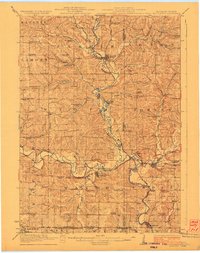
 1904 Lancaster1953 Print · USGSSouthwest Wisconsin and its neighboring river lands are shown at the turn of the century as railroads began to dominate the ridge tops. Researchers can trace the development of the river-and-rail economy through sites like Spechts Ferry, Sinsinawa Mound, and Lancaster.
 - 1908 Map of Lancaster
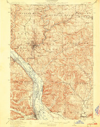
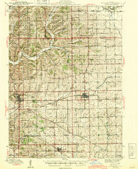
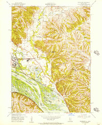
 1908 Lancaster1908 Print · USGSGrant County and the Mississippi River border appear in the first decade of the twentieth century, when river crossings and new rail lines defined local commerce. Researchers can trace the landings at Spechts Ferry and Mc Cartney or locate early settlements like British Hollow and Beetown.5 unique versions available
 - 1911 Map of Elizabeth
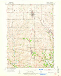
 1911 Elizabeth1911 Print · USGSNorthwestern Illinois at the start of the century was a landscape of ridge-top schools and valley-floor mines. Genealogists can trace early homesteads near Salem Church or locate historic mining operations like the Illinois Mines and Skene Mine.2 unique versions available
 - 1911 Map of Galena, 1953 Print
 1911 Galena1953 Print · USGSBefore the decline of the local lead industry, this area was a hub of mining and river commerce. Genealogists can trace family names through dozens of rural schools and mines like Blackjack Mine, or locate long-lost river crossings like Gears Ferry.3 unique versions available
 - 1913 Map of Galena
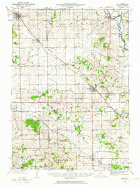
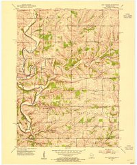
 1913 Galena1913 Print · USGSThe mining and river districts of Jo Daviess County are captured here just before the First World War. Genealogists and researchers can locate family-named landmarks like Horseshoe Mound, local schools such as Miners School, and industrial sites like the Hoskin Mine.3 unique versions available
 - 1923 Map of South Wayne
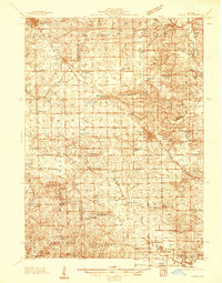
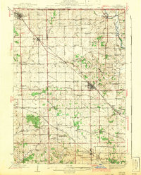
 1923 South Wayne1923 Print · USGSSouthern Wisconsin and northern Illinois are shown in the early twenties as a landscape of interconnected river valleys and rail lines. Genealogists can trace dozens of country schoolhouses and churches, including Apple Grove Church, Reed School, and the community at South Wayne.3 unique versions available
 - 1935 Map of East Dubuque, 1957 Print
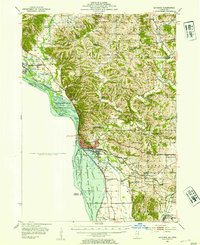
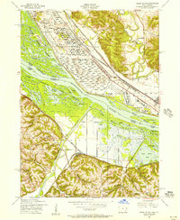
 1935 East Dubuque1957 Print · USGSThe riverfront and rail lines of Jo Daviess County come alive in this mid-1930s survey of the tri-state border region. Researchers can trace the old tracks of the Chicago Illinois Burlington and Quincy and locate vanished rural schoolhouses like Miller Sch and Sand Ridge Sch.
 - 1935 Map of Miles, 1957 Print
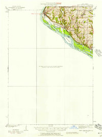
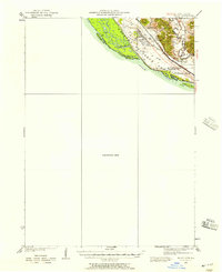 1935 Miles1957 Print · USGSIn the mid-1930s, the Mississippi River shoreline was defined by military expansion and the rail economy. Genealogists and historians can trace the foundations of the Savanna Ordnance Depot and local landmarks like Whitton and Lost Mound Sch.
 - 1936 Map of Elizabeth, 1957 Print
 1936 Elizabeth1957 Print · USGSNorthwest Illinois is shown in the mid-1930s as a landscape of isolated mounds and active lead mines. Genealogists can trace rural communities through dozens of local schoolhouses like Equal Rights School and small mining sites such as the Illinois Mine.2 unique versions available
 - 1937 Map of Lena
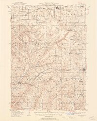
 1937 Lena1937 Print · USGSNorthwestern Illinois at the close of the Depression era shows a landscape dense with rural life and rail activity. Genealogists can trace family roots through numerous landmarks like Chelsea Ch, Blair Cem, and the Blackhawk Battlefield and Monument.
 - 1940 Map of East Dubuque
 1940 East Dubuque1940 Print · USGSThe Mississippi River borderlands of Jo Daviess County appear here in the mid-1930s, showing the vital rail and river connections at East Dubuque. Genealogists and local historians can trace rural school districts like Sand Ridge Sch or the riverside community of Menominee Sta.3 unique versions available
 - 1941 Map of Miles
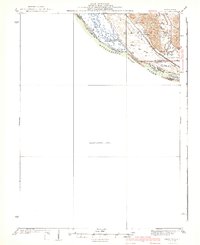 1941 Miles1941 Print · USGSThe Mississippi River borderlands come alive in this pre-war survey, documenting the small settlements and rail lines that defined the Jo Daviess and Carroll County line. Researchers can trace the river's complex island system or find local landmarks like Whitton, Lost Mound, and the Lost Mound Sch.2 unique versions available
 - 1942 Map of Mt Carroll, 1959 Print
 1942 Mt Carroll1959 Print · USGSNorthwest Illinois farmland is mapped here just after the start of the war, showing a landscape tightly connected by rail and rural schools. Genealogists can locate family landmarks like Sabin Ch, the Spring Valley Cem, or rail stops at Ashdale Junc and Kittredge.2 unique versions available
 - 1942 Map of Lena, 1963 Print
 1942 Lena1963 Print · USGSNorthwestern Illinois is documented here just as the rural rail-and-school network reached its peak. Genealogists and historians can trace family roots through numerous country schools like Eells Sch and historic sites such as the Blackhawk Battlefield and Monument.
 - 1943 Map of Lena
 1943 Lena1943 Print · USGSNorthwestern Illinois during the early years of the war shows a landscape shaped by two major railroads and small farming townships. Genealogists can locate dozens of family-named schools and churches, including Puckett Sch, St Marys Ch, and the Blackhawk Battlefield And Monument.2 unique versions available
 - 1944 Map of Mt Carroll
 1944 Mt Carroll1944 Print · USGSThe Carroll County landscape during the mid-1940s was defined by a dense network of country schools and the vital crossroads of the Milwaukee Road. Genealogists and historians can trace old homesteads near St Wendelin Cem, Ashdale Junc, and Loran.2 unique versions available
 - 1952 Map of Shullsburg, 1954 Print
 1952 Shullsburg1954 Print · USGSShullsburg and the surrounding driftless area are shown in the early fifties during a period of transition for its lead and zinc mining industry. Researchers can trace historic family burial sites at St Matthews Cem and Monticello Cem or locate rural landmarks like Dunbarton Sch.2 unique versions available
 - 1952 Map of Cuba City, 1954 Print
 1952 Cuba City1954 Print · USGSThe Wisconsin-Illinois state line comes alive in the early fifties, showing a landscape of zinc and lead mining history near the Galena River. Genealogists can trace rural life through a network of local schools like Hell Sch and cemeteries such as Mt Pleasant Cem.3 unique versions available
 - 1952 Map of New Diggings, 1954 Print
 1952 New Diggings1954 Print · USGSLead and zinc mining dominates the landscape of Lafayette County during the early fifties, where extraction sites are woven into a network of rural schools and churches. Genealogists and historians can trace family-named landmarks like Sullivan Sch, O'Brien Sch, and the Shawnee Cem.
 - 1952 Map of Savanna, 1954 Print
 1952 Savanna1954 Print · USGSThe Mississippi River bluffs and rail corridors define this Illinois riverfront during the early fifties. Genealogists and historians can trace numerous rural schoolhouses and family-named cemeteries like Massbach Cem, Palsgrove, and the sprawling Savanna Ordnance Depot.3 unique versions available
 - 1953 Map of Blackhawk, 1956 Print
 1953 Blackhawk1956 Print · USGSThe river bluffs and backwaters of the Mississippi River come to life in this mid-century survey of the Illinois and Iowa borderlands. Researchers can trace the river's industrial and social pulse through sites like Arnolds Landing, St Mathews Ch, and the winding Chicago Milwaukee St Paul and Pacific rail lines.3 unique versions available
 - 1953 Map of Green Island, 1956 Print
 1953 Green Island1956 Print · USGSThe Mississippi River backwaters and the Savanna Ordnance Depot define this mid-century borderland between Iowa and Illinois. Genealogists and researchers can trace rural life through the Lost Mound Cem, Grand View Sch, and the rail stop at Whitton.3 unique versions available
Showing maps 1-25 of 57
Top cities of Jo Daviess County
Frequently asked questions
- What are the different types of historical maps available for Jo Daviess County?
- What is the oldest map of Jo Daviess County?
- Where can I purchase historical maps of Jo Daviess County for my home or office?
- Where can I download high-res historical maps of Jo Daviess County?
- Are there historical topographic maps available for Jo Daviess County?
- Is there historical aerial imagery available for Jo Daviess County?
- Where are historical maps of Jo Daviess County sourced from?