1980s Maps of Jo Daviess County, Illinois
Explore 7 historic maps of Jo Daviess County from the 1980s. These maps offer a rare glimpse into what life looked like during the 1980s — showing old roads, neighborhoods, homes, and landmarks that have changed or disappeared over time.
Whether you're researching your family's past, planning a metal detecting trip, or studying how Jo Daviess County's landscape evolved across the 1980s, these high-resolution maps are a powerful tool for exploring the history of this region.
- Focus on a specific era: All maps on this page are from the 1980s, giving you a focused view of this time period.
- See what’s changed: Compare century-old streets, trails, and buildings to today's modern landscape using overlays and satellite layers.
- Research with precision: Use these maps for genealogy, historical research, land use analysis, or educational projects.
- View, download, or print: Maps are fully viewable online in high resolution, and can be downloaded or printed for your own records.
Start exploring Jo Daviess County's history through authentic maps from the 1980s. This is your window into the past.
Jo Daviess County, IL maps
(7)- 1980 Map of Springbrook, 1981 Print
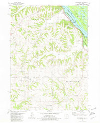 1980 Springbrook1981 Print · USGSJackson County's rugged Mississippi River bluffs and inland townships are captured here in the early eighties. Local researchers can locate several family and parish burial sites such as Old Springbrook Cem and Hazen Cem or trace the river-level route of the CM STP & P railroad.
 - 1981 Map of Monroe
 1981 Monroe1981 Print · USGSSouthern Wisconsin and the Illinois borderlands come into focus in the early 1980s, showcasing a landscape defined by dairy farming and river valleys. Genealogists can trace family roots through historic hubs like Monroe, Stoughton, and Brodhead, or locate regional landmarks such as Yellowstone Lake and the Sugar River.
 - 1981 Map of Rockford
 1981 Rockford1981 Print · USGSNorthern Illinois during the early eighties shows a landscape shaped by river valleys and a maturing rail network. Genealogists can trace family roots through settlements like Morseville and Buckhorn Corners while exploring the Rock River valley.2 unique versions available
 - 1984 Map of Dubuque North, 1985 Print
 1984 Dubuque North1985 Print · USGSThis Tri-State region was a hub of Midwestern mining and river commerce in the mid-eighties. Researchers can trace the legacy of the Lead District through specific sites like Annie Mine or locate early civic centers such as First Capitol State Park.2 unique versions available
 - 1984 Map of Dubuque South, 1985 Print
 1984 Dubuque South1985 Print · USGSEastern Iowa and Northwest Illinois meet along the Mississippi in the mid-eighties, a landscape defined by river industry and limestone bluffs. Trace the rail lines of the Illinois Central Gulf or explore notable sites like the Savanna Army Depot and Maquoketa Caves State Park.4 unique versions available
 - 1985 Map of Loran, 1986 Print
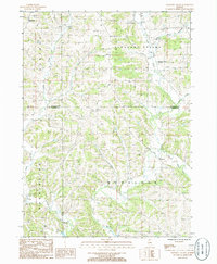
 1985 Loran1986 Print · USGSNorthwest Illinois farmland and valley networks are captured here during the mid-1980s. Genealogists and local historians can trace the rural landscape surrounding the village of Loran and the winding course of Muddy Plum.
 - 1985 Map of Pleasant Valley, 1986 Print
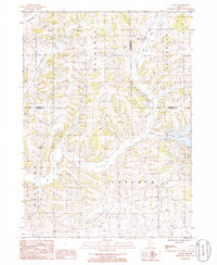
 1985 Pleasant Valley1986 Print · USGSNorthwest Illinois in the mid-1980s is captured here, showing the rural communities of Jo Daviess and Carroll Counties. Researchers can trace family homesteads near Massbach, Pleasant Valley, and Polsgrove or locate rural Cem sites along the Plum River.
End of results
Showing maps 1-7 of 7
Top cities of Jo Daviess County
Frequently asked questions
- What are the different types of historical maps available for Jo Daviess County?
- What is the oldest map of Jo Daviess County?
- Where can I purchase historical maps of Jo Daviess County for my home or office?
- Where can I download high-res historical maps of Jo Daviess County?
- Are there historical topographic maps available for Jo Daviess County?
- Is there historical aerial imagery available for Jo Daviess County?
- Where are historical maps of Jo Daviess County sourced from?