1950s Maps of Knox County, Illinois
Explore 8 historic maps of Knox County from the 1950s. These maps offer a rare glimpse into what life looked like during the 1950s — showing old roads, neighborhoods, homes, and landmarks that have changed or disappeared over time.
Whether you're researching your family's past, planning a metal detecting trip, or studying how Knox County's landscape evolved across the 1950s, these high-resolution maps are a powerful tool for exploring the history of this region.
- Focus on a specific era: All maps on this page are from the 1950s, giving you a focused view of this time period.
- See what’s changed: Compare century-old streets, trails, and buildings to today's modern landscape using overlays and satellite layers.
- Research with precision: Use these maps for genealogy, historical research, land use analysis, or educational projects.
- View, download, or print: Maps are fully viewable online in high resolution, and can be downloaded or printed for your own records.
Start exploring Knox County's history through authentic maps from the 1950s. This is your window into the past.
Knox County, IL maps
(8)- 1953 Map of Nekoma, 1957 Print
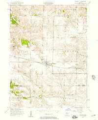
 1953 Nekoma1957 Print · USGSNekoma and the surrounding prairie are captured here in the early 1950s as a thriving rail-side agricultural community. Genealogists and local historians can trace family roots through landmarks like Piatt Cemetery, North Ontario Church, and the River Side School.2 unique versions available
 - 1953 Map of Woodhull, 1957 Print
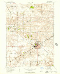
 1953 Woodhull1957 Print · USGSWoodhull and the surrounding Henry County farmlands are captured here in the early fifties, centered on the Chicago Burlington and Quincy rail line. Genealogists can locate family sites near Bethany Church, Summit Level Cemetery, and Alwood High School.2 unique versions available
 - 1953 Map of New Windsor, 1957 Print
 1953 New Windsor1957 Print · USGSNorthwestern Illinois farm country in the early fifties shows a transition from local rail reliance to industrial coal extraction. Genealogists can locate family burial plots at Oxford Cemetery or trace the rural school system through sites like Oakridge School and Hopewell School.2 unique versions available
 - 1953 Map of Galva, 1957 Print
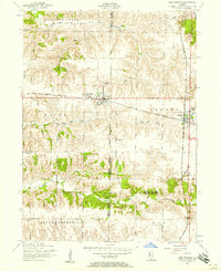
 1953 Galva1957 Print · USGSWestern Illinois farm country and bustling rail corridors come to life in this mid-century survey of Henry County. Genealogists and local historians can locate St Johns Cemetery, the historic colony at Bishop Hill, and rural landmarks like Deem School.2 unique versions available
 - 1958 Map of Burlington, 1968 Print
 1958 Burlington1968 Print · USGSThe tri-state river country of Iowa, Illinois, and Missouri is captured here in the mid-fifties, dominated by the Mississippi River and major rail lines. Genealogists and historians can trace the development of river towns like Keokuk or locate the sprawling Iowa Army Ammunition Plant.4 unique versions available
 - 1958 Map of Davenport, 1968 Print
 1958 Davenport1968 Print · USGSEastern Iowa and western Illinois thrive along the river during the late fifties, defined by the industrial Quad Cities and a robust rail network. Genealogists can trace family roots through settlements like Oasis and Stanwood or along the Cedar River.2 unique versions available
 - 1958 Map of Aurora, 1969 Print
 1958 Aurora1969 Print · USGSNorthern Illinois in the late fifties shows a landscape of powerful river industry and expanding transport corridors. Genealogists and historians can trace the development of Aurora and Joliet or locate sites like the Elwood Ordnance Plant and Starved Rock.3 unique versions available
 - 1958 Map of Peoria, 1969 Print
 1958 Peoria1969 Print · USGSCentral Illinois thrived as a hub of education and transport during the late sixties, as the new interstate system began to reshape the prairie. Genealogists and historians can trace local landmarks like Springdale Cem, Bradley University, and the sprawling grounds of Chanute AFB.4 unique versions available
End of results
Showing maps 1-8 of 8
Top cities of Knox County
- Galesburg historical maps
- Abingdon historical maps
- Knoxville historical maps
- Ontario historical maps
- Wataga historical maps
- East Galesburg historical maps
See more
Frequently asked questions
- What are the different types of historical maps available for Knox County?
- What is the oldest map of Knox County?
- Where can I purchase historical maps of Knox County for my home or office?
- Where can I download high-res historical maps of Knox County?
- Are there historical topographic maps available for Knox County?
- Is there historical aerial imagery available for Knox County?
- Where are historical maps of Knox County sourced from?