1980s Maps of Knox County, Illinois
Explore 24 historic maps of Knox County from the 1980s. These maps offer a rare glimpse into what life looked like during the 1980s — showing old roads, neighborhoods, homes, and landmarks that have changed or disappeared over time.
Whether you're researching your family's past, planning a metal detecting trip, or studying how Knox County's landscape evolved across the 1980s, these high-resolution maps are a powerful tool for exploring the history of this region.
- Focus on a specific era: All maps on this page are from the 1980s, giving you a focused view of this time period.
- See what’s changed: Compare century-old streets, trails, and buildings to today's modern landscape using overlays and satellite layers.
- Research with precision: Use these maps for genealogy, historical research, land use analysis, or educational projects.
- View, download, or print: Maps are fully viewable online in high resolution, and can be downloaded or printed for your own records.
Start exploring Knox County's history through authentic maps from the 1980s. This is your window into the past.
Knox County, IL maps
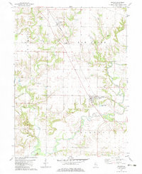
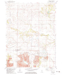
(24)- 1982 Map of Farmington East
 1982 Farmington East1982 Print · USGSThe intersection of Peoria and Fulton counties comes to life in this early 1980s survey of the Illinois prairie. Researchers can trace the industrial footprint of Mine Tailings near Farmington or locate rural homesteads and local Cem sites near Cramer.
 - 1982 Map of Laura, 1983 Print
 1982 Laura1983 Print · USGSThe Spoon River valley at the start of the 1980s reveals a landscape of industrial strip mining and quiet rural hamlets. Local historians can trace rail history along the Atchison Topeka and Santa Fe and locate family sites at French Grove Cem or Elmore.
 - 1982 Map of Galesburg West, 1983 Print
 1982 Galesburg West1983 Print · USGSGalesburg and the surrounding western Illinois prairie appear here in the early eighties as a thriving regional hub of education and rail. Researchers can trace family roots at Linwood Cem or locate former rural landmarks like Utah and the Coldbrook Sch.
 - 1982 Map of Appleton, 1983 Print
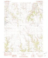
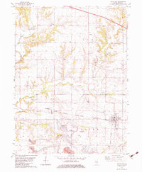
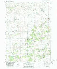
 1982 Appleton1983 Print · USGSKnox County, Illinois, was a landscape of industrial transition in the early eighties as coal extraction shaped the terrain. Genealogists and historians can trace rail lines like the Burlington Northern and locate rural landmarks such as Appleton Cem or Maxey Chapel.
 - 1982 Map of Maquon, 1983 Print
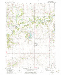
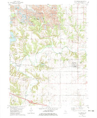
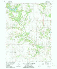
 1982 Maquon1983 Print · USGSKnox County in the early eighties reveals a landscape where the Spoon River and the Burlington Northern rail line define the local economy. Genealogists can trace several family burial sites, including Cook Cem and Mather Cem, alongside landmarks like Clark Chapel.
 - 1982 Map of Yates City, 1983 Print
 1982 Yates City1983 Print · USGSKnox County farming and industry converge here in the early eighties, where the railway meets the rural townships. Genealogists can trace family names at Summitt-Douglas Cem and Elba Cem, or locate the historic Wolf Covered Bridge on the Spoon River.
 - 1982 Map of Williamsfield, 1983 Print
 1982 Williamsfield1983 Print · USGSIn the early 1980s, the Knox County landscape near Williamsfield showed the heavy footprint of industrial Strip Mines alongside traditional river life. Trace the Atchison Topeka and Santa Fe line as it passes Dahinda or locate family plots at Trenton Cem and Parker Cem.
 - 1982 Map of Elmwood, 1983 Print
 1982 Elmwood1983 Print · USGSPeoria and Knox counties meet in this early eighties survey of central Illinois agriculture and industry. Genealogists and historians can locate St Marys Cem, trace the Burlington Northern rail line, or study the Strip Mine works.
 - 1982 Map of North Henderson, 1983 Print
 1982 North Henderson1983 Print · USGSThe rural borderlands of Mercer, Warren, and Knox counties are captured here in the early eighties as agricultural life follows the local creek forks. Researchers can trace family history through numerous burial grounds like Baptist Cem and locate community hubs such as Shanghai City or the Henderson Grove Grange.
 - 1982 Map of Abingdon, 1983 Print
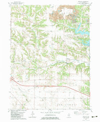
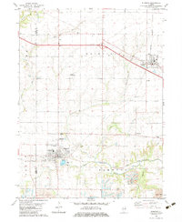
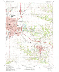
 1982 Abingdon1983 Print · USGSAbingdon and its surrounding townships are captured in the early eighties as the area balanced its rail-based heritage with modern agricultural needs. Researchers can trace family history at the Boydstun-Dawdy Cemetery or locate the site of Hedding School.
 - 1982 Map of De Long, 1983 Print
 1982 De Long1983 Print · USGSKnox County land use in the early eighties shows a mix of rural recreation and traditional farming communities. Researchers can trace family history at Haynes Cem, locate the Good Samaritan Retreat, or study the settlement patterns around DeLong and Hermon.
 - 1982 Map of Galesburg East, 1983 Print
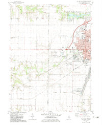
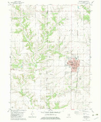
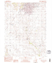
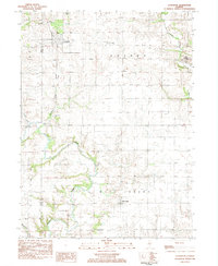
 1982 Galesburg East1983 Print · USGSKnox County shows its industrial and educational roots in the early eighties as the rail lines of the BURLINGTON NORTHERN meet the urban streets of GALESBURG. Genealogists and historians can trace the grounds of Knox College, St Marys Hospital, and the Swedish Cem.
 - 1982 Map of Victoria, 1983 Print
 1982 Victoria1983 Print · USGSKnox County's coal mining and agricultural heritage are on full display in the early eighties as the landscape around Victoria transitions into heavy industrial use. Researchers can trace the legacy of local families at Fraker Cem or follow the path of the Old Railroad Grade through the massive Strip Mines.
 - 1982 Map of Oneida, 1983 Print
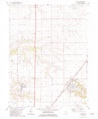
 1982 Oneida1983 Print · USGSKnox County in the early eighties shows a landscape of steady rail towns and evolving industrial footprints. Trace family genealogy through Walnut Grove Cemetery and Scotch Cemetery, or locate the extensive Strip Mines and the settlements at Oneida and Altona.
 - 1982 Map of Wataga, 1983 Print
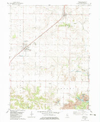
 1982 Wataga1983 Print · USGSKnox County settlement and rail infrastructure are captured here in the early eighties. Genealogists can trace family sites at Bruner Cem or Junk Cem, while historians can follow the Burlington Northern line and an Old RR Grade near Wataga.
 - 1983 Map of Kewanee South, 1984 Print
 1983 Kewanee South1984 Print · USGSKewanee and the surrounding prairies of Henry and Stark Counties are shown in the early 1980s as the city expands southward into Wethersfield. Researchers can trace local genealogy and civic growth through sites like Evergreen Memory Garden, Visitation School, and the Burlington Northern rail line.2 unique versions available
 - 1983 Map of La Fayette, 1984 Print
 1983 La Fayette1984 Print · USGSSettlement patterns and rural life in Stark County are documented here in the early 1980s. Genealogists can locate family landmarks like McClenahan Cem and trace the Old Railroad Grade near La Fayette.
 - 1984 Map of Aledo, 1985 Print
 1984 Aledo1985 Print · USGSThe Mississippi River borderlands and Illinois heartland are captured here in the mid-eighties as industry and agriculture overlap. Trace the Hennepin Canal, the historic Swedish colony at Bishop Hill, and the rail corridors of the Burlington Northern.
 - 1985 Map of Kewanee
 1985 Kewanee1985 Print · USGSNorth-central Illinois in the mid-eighties shows a landscape of river-valley industry and prairie transit. Researchers can trace family roots through Evergreen Memory Garden or follow the historic Hennepin Canal past Tiskilwa and Wyanet.2 unique versions available
 - 1985 Map of Peoria
 1985 Peoria1985 Print · USGSThe Illinois River valley and the Tri-County area are captured here in the mid-1980s as industry and infrastructure reshaped the heart of the state. Researchers can trace the grounds of Jubilee College, locate the Stark Mine near Elmwood, or follow the busy tracks of the Norfolk and Western Railroad.
 - 1985 Map of Galesburg, 1986 Print
 1985 Galesburg1986 Print · USGSWestern Illinois in the mid-eighties was a landscape of riverfront forests and industrial rail hubs. Genealogists and historians can trace the growth of Galesburg and Monmouth alongside rural landmarks like Stronghurst and the coal operations of the Strip Mine near Canton.2 unique versions available
 - 1989 Map of Galesburg
 1989 Galesburg1989 Print · USGSWestern Illinois in the late eighties reveals a landscape of industrial rail hubs and riverfront timberland. Genealogists and historians can trace the routes of the Atchison Topeka and Santa Fe RR through small towns like Stronghurst, London Mills, and Middle Grove (Middlepoint).
 - 1989 Map of Aledo
 1989 Aledo1989 Print · USGSWestern Illinois and eastern Iowa are shown here during the late twentieth century, when the river-and-rail economy still defined the Quad Cities and the surrounding prairie. Researchers can trace historic settlements like Bishop Hill and Millersburg alongside active routes like the Chicago Rock Island & Pacific RR.
 - 1989 Map of Peoria
 1989 Peoria1989 Print · USGSThe Illinois River valley thrived as a regional center of industry, education, and transport during the late eighties. Researchers can trace the extensive rail networks of the Peoria and Pekin Union Railway or locate landmarks like Bradley University and the Peoria Air National Guard Base.
End of results
Showing maps 1-24 of 24
Top cities of Knox County
- Galesburg historical maps
- Abingdon historical maps
- Knoxville historical maps
- Ontario historical maps
- Wataga historical maps
- East Galesburg historical maps
See more
Frequently asked questions
- What are the different types of historical maps available for Knox County?
- What is the oldest map of Knox County?
- Where can I purchase historical maps of Knox County for my home or office?
- Where can I download high-res historical maps of Knox County?
- Are there historical topographic maps available for Knox County?
- Is there historical aerial imagery available for Knox County?
- Where are historical maps of Knox County sourced from?