Old Maps of Lake County, Illinois for Academic Research
Study the evolution of Lake County with 123 high-resolution historic maps. Whether you're teaching, researching, or modeling changes in land use, these maps provide essential visual documentation of urban, environmental, and geographic change.
- Analyze long-term change: Track patterns in development, transportation, and natural features.
- Ideal for environmental or urban studies: Support academic projects with primary historical map data.
- Use in the classroom or lab: Educators and researchers rely on these maps to bring historical context to life.
These maps are a powerful tool for teaching, research, and visualizing how Lake County has changed over the decades.
Lake County, IL maps
(123)- 1899 Map of Evanston
 1899 Evanston1899 Print · USGSThe Illinois lakefront north of Chicago was undergoing rapid suburbanization during the late nineteenth century. Genealogists and historians can trace the early street grids of Evanston and Winnetka along the Chicago and Northwestern rail line.3 unique versions available
 - 1900 Map of Highwood
 1900 Highwood1900 Print · USGSCoastal bluffs and river valleys north of Chicago come alive in this late nineteenth-century survey. Trace the early footprints of settlements like Highland Park and Arlington Heights or locate the historic military grounds at Fort Sheridan.5 unique versions available
 - 1906 Map of Waukegan, 1959 Print
 1906 Waukegan1959 Print · USGSCoastal Lake County thrives during the early twentieth century as a hub of military training and religious settlement along Lake Michigan. Researchers can trace the roots of local communities through landmarks like Zion City, the Great Lakes US Naval Training Station, and Mount Rest Cemetery.
 - 1908 Map of Waukegan
 1908 Waukegan1908 Print · USGSLake County and the Illinois-Wisconsin border are captured here in the early 1900s as coastal industry and inland farming thrived. Genealogists can trace family roots through numerous crossroads like Rosecrans, early institutions like St. Marys Academy, and historic sites like Camp Logan.5 unique versions available
 - 1920 Map of Grays Lake
 1920 Grays Lake1920 Print · USGSLake County and the Illinois-Wisconsin borderlands are shown here in the early twenties, when the region was a bustling network of lakeside retreats and rural school districts. Genealogists and historians can trace dozens of family-named landmarks and institutions, including the English Prairie School, St Marys Chapel, and Union Cemetery.3 unique versions available
 - 1923 Map of Grays Lake
 1923 Grays Lake1923 Print · USGSThe glacial lake country of northern Illinois is captured here in the early twenties, just as the resort and rail economy flourished. Genealogists can trace family roots at St Marys Chapel, English Prairie School, and numerous villages like Wauconda and Spring Grove.4 unique versions available
 - 1923 Map of Barrington
 1923 Barrington1923 Print · USGSNorthwest of Chicago in the early twenties, these townships were a network of farm-to-market roads and lakefront resorts. Trace the early boundaries of the Cook County Forest Preserve and find long-gone rural landmarks like Speeck Resort or Quentins Corners.4 unique versions available
 - 1928 Map of Wheeling
 1928 Wheeling1928 Print · USGSNortheastern Illinois appears in the mid-twenties as a landscape of rural schoolhouses and expanding rail lines along the Des Plaines River. Genealogists and local historians can locate early landmarks like Diamond Lake Cemetery, Tripp School, and the settlement of Aptakisic.4 unique versions available
 - 1928 Map of Highland Park
 1928 Highland Park1928 Print · USGSThe North Shore was entering a golden age of suburban development and leisure in the late twenties. Trace the expansion of Highland Park and Lake Forest through their numerous estate clubs and historic schools like Lake Forest Academy.4 unique versions available
 - 1935 Map of Barrington, 1958 Print
 1935 Barrington1958 Print · USGSNortheastern Illinois appears here in the decades following the first World War as rural townships began to shift toward a suburban future. Genealogists can trace family roots through numerous district schools and local landmarks like St Johns Church, Lake Zurich, and Fox River Grove.
 - 1951 Map of Highland Park
 1951 Highland Park1951 Print · USGSThe Illinois North Shore thrived in the early fifties as a landscape of prestigious clubs, military outposts, and growing suburbs. Genealogists and historians can trace the footprints of Fort Sheridan, Sky Harbor Airport, and the vanished Brickyard near Northbrook.2 unique versions available
 - 1953 Map of Highland Park, 1955 Print
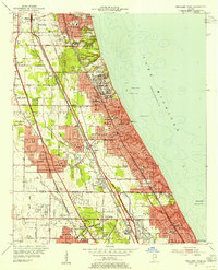 1953 Highland Park1955 Print · USGSThe North Shore was in the midst of post-war expansion when this survey was updated, showing the growing suburbs between the lake and the forest preserves. Genealogists and local historians can locate Fort Sheridan, Mooney Cemetery, and the many country clubs that defined this era.
 - 1953 Map of Wheeling, 1955 Print
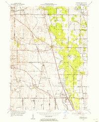 1953 Wheeling1955 Print · USGSThe Lake County and Cook County borderlands appear here in the early fifties as the region's agricultural past meets a new era of aviation and speedways. Genealogists and local researchers can trace old crossroads like Aptakisic and Halfday or locate family sites at Vernon Cem and Tripp Sch.
 - 1954 Map of Rockford
 1954 Rockford1954 Print · USGSThe Rock River valley and the Illinois-Wisconsin borderlands are captured here in the mid-1950s during a period of robust industrial and agricultural activity. Genealogists and historians can trace rail-era corridors like the Illinois Central RR and locate landmarks from Big Foot Prairie to Lake Geneva.
 - 1955 Map of Rockford
 1955 Rockford1955 Print · USGSThe Rock River valley and southern Wisconsin dairy country are shown here in the mid-fifties as the region's manufacturing centers grew. Genealogists and historians can trace the paths of the Chicago and North Western RR and Illinois Central RR through hubs like Rockford and Beloit.
 - 1958 Map of Racine, 1971 Print
 1958 Racine1971 Print · USGSThe Lake Michigan shoreline in the late fifties was a study in contrasts between the industrial bustle of Kenosha and the quiet woods of the Allegan State Forest. Genealogists and historians can trace the urban footprint of Evanston or locate strategic sites like Fort Sheridan and the Wind Point Light.3 unique versions available
 - 1958 Map of Rockford, 1974 Print
 1958 Rockford1974 Print · USGSNorthern Illinois and southern Wisconsin are shown here in the mid-twentieth century as rail-dependent industrial towns began to interface with growing lakefront communities. Genealogists can trace family roots through settlements like Saylesville and Tess Corners or locate historical landmarks like the Rockford Ordnance Depot.4 unique versions available
 - 1960 Map of Fox Lake, 1962 Print
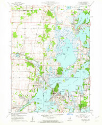 1960 Fox Lake1962 Print · USGSThe Chain O’Lakes region in the early sixties was a bustling landscape of resort life and growing residential pockets. Trace the layout of settlements like Lotus Woods, locate local landmarks like Wilmot Hills Raceway, and find family-named cemeteries such as Orvis Cem.3 unique versions available
 - 1960 Map of Lake Zurich, 1962 Print
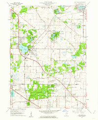 1960 Lake Zurich1962 Print · USGSSoutheastern Lake County transitioned from rural farming to suburban communities during the early sixties. Genealogists and local researchers can locate family plots at Fairfield Cem or Cady Cem and trace old rail lines through Lake Zurich.4 unique versions available
 - 1960 Map of Waukegan, 1962 Print
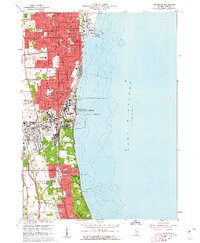 1960 Waukegan1962 Print · USGSThe Lake Michigan shoreline in the early sixties shows a dense industrial and military landscape stretching from Waukegan to Lake Forest. Researchers can trace the massive Great Lakes Naval Training Center and old family plots at St Marys Cem or Northshore Cemetery.4 unique versions available
 - 1960 Map of Grayslake, 1962 Print
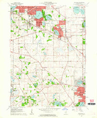 1960 Grayslake1962 Print · USGSLake County was entering a period of suburban transformation in the early sixties as former resort areas became permanent residential hubs. Researchers can trace the development of Round Lake Beach, old schools like Swan Sch, and cemeteries such as Avon Centre Cem.4 unique versions available
 - 1960 Map of Zion, 1962 Print
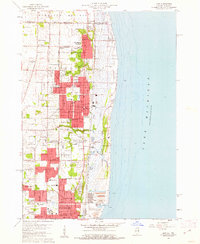 1960 Zion1962 Print · USGSThe Lake Michigan coast at the turn of the 1960s shows the suburban and industrial expansion of Lake County. Local historians can trace the development of ZION and Winthrop Harbor, from the Jack Benny Jr High Sch to the grounds of Camp Logan and ILLINOIS BEACH STATE PARK.3 unique versions available
 - 1960 Map of Waukegan, 1962 Print
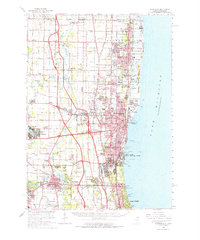 1960 Waukegan1962 Print · USGSCoastal Lake County thrives in the early sixties as industrial centers and military installations expand along the lakefront. Researchers can locate family landmarks like St Patricks Cem, trace the rail corridors of Rondout, or explore the grounds of St Marys of the Lake Seminary.
 - 1960 Map of Wadsworth, 1962 Print
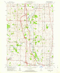 1960 Wadsworth1962 Print · USGSNortheastern Illinois and the Wisconsin borderlands are captured here during the early years of the tollway era. Genealogists and historians can trace family plots at Mount Rest Cem or locate community centers like Newport Sch and York House Ch.3 unique versions available
 - 1960 Map of Barrington, 1962 Print
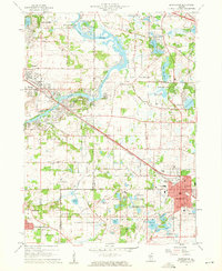 1960 Barrington1962 Print · USGSThe Fox River valley and the emerging suburban corridors of Cook and Lake Counties are captured here at the dawn of the 1960s. Researchers can locate family landmarks such as Evergreen Cem, St Ann Sch, and the rail lines of the Chicago and North Western.4 unique versions available
Showing maps 1-25 of 123
Top cities of Lake County
- Waukegan historical maps
- Mundelein historical maps
- North Chicago historical maps
- Gurnee historical maps
- Highland Park historical maps
- Round Lake Beach historical maps
See more
Frequently asked questions
- What are the different types of historical maps available for Lake County?
- What is the oldest map of Lake County?
- Where can I purchase historical maps of Lake County for my home or office?
- Where can I download high-res historical maps of Lake County?
- Are there historical topographic maps available for Lake County?
- Is there historical aerial imagery available for Lake County?
- Where are historical maps of Lake County sourced from?