Old Maps of Decatur, Illinois for Academic Research
Study the evolution of Decatur with 47 high-resolution historic maps. Whether you're teaching, researching, or modeling changes in land use, these maps provide essential visual documentation of urban, environmental, and geographic change.
- Analyze long-term change: Track patterns in development, transportation, and natural features.
- Ideal for environmental or urban studies: Support academic projects with primary historical map data.
- Use in the classroom or lab: Educators and researchers rely on these maps to bring historical context to life.
These maps are a powerful tool for teaching, research, and visualizing how Decatur has changed over the decades.
Decatur, IL maps
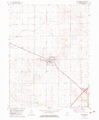
(47)- 1929 Map of Decatur, 1965 Print
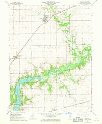
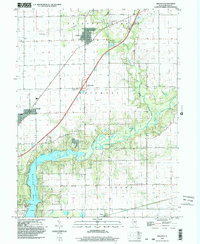
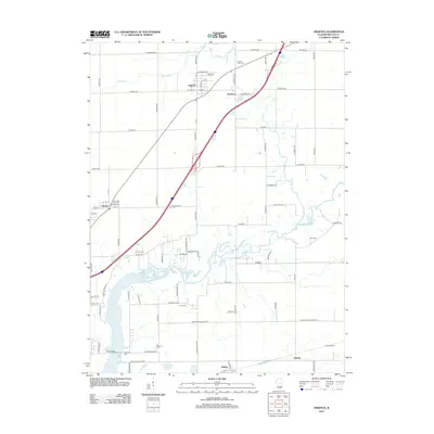
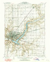 1929 Decatur1965 Print · USGSCentral Illinois during the mid-twentieth century reveals a landscape defined by the expansion of Lake Decatur and a busy rail network. Researchers can trace dozens of rural schools like Blue Door Sch and landmarks including Decatur Airport.
 - 1933 Map of Decatur
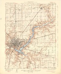 1933 Decatur1933 Print · USGSThe rail-and-river hub of Decatur is captured here in the early thirties, showing a landscape defined by industrial growth and rural school districts. Genealogists can trace family landmarks like Antioch Ch or dozens of local schoolhouses including Blue Door Sch and Mound Sch.3 unique versions available
 - 1954 Map of Niantic, 1955 Print
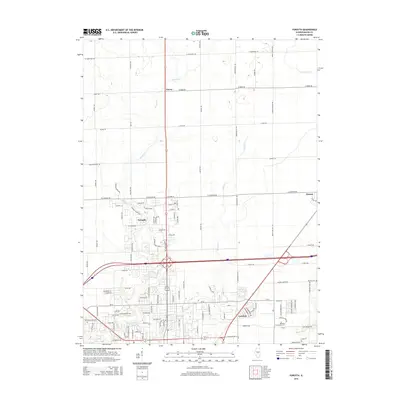
 1954 Niantic1955 Print · USGSMid-century Macon County is defined here by its bustling rail corridors and the winding Sangamon River. Researchers can trace old family names at Lake Bank Cem or locate forgotten stops like Wyckles Corners and Bulldog Crossing.3 unique versions available
 - 1958 Map of Decatur, 1971 Print
 1958 Decatur1971 Print · USGSCentral Illinois in the mid-twentieth century shows a landscape defined by industrial rail hubs and the creation of large reservoirs. Researchers can trace historic corridors like the Penn Central or locate landmarks such as Lincoln Log Cabin State Park and Lake Springfield.3 unique versions available
 - 1961 Map of Decatur
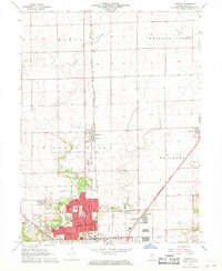
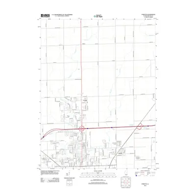
 1961 Decatur1961 Print · USGSCentral Illinois in the late fifties was a bustling corridor of rail lines and prairie commerce centered on the state capital. Genealogists and historians can trace the intricate connections between Springfield, Decatur, and dozens of smaller settlements like Nokomis and Arcola.2 unique versions available
 - 1967 Map of Long Creek, 1968 Print
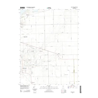
 1967 Long Creek1968 Print · USGSMacon County transitioned from heavy rail-and-river industry to suburban growth in the late sixties. Researchers can trace historic family burial sites at Ridge Cem, follow the Baltimore and Ohio tracks, or locate old schools like Salem Sch.2 unique versions available
 - 1967 Map of Argenta, 1968 Print
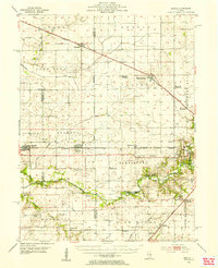
 1967 Argenta1968 Print · USGSMacon County's rural heartland is captured here in the late sixties, where the Sangamon River flows toward the expanding shoreline of Lake Decatur. Genealogists and local historians can locate several rural landmarks including the Oakley Brick Ch, Berry Sch, and the Friends Creek Cem.2 unique versions available
 - 1967 Map of Decatur, 1968 Print
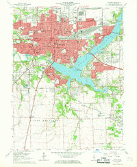 1967 Decatur1968 Print · USGSDecatur is shown at its mid-century industrial peak, dominated by a complex network of railroads and the rising waters of Lake Decatur. Researchers can locate specific sites from Millikin University to family plots in Graceland Cemetery and Greenwood Cemetery.2 unique versions available
 - 1967 Map of Forsyth, 1968 Print
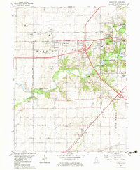
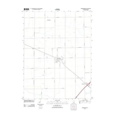
 1967 Forsyth1968 Print · USGSThe northern reaches of the Decatur area are documented here during a period of steady mid-century growth. Genealogists and local historians can trace the development of Forsyth and Larkdale alongside landmarks like Boiling Springs Cem and the County Fairground.2 unique versions available
 - 1982 Map of Harristown, 1983 Print
 1982 Harristown1983 Print · USGSMacon County's rural landscape and the western expansion of Decatur are captured here in the early eighties. Genealogists and historians can trace family-named landmarks like Crum Cem and Whitley Cem alongside the winding Sangamon River.
 - 1982 Map of Warrensburg, 1983 Print
 1982 Warrensburg1983 Print · USGSWarrensburg and the surrounding townships of Illini and Austin are shown here in the early eighties as the railroad still anchored the local economy. Researchers can locate family landmarks like Illini Ch Cem, the Warrensburg-Latham Sch, and the small settlement of Bearsdale.
 - 1985 Map of Decatur
 1985 Decatur1985 Print · USGSCentral Illinois farming and rail hubs thrive in the mid-1980s as Decatur anchors a sprawling network of track and timber. Trace the paths of the Sangamon River and the Illinois Central Gulf RR through old towns like Cerro Gordo and Bement.2 unique versions available
 - 1985 Map of Springfield
 1985 Springfield1985 Print · USGSCentral Illinois during the mid-eighties shows a landscape of growing state capital influence and deep historical roots. Genealogists and historians can trace family sites near Oak Ridge Cem or follow the path of the Sangamon River past Williamsville and Riverton.2 unique versions available
 - 1998 Map of Decatur, 2000 Print
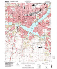 1998 Decatur2000 Print · USGSDecatur and the shores of Lake Decatur appear in high detail during the late nineties, showcasing the city's complex rail and educational infrastructure. Genealogists can trace family landmarks at Graceland Cemetery or locate schools like Millikin University and St Teresa Academy.
 - 1998 Map of Forsyth, 2001 Print
 1998 Forsyth2001 Print · USGSMacon County at the close of the twentieth century shows the steady northward growth of the Decatur area into traditional prairie farmland. Genealogists and local historians can trace neighborhood developments near Greens Switch and locate schools like Stephen Decatur High Sch.
 - 1998 Map of Long Creek, 2002 Print
 1998 Long Creek2002 Print · USGSMacon County at the turn of the millennium shows a landscape shaped by suburban growth and conservation efforts near Mount Zion. Researchers can locate family landmarks like Point Pleasant Cem or trace the early paths of Big Creek.
 - 1998 Map of Argenta, 2003 Print
 1998 Argenta2003 Print · USGSThe rural landscape of Macon County is captured here at the end of the century, showing the transition from traditional farming communities to the outskirts of the growing city. Genealogists can trace family names at Friends Creek Cem, Cross Cem, and Wheeler Cem, or locate landmarks like Berry Sch.
 - 2012 Map of Harristown, 2012 Print
 2012 Harristown2012 Print · USGSCovers Decatur, including Harristown, Boody, and other nearby areas
 - 2012 Map of Decatur, 2012 Print
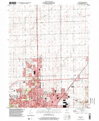
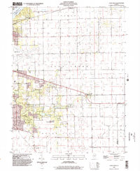
 2012 Decatur2012 Print · USGSCovers Decatur, including Mount Zion, Long Creek, and other nearby areas
 - 2012 Map of Long Creek, 2012 Print
 2012 Long Creek2012 Print · USGSCovers Decatur, including Mount Zion, Long Creek, and other nearby areas
 - 2012 Map of Argenta, 2012 Print
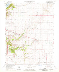
 2012 Argenta2012 Print · USGSCovers Decatur, including Oakley, Oreana, and other nearby areas
 - 2012 Map of Forsyth, 2012 Print
 2012 Forsyth2012 Print · USGSCovers Decatur, including Forsyth, Oreana, and other nearby areas
 - 2012 Map of Warrensburg, 2012 Print
 2012 Warrensburg2012 Print · USGSCovers Decatur, including Warrensburg, Heman, and other nearby areas
 - 2015 Map of Long Creek, 2015 Print
 2015 Long Creek2015 Print · USGSCovers Decatur, including Mount Zion, Long Creek, and other nearby areas
 - 2015 Map of Forsyth, 2015 Print
 2015 Forsyth2015 Print · USGSCovers Decatur, including Forsyth, Oreana, and other nearby areas
Showing maps 1-25 of 47
Top cities near Decatur
- Mount Zion historical maps
- Forsyth historical maps
- Moweaqua historical maps
- Maroa historical maps
- Cerro Gordo historical maps
- Long Creek historical maps
See more
Top neighborhoods of Decatur
- Longview Place historical maps
- Larkdale historical maps
- Southwest Manufactured Housing Community historical maps
- H &K Trailer Court historical maps
Frequently asked questions
- What are the different types of historical maps available for Decatur?
- What is the oldest map of Decatur?
- Where can I purchase historical maps of Decatur for my home or office?
- Where can I download high-res historical maps of Decatur?
- Are there historical topographic maps available for Decatur?
- Is there historical aerial imagery available for Decatur?
- Where are historical maps of Decatur sourced from?