Old Maps of Scottville, Illinois for Academic Research
Study the evolution of Scottville with 10 high-resolution historic maps. Whether you're teaching, researching, or modeling changes in land use, these maps provide essential visual documentation of urban, environmental, and geographic change.
- Analyze long-term change: Track patterns in development, transportation, and natural features.
- Ideal for environmental or urban studies: Support academic projects with primary historical map data.
- Use in the classroom or lab: Educators and researchers rely on these maps to bring historical context to life.
These maps are a powerful tool for teaching, research, and visualizing how Scottville has changed over the decades.
Scottville, IL maps
(10)- 1932 Map of Greenfield
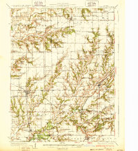 1932 Greenfield1932 Print · USGSGreene and Macoupin counties thrive as a rail-centered agricultural heartland during the early thirties. Genealogists can trace family homesteads near numerous rural schools like Oak Hill Sch and Landreth Sch, or churches such as Mt Moriah Ch.3 unique versions available
 - 1948 Map of Quincy
 1948 Quincy1948 Print · USGSThe Mississippi and Illinois River valleys are captured at a post-war crossroads as rail and river travel met the expanding highway system. Genealogists can trace family settlements from Quincy to Hannibal and smaller towns like Vandalia and Jerseyville.2 unique versions available
 - 1956 Map of Quincy, 1967 Print
 1956 Quincy1967 Print · USGSThe river and rail corridors of the Illinois-Missouri border are documented here during the mid-1950s. Researchers can trace historic river landings and regional transit hubs from Quincy and Hannibal to smaller settlements like Meredosia and Roodhouse.3 unique versions available
 - 1983 Map of Scottville, 1984 Print
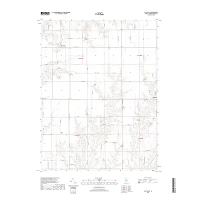
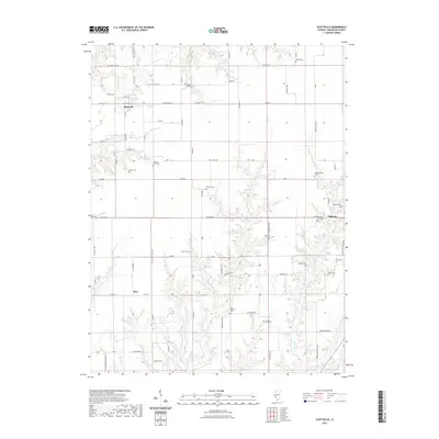
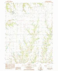 1983 Scottville1984 Print · USGSMacoupin County in the early eighties remains a quiet network of small townships and family burial grounds. Researchers can trace ancestral sites like East Scottville Cem and Hollingsworth Cem alongside rural landmarks like Asbury Ch.
 - 1985 Map of Jerseyville
 1985 Jerseyville1985 Print · USGSThe confluence of the Illinois and Mississippi rivers defines this 1980s landscape of fertile bottomlands and rail-hub towns. Genealogists and historians can trace the foundations of communities like Jerseyville and White Hall alongside the Oak Grove Cem and St Mary Church.2 unique versions available
 - 2012 Map of Scottville, 2012 Print
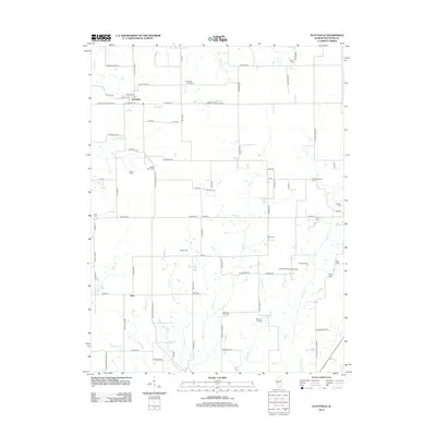 2012 Scottville2012 Print · USGSCovers Scottville, including Palmyra, Barr, and other nearby areas
 - 2015 Map of Scottville, 2015 Print
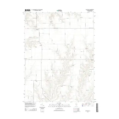 2015 Scottville2015 Print · USGSCovers Scottville, including Palmyra, Barr, and other nearby areas
 - 2018 Map of Scottville, 2018 Print
 2018 Scottville2018 Print · USGSCovers Scottville, including Palmyra, Barr, and other nearby areas
 - 2021 Map of Scottville, 2021 Print
 2021 Scottville2021 Print · USGSCovers Scottville, including Palmyra, Barr, and other nearby areas
 - 2024 Map of Scottville, 2024 Print
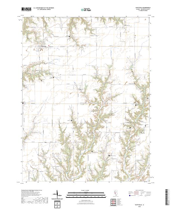 2024 Scottville2024 Print · USGSMacoupin County's rural landscape is captured here in the early 2020s, showing a region where agricultural traditions and family history remain deeply rooted. Researchers can trace dozens of burial sites like Hettick Point Cem, Crum Cem, and Wills Cem tucked along the valley of Joes Creek.
End of results
Showing maps 1-10 of 10
Top cities near Scottville
- Jacksonville historical maps
- Carlinville historical maps
- South Jacksonville historical maps
- Waverly historical maps
- Greenfield historical maps
- Palmyra historical maps
See more
Frequently asked questions
- What are the different types of historical maps available for Scottville?
- What is the oldest map of Scottville?
- Where can I purchase historical maps of Scottville for my home or office?
- Where can I download high-res historical maps of Scottville?
- Are there historical topographic maps available for Scottville?
- Is there historical aerial imagery available for Scottville?
- Where are historical maps of Scottville sourced from?