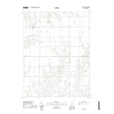
2021 Map of Scottville
USGS Topo · Published 2021About this map
Scottville and Palmyra anchor this rural landscape in Macoupin County, where the agricultural grid is deeply etched by the winding drainages of Panther Cr and Solomon Cr. The map is particularly notable for its concentration of family-named cemeteries, which serve as silent markers of the area's ancestral homesteads. From the Nifong Cem in the north to the A M Solomon Cem and Solomon G O Cem further south, these sites delineate the early settlement patterns of the region. The terrain is characterized by numerous small watercourses like Little Negro Lick and Taylor Cr, which cut through the farm plots. Near the eastern edge, Bunn Lake provides a localized water feature amidst the expansive network of county roads, including the historic routes of Scottville Rd and Palmyra Rd.
Find a feature on this map
89 named features on this map. Tap any name to fly to it.
Don’t see what you’re looking for? This feature index may not catch every label — zoom into the map to look around manually.
Map Details
Editions of this 2021 Scottville Map
This is the sole edition of this map. No revisions or reprints were ever made.
Other maps of this area

1923 · Carlinville
USGS Topo · 1:48,000

1924 · Waverly
USGS Topo · 1:62,500

1925 · Carlinville
USGS Topo · 1:62,500

1926 · Waverly
USGS Topo · 1:62,500

1931 · Carlinville
USGS Topo · 1:62,500

1932 · Greenfield
USGS Topo · 1:62,500

1932 · Jacksonville
USGS Topo · 1:62,500

1937 · Jacksonville
USGS Topo · 1:62,500

1948 · Quincy
USGS Topo · 1:250,000

1956 · Quincy
USGS Topo · 1:250,000