
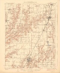
1925 Map of Carlinville
USGS Topo · Published 1925About this map
Carlinville serves as the central hub of this mid-1920s Illinois survey, where a dense network of rail lines converge, including the Illinois Chicago and Alton and the Illinois Traction. The landscape is a study in early 20th-century rural education and community structure, documented by a high density of country schools like Dressor Mill School, Hickory Point School, and Lawn Grove School. The terrain is defined by the winding paths of Otter Creek and Macoupin Creek, which cut through the agricultural townships of North Palmyra and North Otter. Small settlements such as Nilwood, Girard, and South Standard are shown at their peak rail-era development, connected by the emerging State Highway system that began to parallel the long-established tracks of the Chicago and Northwestern.
Find a feature on this map
81 named features on this map. Tap any name to fly to it.
Don’t see what you’re looking for? This feature index may not catch every label — zoom into the map to look around manually.
Map Details
Editions of this 1925 Carlinville Map
2 editions found
Other maps of this area

1912 · Gillespie
USGS Topo · 1:62,500

1915 · Gillespie
USGS Topo · 1:62,500

1915 · Mount Olive
USGS Topo · 1:62,500

1922 · Divernon
USGS Topo · 1:62,500

1923 · Carlinville
USGS Topo · 1:48,000

1923 · Raymond
USGS Topo · 1:62,500

1924 · Divernon
USGS Topo · 1:62,500

1924 · Waverly
USGS Topo · 1:62,500

1925 · Raymond
USGS Topo · 1:62,500

1925 · Brighton
USGS Topo · 1:62,500