Loading...
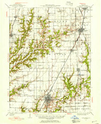
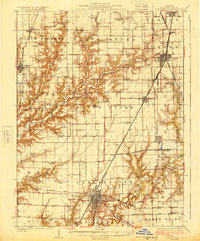
Loading map...1931 Map of Carlinville
USGS Topo · Published 1955About this map
The Chicago and Alton and the electric Illinois Traction System intersect at Carlinville, anchoring a dense agrarian and industrial corridor in Macoupin County. This 1931 revision of a 1923 survey reveals a landscape organized by both the township grid and the winding paths of Otter Creek and Macoupin Creek. The rail network defines the region's economy, with the Chicago and Northwestern and the Peoria and St Louis lines connecting smaller outposts like Nilwood, Girard, and Modesto.
Find a feature on this map
77 named features on this map. Tap any name to fly to it.
Don’t see what you’re looking for? This feature index may not catch every label — zoom into the map to look around manually.
Map Details
Date Portrayed1931
Date Published1955
PublisherU.S. Geological Survey
Map TypeTopographic
Scale1:62,500
Physical Dimensions17 x 20.7 inches
Editions of this 1931 Carlinville Map
3 editions found
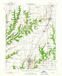
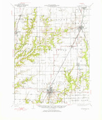
Historical Maps of Carlinville Through Time
3 maps found

Featured Locations
Source Details
SourceU.S. Geological Survey
CopyrightPublic Domain