1990s Maps of Virden, Illinois
Explore 2 historic maps of Virden from the 1990s. These maps offer a rare glimpse into what life looked like during the 1990s — showing old roads, neighborhoods, homes, and landmarks that have changed or disappeared over time.
Whether you're researching your family's past, planning a metal detecting trip, or studying how Virden's landscape evolved across the 1990s, these high-resolution maps are a powerful tool for exploring the history of this region.
- Focus on a specific era: All maps on this page are from the 1990s, giving you a focused view of this time period.
- See what’s changed: Compare century-old streets, trails, and buildings to today's modern landscape using overlays and satellite layers.
- Research with precision: Use these maps for genealogy, historical research, land use analysis, or educational projects.
- View, download, or print: Maps are fully viewable online in high resolution, and can be downloaded or printed for your own records.
Start exploring Virden's history through authentic maps from the 1990s. This is your window into the past.
Virden, IL maps
(2)- 1998 Map of Virden North, 2002 Print
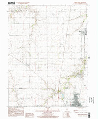 1998 Virden North2002 Print · USGSThe Sangamon and Macoupin county border area is captured here in the late 1990s, showcasing the persistent layout of historic mining and farming towns. Genealogists and local historians can trace family locations near Lowder, the West Cemetery, and the coal-era Abandoned Railroad corridor.
 - 1998 Map of Virden South, 2002 Print
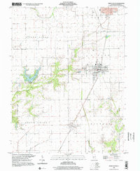 1998 Virden South2002 Print · USGSMacoupin County at the close of the twentieth century shows a landscape of steady agricultural townships and growing lakefront areas. Researchers can trace family sites near Pleasant Hill Cemetery, explore the streets of Girard, or locate the Union Chapel and Sunset Lake shoreline.
End of results
Showing maps 1-2 of 2
Top cities near Virden
- Springfield historical maps
- Woodside historical maps
- Chatham historical maps
- Carlinville historical maps
- Auburn historical maps
- Rochester historical maps
See more
Frequently asked questions
- What are the different types of historical maps available for Virden?
- What is the oldest map of Virden?
- Where can I purchase historical maps of Virden for my home or office?
- Where can I download high-res historical maps of Virden?
- Are there historical topographic maps available for Virden?
- Is there historical aerial imagery available for Virden?
- Where are historical maps of Virden sourced from?