Old Maps of Marion County, Illinois for Hiking & Exploration
Hike through history with 141 historic maps of Marion County. Explore old trails, ghost towns, and forgotten backroads — perfect for outdoor adventurers and local explorers.
- Rediscover forgotten places: Map out old mining camps, roads, and footpaths that no longer exist on modern maps.
- Layer with modern tools: Combine with LiDAR or satellite views to plan hikes through historical terrain.
- Made for exploration: Popular among hikers, overlanders, and local history lovers.
Use these maps to find adventure and explore the hidden past of Marion County.
Marion County, IL maps
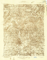
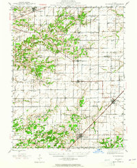
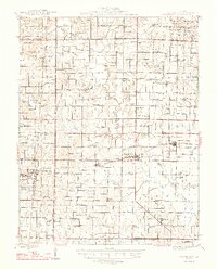
(141)- 1914 Map of Centralia
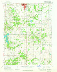
 1914 Centralia1914 Print · USGSSouthern Illinois at the peak of the rail era shows a landscape of busy junctions and tightly-knit rural school districts. Genealogists and historians can trace family locations near landmarks like Possumtrot School, Fikes Hill, and the bustling yards of Centralia.3 unique versions available
 - 1933 Map of Mount Vernon
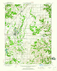
 1933 Mount Vernon1933 Print · USGSMount Vernon and the surrounding Jefferson County countryside are captured here in the early 1930s as a vital crossroads of rail and road. Genealogists can trace family roots through dozens of rural landmarks like Old Shiloh Ch, George College Sch, and Atkinson Cem.3 unique versions available
 - 1934 Map of Salem, 1960 Print
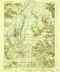
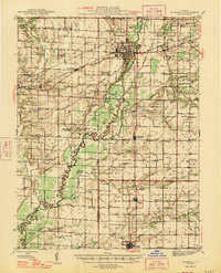
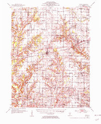
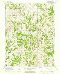
 1934 Salem1960 Print · USGSMarion County in the mid-1930s is a dense network of steam railroads and rural township life centered around the bustling city of Salem. Genealogists and historians can trace family roots at numerous rural schoolhouses like Allmon Sch and historic landmarks such as the County Infirmary.
 - 1935 Map of Centralia, 1958 Print
 1935 Centralia1958 Print · USGSCentralia and the surrounding Marion County townships thrived as a major railroad crossroads in the mid-1930s. Researchers can locate dozens of localized rural schoolhouses like Red Stripe and Possumtrot School or trace the early paths of the Illinois Central through Sandoval and Odin.
 - 1938 Map of Salem
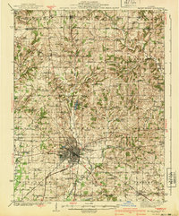
 1938 Salem1938 Print · USGSMarion County thrived as a rail-centric agricultural hub in the late 1930s, defined by the intersection of three major railroads. Genealogists can trace family roots through dozens of local landmarks like Givens Chapel, County Infirmary, and the Martin Cem.2 unique versions available
 - 1940 Map of Mount Vernon
 1940 Mount Vernon1940 Print · USGSMount Vernon and the surrounding Jefferson County countryside are captured here during the late Depression years. Researchers can trace rural family life through dozens of named country schools and churches like George College Sch, Old Shiloh Ch, and Atkinson Cem.2 unique versions available
 - 1943 Map of Ashley, 1967 Print
 1943 Ashley1967 Print · USGSSouthern Illinois during the early 1940s is captured here as a thriving rail and agricultural hub. Genealogists can locate specific family-linked landmarks like the Blissville Polling House, Conta Colliery, and the Odd Fellows Cem.
 - 1945 Map of Kinmundy, 1965 Print
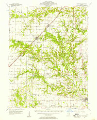
 1945 Kinmundy1965 Print · USGSThe rural borderlands of Fayette and Marion Counties are shown at the end of the war, when small farming communities still thrived around rail junctions. You can trace family roots at St Johns Ch or locate forgotten sites like Old Loogootee Sch and Gray Cem.2 unique versions available
 - 1945 Map of Vandalia, 1969 Print
 1945 Vandalia1969 Print · USGSMid-century Fayette County life centered on the Kaskaskia River and the rail-connected hub of Vandalia. Genealogists can trace family names through dozens of rural landmarks, from the Mc Inturff Cem to school sites like Clover College Sch and Elm Grove Sch.
 - 1946 Map of Ashley
 1946 Ashley1946 Print · USGSSouthern Illinois at the end of the war was a landscape of concentrated rail corridors and rural school districts. Genealogists can trace family roots through dozens of local landmarks like St Michael Cem, Oniontown, and the Blissville Polling House.
 - 1947 Map of Vandalia
 1947 Vandalia1947 Print · USGSThe Kaskaskia River valley in the post-war era shows a landscape of busy rail junctions and rural school districts. Genealogists can trace family names through dozens of landmarks like Evans Cem, Clover College Sch, and the community of Hagarstown.
 - 1947 Map of Kinmundy
 1947 Kinmundy1947 Print · USGSMarion and Fayette counties are captured here just after the war, showing a rural landscape anchored by a dense network of farm-to-market railroads. Genealogists can trace family footprints through numerous small schools and cemeteries, from Farina and St Peter to Shanghai Sch and Cumberland Cem.2 unique versions available
 - 1947 Map of Wayne City
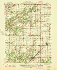
 1947 Wayne City1947 Print · USGSSouthern Illinois in the mid-1940s is captured here at a time when small rural schools and country churches still defined the local geography. Researchers can trace the rail-centered growth of Wayne City and Bluford or locate family sites like Garrison Temple, Thomason Cem, and Berry Sch.3 unique versions available
 - 1952 Map of Xenia, 1954 Print
 1952 Xenia1954 Print · USGSSouthern Illinois prairie and farmland are captured here in the early fifties, showing the rural crossroads of Clay and Wayne Counties. Researchers can trace dozens of country schools and family landmarks like Henson Cem, Vickrey Sch, and the Baltimore and Ohio rail line.2 unique versions available
 - 1956 Map of Edgewood, 1957 Print
 1956 Edgewood1957 Print · USGSRailroad junctions and rising oil fields define this mid-century look at the Clay and Effingham county lines. Genealogists can trace family names at St Ann Cem, Keen Chapel, and the settlement of La Clede along the ILLINOIS CENTRAL tracks.2 unique versions available
 - 1958 Map of Belleville, 1973 Print
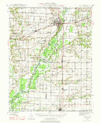
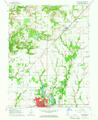
 1958 Belleville1973 Print · USGSSouthern Illinois during the mid-twentieth century reveals a landscape of industrial growth and massive new reservoirs. Genealogists and historians can trace the paths of the Illinois Central RR through towns like Centralia or locate landmarks such as Emerald Mound and the Looking Glass Prairie.3 unique versions available
 - 1962 Map of Belleville
 1962 Belleville1962 Print · USGSSouthern Illinois in the late fifties reveals a landscape of industrial growth and ancient landmarks before the full expansion of the interstate system. Genealogists can trace family names and rural post offices near Centralia, Salem, and the historic Monks Mound.
 - 1965 Map of Iuka, 1966 Print
 1965 Iuka1966 Print · USGSMarion County agriculture and industry meet in the mid-sixties along the Baltimore and Ohio line. Genealogists can trace rural family roots at Rabbit Grove Cem, Stuber Cem, and the community surrounding Union Town.2 unique versions available
 - 1965 Map of Salem South, 1966 Print
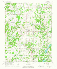
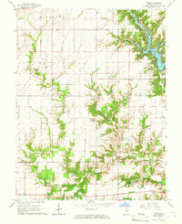
 1965 Salem South1966 Print · USGSMarion County during the mid-sixties reveals a landscape defined by industrial rail lines and small rural townships. Genealogists can locate family-named landmarks like Purdue Cem and Young Chapel or trace the early footprint of Lake Centralia.2 unique versions available
 - 1965 Map of Harmony, 1966 Print
 1965 Harmony1966 Print · USGSJefferson and Marion counties are captured here in the mid-sixties, a period when rural schoolhouses and family cemeteries still anchored the community. Genealogists can trace local roots at Old Panther Fork Cem, Union Chapel, and Farrington Sch.
 - 1965 Map of Salem North, 1966 Print
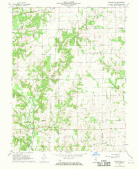
 1965 Salem North1966 Print · USGSMarion County's rail-and-road network is on full display in the mid-sixties as the city of Salem expands northward toward the Salem Reservoir. Researchers can trace old family burial grounds like Martin Cem and Allison Cem or locate community anchors such as Givens Chapel.2 unique versions available
 - 1965 Map of Kell, 1968 Print
 1965 Kell1968 Print · USGSSouthern Illinois at the mid-century reveals a landscape defined by crossroads settlements and a network of parish life along the Marion and Jefferson County line. Family historians can trace deep roots through local landmarks like Old Covenanter Cem, Dix, and the Zion Grove Ch.2 unique versions available
 - 1965 Map of Omega, 1968 Print
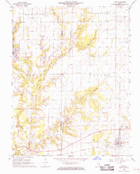
 1965 Omega1968 Print · USGSMid-century Marion County is captured here at a time when rural life centered on crossroads churches and family cemeteries. Trace the development of Stephen A Forbes State Lake or find ancestral sites like Vatican Cem and New Bethel Ch.2 unique versions available
 - 1968 Map of Orchardville, 1970 Print
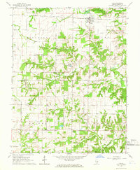
 1968 Orchardville1970 Print · USGSSouthern Illinois rural life remains visible in the late sixties as the towns of Orchardville and Helm anchor a landscape of family farms. Genealogists can trace deep roots through numerous sites like Burroughs Cem and New Liberty Ch.
 - 1968 Map of Xenia, 1970 Print
 1968 Xenia1970 Print · USGSThe clay and marion county line in the late sixties reveals a landscape defined by the Baltimore and Ohio railroad and active petroleum extraction. Researchers can locate numerous family-named landmarks and rural institutions, from Conners Chapel and Smith Cem to the infrastructure of the Xenia Oil Field.2 unique versions available
Showing maps 1-25 of 141
Top cities of Marion County
- Centralia historical maps
- Salem historical maps
- Sandoval historical maps
- Central City historical maps
- Odin historical maps
- Tonti historical maps
See more
Frequently asked questions
- What are the different types of historical maps available for Marion County?
- What is the oldest map of Marion County?
- Where can I purchase historical maps of Marion County for my home or office?
- Where can I download high-res historical maps of Marion County?
- Are there historical topographic maps available for Marion County?
- Is there historical aerial imagery available for Marion County?
- Where are historical maps of Marion County sourced from?