1980s Maps of McLean County, Illinois
Explore 35 historic maps of McLean County from the 1980s. These maps offer a rare glimpse into what life looked like during the 1980s — showing old roads, neighborhoods, homes, and landmarks that have changed or disappeared over time.
Whether you're researching your family's past, planning a metal detecting trip, or studying how McLean County's landscape evolved across the 1980s, these high-resolution maps are a powerful tool for exploring the history of this region.
- Focus on a specific era: All maps on this page are from the 1980s, giving you a focused view of this time period.
- See what’s changed: Compare century-old streets, trails, and buildings to today's modern landscape using overlays and satellite layers.
- Research with precision: Use these maps for genealogy, historical research, land use analysis, or educational projects.
- View, download, or print: Maps are fully viewable online in high resolution, and can be downloaded or printed for your own records.
Start exploring McLean County's history through authentic maps from the 1980s. This is your window into the past.
McLean County, IL maps
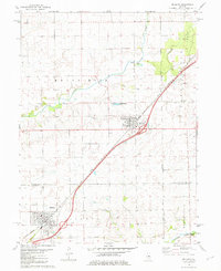
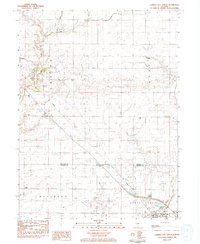
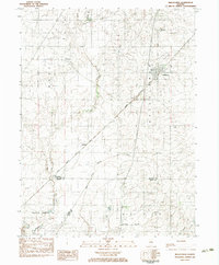
(35)- 1980 Map of Armington
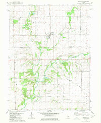 1980 Armington1980 Print · USGSThe rural borderlands of Tazewell and Logan counties are captured here in the late seventies. Family historians can trace several pioneer burial sites, including Oak View Cem and Miller Cem, alongside the Illinois Terminal rail line.
 - 1980 Map of Minier
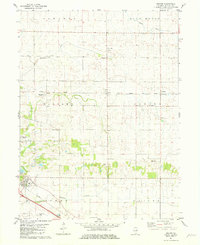
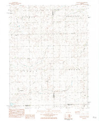
 1980 Minier1980 Print · USGSTazewell County's rural landscape at the start of the eighties is centered on the rail junction at Minier. Researchers can trace old family sites and transport links through settlements like Mindale and Fravert, or locate burials at Broadway Cem and Camp Cem.
 - 1981 Map of Heyworth
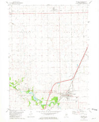
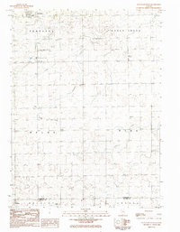
 1981 Heyworth1981 Print · USGSCentral Illinois farmland near Heyworth is captured here in the early eighties, showcasing a landscape of winding creeks and pioneer cemeteries. Researchers can trace family history at Old Rutledge Cem or locate the old Illinois Central Gulf rail corridor.
 - 1981 Map of Funks Grove
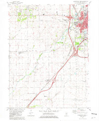
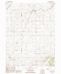
 1981 Funks Grove1981 Print · USGSMcLean and De Witt counties were mapped in the early eighties as the modern highway system integrated with old rail corridors. Researchers can locate family burial sites at Fremont Cem or Halsey Cem and trace the path of the ILLINOIS CENTRAL GULF near Funks Grove.
 - 1981 Map of McLean
 1981 McLean1981 Print · USGSThe rail corridor between McLean and Atlanta comes alive in the early eighties as the Illinois Central Gulf cuts through the prairie. Researchers can find numerous pioneer burial sites and rural churches, including Mt Hope Cem, Brock Cem, and Funks Grove Ch.
 - 1981 Map of Holder
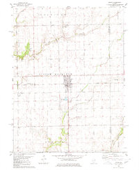
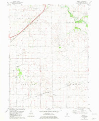
 1981 Holder1981 Print · USGSMcLean County, Illinois, remains a quintessential rail-and-creek landscape during the early 1980s. Local researchers can trace family landmarks and transport hubs from the village of Downs to the rural Benjaminville Cem and the NORFOLK AND WESTERN rail line.2 unique versions available
 - 1981 Map of Lexington
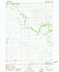
 1981 Lexington1981 Print · USGSMcLean County in the early eighties shows a landscape shaped by the Mackinaw River and vital rail lines. Genealogists can locate several family burial sites like Hibbs-Bigger Cem and trace the rural layouts of Meadows and Ballard.
 - 1981 Map of Bloomington West
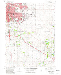
 1981 Bloomington West1981 Print · USGSMcLean County in the early eighties shows the expansion of the Bloomington-Normal area into the surrounding prairie. Researchers can trace the layout of old burial grounds like Twin Grove Cem and Scogin Hill Cem or locate rural landmarks such as Shirley and Covell.
 - 1981 Map of Gridley
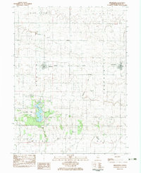
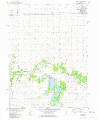 1981 Gridley1981 Print · USGSThe rail-and-river landscape of McLean County comes to life in the early 1980s. Genealogists and local historians can trace family ties at Messer Cem and Wilcox Cem or explore the mid-century recreation sites around Lake Bloomington.
 - 1981 Map of Merna
 1981 Merna1981 Print · USGSMcLean County farmland near the start of the eighties is captured here in detail, showcasing the quiet rural life between the Mackinaw River and Blue Mound. Genealogists can locate family landmarks like Merna Cem or trace the path of the Illinois Central Gulf railroad.
 - 1981 Map of Bloomington East
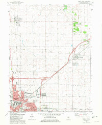
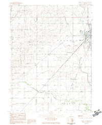
 1981 Bloomington East1981 Print · USGSBloomington and Normal expansion is captured here in the early eighties as the urban grid meets the central Illinois prairie. Trace local history at Illinois Wesleyan University, or locate family sites at Evergreen Memorial Cemetery and the County Farm.
 - 1981 Map of Normal East
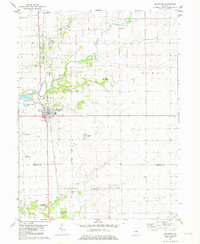
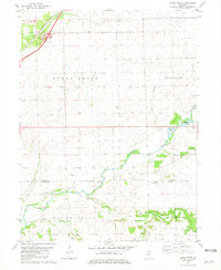
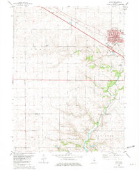
 1981 Normal East1981 Print · USGSCentral Illinois growth reaches toward Hudson and Towanda in the early eighties as urban borders expand near the university campus. Genealogists can trace family plots at Bishop Cem or Havens Cem and locate landmarks like the Soldiers and Sailors State Childrens Home.
 - 1981 Map of Le Roy
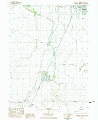
 1981 Le Roy1981 Print · USGSThe rail-and-creek landscape of McLean County comes into focus in the early 1980s, centered on the bustling community of Le Roy. Genealogists and local historians can trace rural family sites like Rutledge Cem and Rucker Chapel or follow the Conrail rail line through the valley.
 - 1981 Map of Stanford
 1981 Stanford1981 Print · USGSStanford and the fertile plains of McLean County are shown in the early eighties as the rail-and-creek economy evolved. Researchers can trace the Illinois Central Gulf corridor or locate local landmarks like Brooks Grove Cem and Olympia High Sch.2 unique versions available
 - 1982 Map of Gibson City West, 1983 Print
 1982 Gibson City West1983 Print · USGSFord County farmland and the rail hub of Gibson City are documented here in the early 1980s. Researchers can locate specific local landmarks like Township Cem, the old Drive-in Theater, and the rural sidings at Harpster.
 - 1983 Map of Southeast Pontiac
 1983 Southeast Pontiac1983 Print · USGSLivingston County's agricultural heartland is documented here in the early eighties, showcasing a landscape of river-bend settlements and prairie townships. Local researchers can locate family-named cemeteries like Houder Cem and Patty Cem or trace rural aviation history at Ziller Landing Strip.
 - 1983 Map of Farmer City North
 1983 Farmer City North1983 Print · USGSAgricultural life in McLean and DeWitt Counties during the early eighties is defined by the rail lines and creeks that knit these prairie towns together. Genealogists and local historians can trace the foundations of Sabina, locate Prairie Chapel, and find family plots at Oak Grove Cem.
 - 1983 Map of Southwest Pontiac
 1983 Southwest Pontiac1983 Print · USGSLivingston County in the early eighties shows a landscape shaped by rail, aviation, and institutional history. Researchers can trace the grounds of the State Correctional Center or locate smaller sites like Ocoya and Payne Cem.
 - 1983 Map of Arrowsmith
 1983 Arrowsmith1983 Print · USGSThe rural prairie of McLean County is shown in the early 1980s as the railroad and the interstate-era parks shaped local life. Researchers can locate family plots at Township Cem and Barnes Cem or trace the early course of the Sangamon River.
 - 1983 Map of Saybrook
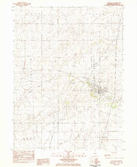 1983 Saybrook1983 Print · USGSSaybrook and the Cheneys Grove region are captured here in the early 1980s, centered on the Sangamon River. Researchers can trace old family burial sites at Greenwood Cem and Riverside Cem or follow the Norfolk and Western rail line.
 - 1983 Map of Bellflower
 1983 Bellflower1983 Print · USGSAgricultural life in McLean and De Witt Counties centered on the Illinois Central Gulf rail line during the early 1980s. Trace old township roots and transit points from Bellflower to Weedman, alongside the Bellflower Cem and Blue Ridge.
 - 1983 Map of Flanagan SW, 1984 Print
 1983 Flanagan SW1984 Print · USGSCentral Illinois farmland at the dawn of the eighties reveals a network of rural townships and private aviation. Trace family sites near Baughman Cem or locate landmarks like the Historical Monument and Pfister Landing Strip.
 - 1984 Map of Flanagan South, 1985 Print
 1984 Flanagan South1985 Print · USGSThe northern Illinois prairie in the late seventies is captured here, centered on the townships of Waldo and Nebraska. Researchers can trace rural landmarks from Salem Childrens Home and St Josephs Cem to the Slagel Landing Strip.
 - 1984 Map of Foosland, 1985 Print
 1984 Foosland1985 Print · USGSThe rural borderlands of Champaign and McLean counties come alive in the 1980s as a hub for rail transport and resource management. Genealogists and local historians can trace small prairie settlements like Lotus, Osman, and Dickerson, or locate family sites at Shiloh Cem and Naylor Cem.
 - 1985 Map of Peoria
 1985 Peoria1985 Print · USGSThe Illinois River valley and the Tri-County area are captured here in the mid-1980s as industry and infrastructure reshaped the heart of the state. Researchers can trace the grounds of Jubilee College, locate the Stark Mine near Elmwood, or follow the busy tracks of the Norfolk and Western Railroad.
Showing maps 1-25 of 35
Top cities of McLean County
- Bloomington historical maps
- Normal historical maps
- Empire historical maps
- Randolph historical maps
- Le Roy historical maps
- Heyworth historical maps
See more
Frequently asked questions
- What are the different types of historical maps available for McLean County?
- What is the oldest map of McLean County?
- Where can I purchase historical maps of McLean County for my home or office?
- Where can I download high-res historical maps of McLean County?
- Are there historical topographic maps available for McLean County?
- Is there historical aerial imagery available for McLean County?
- Where are historical maps of McLean County sourced from?