1980s Maps of Menard County, Illinois
Explore 6 historic maps of Menard County from the 1980s. These maps offer a rare glimpse into what life looked like during the 1980s — showing old roads, neighborhoods, homes, and landmarks that have changed or disappeared over time.
Whether you're researching your family's past, planning a metal detecting trip, or studying how Menard County's landscape evolved across the 1980s, these high-resolution maps are a powerful tool for exploring the history of this region.
- Focus on a specific era: All maps on this page are from the 1980s, giving you a focused view of this time period.
- See what’s changed: Compare century-old streets, trails, and buildings to today's modern landscape using overlays and satellite layers.
- Research with precision: Use these maps for genealogy, historical research, land use analysis, or educational projects.
- View, download, or print: Maps are fully viewable online in high resolution, and can be downloaded or printed for your own records.
Start exploring Menard County's history through authentic maps from the 1980s. This is your window into the past.
Menard County, IL maps
(6)- 1980 Map of Mason City
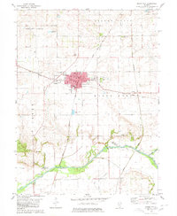 1980 Mason City1980 Print · USGSMason City stands at the crossing of two major rail lines in 1980, anchoring a landscape of fertile prairie and creek bottoms. Genealogists can locate family plots at Cherry Grove Cem or Swing Grove Cem, and trace the path of Salt Creek down to Hubly.
 - 1980 Map of New Holland
 1980 New Holland1980 Print · USGSNew Holland and the surrounding townships of Logan and Mason counties are shown here at the start of the 1980s. Researchers can trace old transit lines like the Old Railroad Grade or locate family sites at Stephens Cemetery and Pool Hill.
 - 1980 Map of Greenview
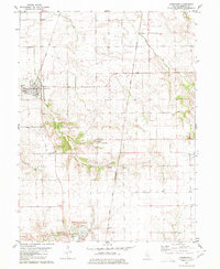 1980 Greenview1980 Print · USGSThe Menard County prairie is captured here in the 1980s, centered on the rail hub of Greenview and the surrounding farmland. Researchers can trace rural lineages at Sugar Grove Cem or locate industrial sites like the large Quarry near Indian Point.
 - 1985 Map of Lincoln
 1985 Lincoln1985 Print · USGSMid-century Illinois comes to life in this survey of Logan and Mason counties as the interstate era reshapes the prairie. Genealogists and historians can trace rail-town development from San Jose to Kenney or locate landmarks like Rose Hill Cem and Funks Grove.
 - 1985 Map of Springfield
 1985 Springfield1985 Print · USGSCentral Illinois during the mid-eighties shows a landscape of growing state capital influence and deep historical roots. Genealogists and historians can trace family sites near Oak Ridge Cem or follow the path of the Sangamon River past Williamsville and Riverton.2 unique versions available
 - 1989 Map of Lincoln
 1989 Lincoln1989 Print · USGSCentral Illinois in the late eighties remains a landscape of productive prairie and vital river arteries. Genealogists and local historians can trace rural family landmarks like Rose Hill Cem, identify early aviation at Logan County Airport, or follow the Illinois Central Gulf Railroad through towns like Atlanta and Lincoln.
End of results
Showing maps 1-6 of 6
Top cities of Menard County
- Petersburg historical maps
- Athens historical maps
- Greenview historical maps
- Tallula historical maps
- Oakford historical maps
Frequently asked questions
- What are the different types of historical maps available for Menard County?
- What is the oldest map of Menard County?
- Where can I purchase historical maps of Menard County for my home or office?
- Where can I download high-res historical maps of Menard County?
- Are there historical topographic maps available for Menard County?
- Is there historical aerial imagery available for Menard County?
- Where are historical maps of Menard County sourced from?