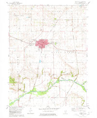
1980 Map of Mason City
USGS Topo · Published 1980About this map
Mason City serves as the primary hub of this Central Illinois prairie landscape, where the Illinois Central Gulf and Chicago and North Western rail lines intersect. This junction defined the local economy, facilitating the movement of agricultural goods from the surrounding fields of Allens Grove and Pennsylvania townships. The map documents the town's civic core, including the City Hall and Post Office, as well as recreational spaces like the Golf Course and Court Memorial Park.
Find a feature on this map
29 named features on this map. Tap any name to fly to it.
Don’t see what you’re looking for? This feature index may not catch every label — zoom into the map to look around manually.
Map Details
Editions of this 1980 Mason City Map
This is the sole edition of this map. No revisions or reprints were ever made.
Other maps of this area

1929 · Manito
USGS Topo · 1:62,500

1932 · Manito
USGS Topo · 1:62,500

1933 · Petersburg
USGS Topo · 1:62,500

1938 · Petersburg
USGS Topo · 1:62,500

1942 · Delavan
USGS Topo · 1:62,500

1948 · Mason City
USGS Topo · 1:62,500

1949 · Mason City
USGS Topo · 1:62,500

1958 · Peoria
USGS Topo · 1:250,000

1961 · Peoria
USGS Topo · 1:250,000

1963 · Peoria
USGS Topo · 1:250,000