Old Maps of Witt, Illinois for Genealogy
Trace your family roots with 21 historic maps of Witt. These high-res maps reveal old neighborhoods, homesites, landmarks, and streets — helping you uncover where your ancestors lived and how the area evolved over time.
- Explore historic neighborhoods: Identify where your relatives may have lived in the 1800s or 1900s.
- Compare maps over time: Trace the changes in streets, buildings, and landmarks for multi-generational research.
- Perfect for genealogy & ancestry research: Used by family historians and researchers to map out lineage and migration.
These maps are an incredible resource for exploring your personal connection to Witt's past.
Witt, IL maps
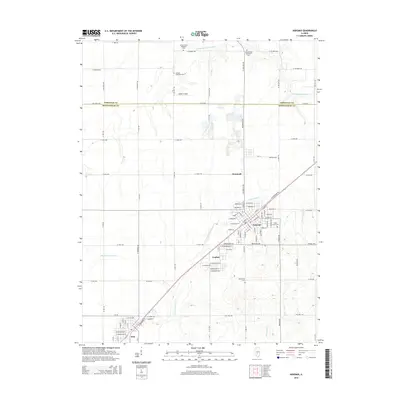
(21)- 1946 Map of Nokomis, 1965 Print
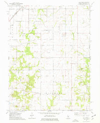
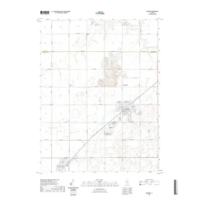
 1946 Nokomis1965 Print · USGSThe Illinois prairie south of Taylorville reached its industrial and agricultural peak just after World War II. Genealogists can trace family names across dozens of rural sites, including Mound Chapel, D'Arcy Sch, and the mining corridor near Coalton.2 unique versions available
 - 1947 Map of Hillsboro, 1963 Print
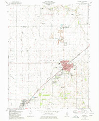
 1947 Hillsboro1963 Print · USGSMid-century Montgomery County centers on the rail and water networks around Hillsboro and Coffeen. Local historians can trace dozens of rural landmarks, from the County Farm and Sycamore School to small family plots like McCord Cem and Taylor Cem.
 - 1949 Map of Hillsboro
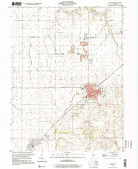
 1949 Hillsboro1949 Print · USGSMontgomery County in the late 1940s is captured here at a peak of rail-driven industry and small-town growth. Genealogists and historians can trace the many rural schools and family cemeteries that dotted the landscape, from Taylor Springs to Fillmore and the Shiloh Ch.2 unique versions available
 - 1949 Map of Nokomis
 1949 Nokomis1949 Print · USGSCentral Illinois rail and agricultural life are captured here in the late 1940s, showing the intricate network of country schools and family cemeteries. Genealogists can locate family sites near St Maurice Cem or trace the many local schoolhouses like Mound Sch and Prosperity Sch.2 unique versions available
 - 1958 Map of Decatur, 1971 Print
 1958 Decatur1971 Print · USGSCentral Illinois in the mid-twentieth century shows a landscape defined by industrial rail hubs and the creation of large reservoirs. Researchers can trace historic corridors like the Penn Central or locate landmarks such as Lincoln Log Cabin State Park and Lake Springfield.3 unique versions available
 - 1961 Map of Decatur
 1961 Decatur1961 Print · USGSCentral Illinois in the late fifties was a bustling corridor of rail lines and prairie commerce centered on the state capital. Genealogists and historians can trace the intricate connections between Springfield, Decatur, and dozens of smaller settlements like Nokomis and Arcola.2 unique versions available
 - 1974 Map of Bald Knob, 1977 Print
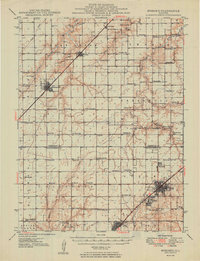
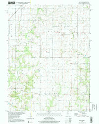
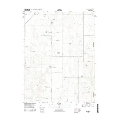
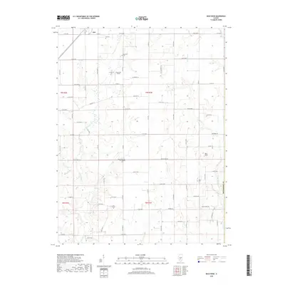
 1974 Bald Knob1977 Print · USGSMontgomery County agriculture and small-town rail life are captured here during the mid-seventies. Genealogists and local historians can trace family landmarks like Armentrout Cem, Bost Hill Ch, and the prominent local rise of Bald Knob.
 - 1980 Map of Nokomis
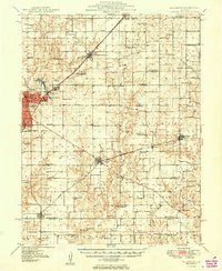
 1980 Nokomis1980 Print · USGSNokomis and the surrounding coal-belt townships are captured here during the late twentieth century, showing the region's industrial and rural character. Genealogists and local historians can trace family sites like St Louis Cem, Oak Grove Cem, and Center Grove Ch among the rail lines and creek forks.
 - 1982 Map of Litchfield
 1982 Litchfield1982 Print · USGSThe coal and rail corridors of Central Illinois are captured here in the early eighties as the region balanced industrial mining with its agricultural roots. Researchers can trace family history through sites like Zelmer Memorial Cemetery or the grounds of Blackburn College and the Crown Mine No 1.
 - 1998 Map of Nokomis, 2002 Print
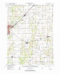
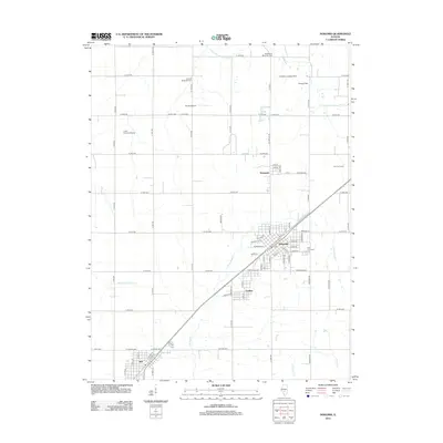
 1998 Nokomis2002 Print · USGSThe Montgomery County prairie around the turn of the millennium shows a landscape defined by small-town grids and industrial sites. Family historians can trace local roots through landmarks like Oak Grove Cem, St Paul Sch, and the quiet settlements of Coalton and Witt.
 - 1998 Map of Bald Knob, 2002 Print
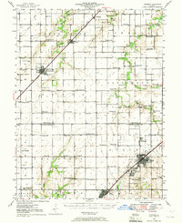
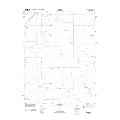
 1998 Bald Knob2002 Print · USGSThe agricultural heart of Montgomery and Fayette counties is captured in the late twentieth century, showing the small-town life around Witt. Genealogists can trace family roots through sites like Armentrout Cemetery, Woodside Church, and the distinctive Bald Knob summit.
 - 2012 Map of Nokomis, 2012 Print
 2012 Nokomis2012 Print · USGSCovers Witt, including Nokomis, Coalton, and other nearby areas
 - 2012 Map of Bald Knob, 2012 Print
 2012 Bald Knob2012 Print · USGSCovers Witt, including Montgomery County, Fayette County, and other nearby areas
 - 2015 Map of Nokomis, 2015 Print
 2015 Nokomis2015 Print · USGSCovers Witt, including Nokomis, Coalton, and other nearby areas
 - 2015 Map of Bald Knob, 2015 Print
 2015 Bald Knob2015 Print · USGSCovers Witt, including Montgomery County, Fayette County, and other nearby areas
 - 2018 Map of Nokomis, 2018 Print
 2018 Nokomis2018 Print · USGSCovers Witt, including Nokomis, Coalton, and other nearby areas
 - 2018 Map of Bald Knob, 2018 Print
 2018 Bald Knob2018 Print · USGSCovers Witt, including Montgomery County, Fayette County, and other nearby areas
 - 2021 Map of Bald Knob, 2021 Print
 2021 Bald Knob2021 Print · USGSCovers Witt, including Montgomery County, Fayette County, and other nearby areas
 - 2021 Map of Nokomis, 2021 Print
 2021 Nokomis2021 Print · USGSCovers Witt, including Nokomis, Coalton, and other nearby areas
 - 2024 Map of Nokomis, 2024 Print
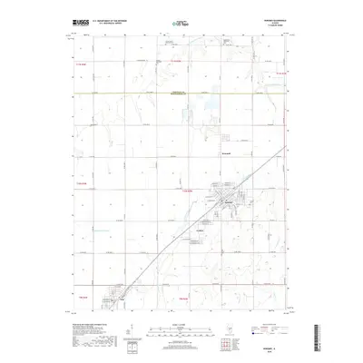
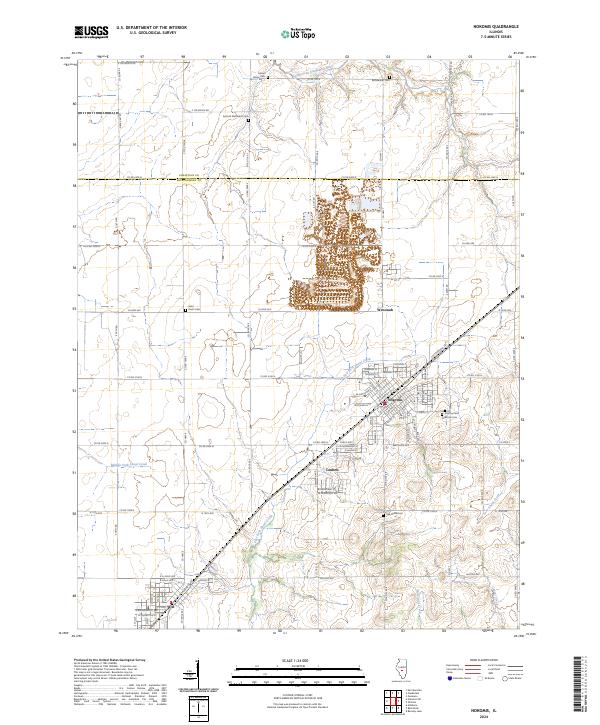 2024 Nokomis2024 Print · USGSCentral Illinois prairie and creek-side settlements are captured here in the 2020s. Researchers can locate family plots at Antioch Methodist Cem or Calvary Cem and trace the early town layouts of Nokomis and Coalton.
 - 2024 Map of Bald Knob, 2024 Print
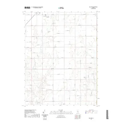
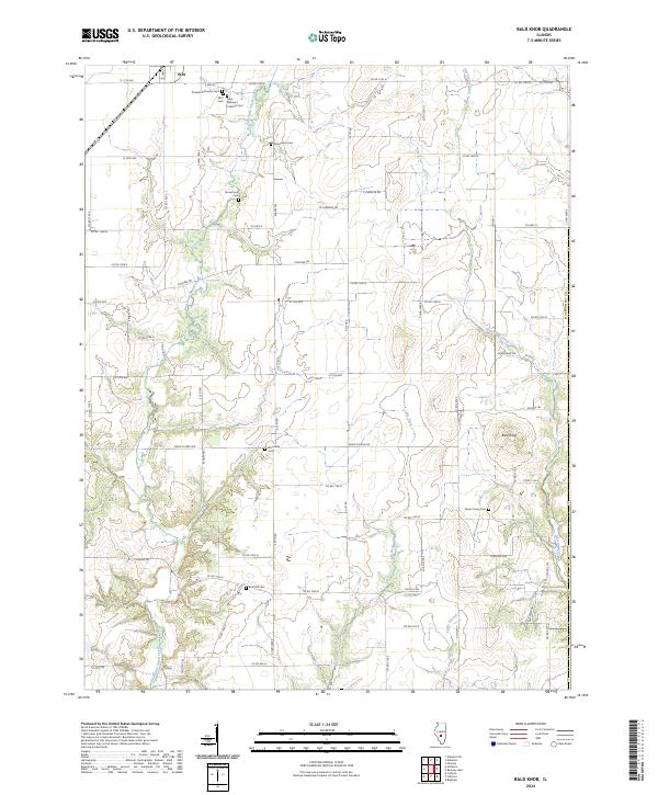 2024 Bald Knob2024 Print · USGSMontgomery County’s rural landscape is captured here in the early twenty-first century, showing the enduring agricultural and community boundaries of central Illinois. Genealogists can trace family heritage across numerous local burial sites, including the Russian Orthodox Cem, Bost Hill Cem, and Gooseneck Cem.
End of results
Showing maps 1-21 of 21
Top cities near Witt
- Taylorville historical maps
- Hillsboro historical maps
- Nokomis historical maps
- Morrisonville historical maps
- Raymond historical maps
- Coffeen historical maps
See more
Frequently asked questions
- What are the different types of historical maps available for Witt?
- What is the oldest map of Witt?
- Where can I purchase historical maps of Witt for my home or office?
- Where can I download high-res historical maps of Witt?
- Are there historical topographic maps available for Witt?
- Is there historical aerial imagery available for Witt?
- Where are historical maps of Witt sourced from?