Old Maps of Dixon Springs, Illinois for Academic Research
Study the evolution of Dixon Springs with 17 high-resolution historic maps. Whether you're teaching, researching, or modeling changes in land use, these maps provide essential visual documentation of urban, environmental, and geographic change.
- Analyze long-term change: Track patterns in development, transportation, and natural features.
- Ideal for environmental or urban studies: Support academic projects with primary historical map data.
- Use in the classroom or lab: Educators and researchers rely on these maps to bring historical context to life.
These maps are a powerful tool for teaching, research, and visualizing how Dixon Springs has changed over the decades.
Dixon Springs, IL maps
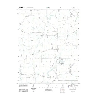
(17)- 1917 Map of Brownfield
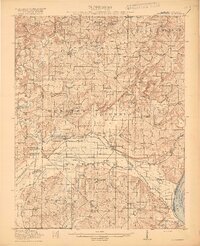 1917 Brownfield1917 Print · USGSSouthern Illinois in the years before the Great War is captured here through its dense network of rural schoolhouses and rail sidings. Researchers can locate family landmarks like Lackey Bridge, Allard College School, and Dixon Springs Sta (Renshaw P.O.).4 unique versions available
 - 1949 Map of Paducah
 1949 Paducah1949 Print · USGSThe confluence of the Ohio, Mississippi, Tennessee, and Cumberland rivers at the close of the 1940s reveals a region bound by water and rail. Researchers can trace historic river landings, timberlands in the Shawnee National Forest, and the coal-mining infrastructure around West Frankfort and Herrin.2 unique versions available
 - 1950 Map of Paducah
 1950 Paducah1950 Print · USGSThe confluence of the great midwestern rivers defines this mid-century landscape at the intersection of Illinois, Kentucky, and Missouri. Genealogists and historians can trace the rail-and-river economy through the hubs of Paducah, Cairo, and Metropolis or locate family roots near the Wildcat Hills.
 - 1954 Map of Paducah
 1954 Paducah1954 Print · USGSSouthern Illinois and Western Kentucky intersect at the great river confluences during this mid-century era of rail and river industry. Genealogists and historians can trace family roots and commerce through river towns like Cairo, Metropolis, and Golconda, or along the tracks of the Illinois Central Railroad.2 unique versions available
 - 1961 Map of Paducah
 1961 Paducah1961 Print · USGSThe Lower Ohio Valley at mid-century is a landscape defined by its great rivers and newly formed reservoirs. Researchers can trace the riverfronts of Paducah and Metropolis, or locate smaller settlements like Old Shawneetown and Cave in Rock along the banks.2 unique versions available
 - 1962 Map of Glendale, 1963 Print
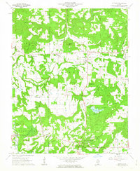 1962 Glendale1963 Print · USGSSouthern Illinois forest country in the early sixties was a landscape of remote ridges and rail-side settlements. Genealogists can trace family roots through sites like Rock Springs Ch or the McShanahan Cem while rail fans follow the Illinois Central line.
 - 1962 Map of Brownfield, 1965 Print
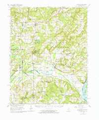 1962 Brownfield1965 Print · USGSSouthern Illinois at the peak of the mid-century era shows a landscape where the deep woods of the Shawnee National Forest meet the Ohio River. Genealogists and historians can trace rail-side towns like Reevesville and discover dozens of family burial grounds, including Barger Cem and Nelson Cem.
 - 1964 Map of Paducah
 1964 Paducah1964 Print · USGSThe river-and-rail corridor of Southern Illinois and Western Kentucky is captured here during the height of the mid-century industrial era. Genealogists and researchers can trace local landmarks across several counties, from the rail yards of Paducah to the waters of Crab Orchard Lake and Kentucky Reservoir.2 unique versions available
 - 1984 Map of Paducah, 1986 Print
 1984 Paducah1986 Print · USGSThe river-driven economy of western Kentucky and southern Illinois is captured here in the mid-eighties, showing the massive impact of the Kentucky Lake and Lake Barkley reservoirs. Genealogists and historians can trace rail lines like the Illinois Central Gulf RR and explore sites from Fort Massac State Park to the Kentucky State Penitentiary.
 - 1986 Map of Paducah, 1987 Print
 1986 Paducah1987 Print · USGSThe tri-river confluence of the Ohio, Tennessee, and Cumberland rivers is captured here in the mid-1980s during a period of established river power and industry. Researchers can trace local heritage through landmarks like Friendship Church, the Smithland Locks and Dam, and the Illinois Central Gulf RR.
 - 1987 Map of Paducah, 1988 Print
 1987 Paducah1988 Print · USGSThe Lower Ohio Valley and the Illinois Ozarks come alive in this late twentieth-century regional survey. Genealogists and local historians can trace river-town roots and state park landmarks from Metropolis to Cape Girardeau and Trail of Tears State Park.
 - 1996 Map of Glendale, 1998 Print
 1996 Glendale1998 Print · USGSSouthern Illinois in the 1990s reveals a landscape of protected forests and deep history. Genealogists and historians can trace family roots at Harper Cem or explore the prehistoric significance of the Millstone Bluff National Register Site.
 - 2012 Map of Glendale, 2012 Print
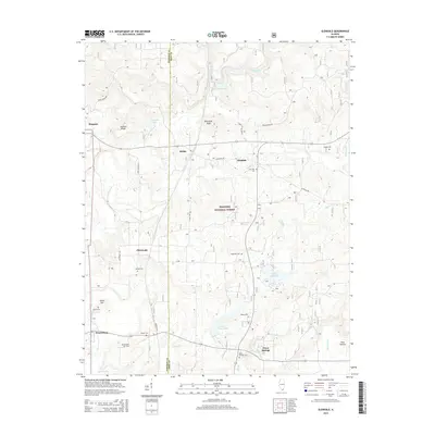
 2012 Glendale2012 Print · USGSCovers Dixon Springs, including Simpson, Robbs, and other nearby areas
 - 2015 Map of Glendale, 2015 Print
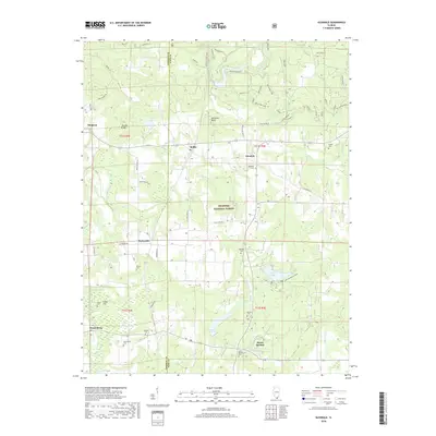
 2015 Glendale2015 Print · USGSCovers Dixon Springs, including Simpson, Robbs, and other nearby areas
 - 2018 Map of Glendale, 2018 Print
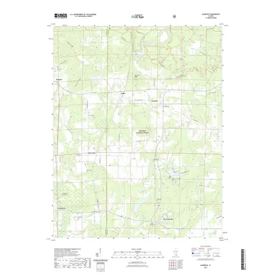
 2018 Glendale2018 Print · USGSCovers Dixon Springs, including Simpson, Robbs, and other nearby areas
 - 2021 Map of Glendale, 2021 Print
 2021 Glendale2021 Print · USGSCovers Dixon Springs, including Simpson, Robbs, and other nearby areas
 - 2024 Map of Glendale, 2024 Print
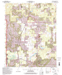
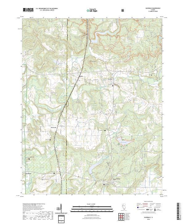 2024 Glendale2024 Print · USGSPope and Johnson counties are captured in the present day, showcasing a landscape of protected forest and enduring rural settlements. Researchers can locate numerous historic burial sites like McClanahan Cem and Nelson Cem, or trace the path of Sugar Creek near Dixon Springs.
End of results
Showing maps 1-17 of 17
Top cities near Dixon Springs
- Marion historical maps
- Metropolis historical maps
- Vienna historical maps
- Golconda historical maps
- Joppa historical maps
- New Burnside historical maps
See more
Frequently asked questions
- What are the different types of historical maps available for Dixon Springs?
- What is the oldest map of Dixon Springs?
- Where can I purchase historical maps of Dixon Springs for my home or office?
- Where can I download high-res historical maps of Dixon Springs?
- Are there historical topographic maps available for Dixon Springs?
- Is there historical aerial imagery available for Dixon Springs?
- Where are historical maps of Dixon Springs sourced from?