
1917 Map of Brownfield
USGS Topo · Published 1917About this map
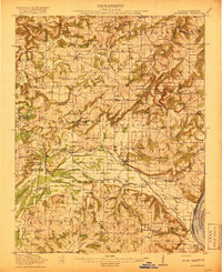
Dixon Springs and the surrounding southern Illinois townships of Eddyville, Alexander, and Columbus characterize this rural landscape surveyed shortly before the United States entered the Great War. The territory is defined by a high density of country schools, including Allard College School, Sulphur Spring School, and Point Pleasant School, reflecting a period when education was deeply localized. The Illinois Central railroad cuts through the terrain, serving small depots and post offices like Dixon Springs Sta (Renshaw P.O.) and Big Bay (McNoel P.O.).
Find a feature on this map
92 named features on this map. Tap any name to fly to it.
Don’t see what you’re looking for? This feature index may not catch every label — zoom into the map to look around manually.
Map Details
Editions of this 1917 Brownfield Map
4 editions found
Other maps of this area

1916 · Golconda
USGS Topo · 1:62,500

1916 · Equality
USGS Topo · 1:62,500

1918 · Vienna
USGS Topo · 1:62,500

1919 · Vienna
USGS Topo · 1:62,500

1920 · Goloonda
USGS Topo · 1:48,000

1921 · Golconda
USGS Topo · 1:62,500

1925 · Marion
USGS Topo · 1:62,500

1925 · Harrisburg
USGS Topo · 1:62,500

1926 · Paducah
USGS Topo · 1:62,500

1928 · La Center
USGS Topo · 1:62,500