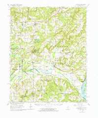
1962 Map of Brownfield
USGS Topo · Published 1965About this map
The Shawnee National Forest dominates this Southern Illinois landscape, where the rugged terrain of the Shawnee Hills meets the lowlands of the Ohio River valley. This 1965 compilation reflects the mid-century intersection of natural conservation and agricultural infrastructure. Established recreational areas like Dixon Springs State Park and Lake Glendale are prominent, while the Dixon Springs Experiment Station highlights the region's historical role in agricultural research.
Find a feature on this map
125 named features on this map. Tap any name to fly to it.
Don’t see what you’re looking for? This feature index may not catch every label — zoom into the map to look around manually.
Map Details
Editions of this 1962 Brownfield Map
This is the sole edition of this map. No revisions or reprints were ever made.
Other maps of this area

1916 · Golconda
USGS Topo · 1:62,500

1916 · Equality
USGS Topo · 1:62,500

1917 · Brownfield
USGS Topo · 1:62,500

1918 · Vienna
USGS Topo · 1:62,500

1919 · Vienna
USGS Topo · 1:62,500

1920 · Goloonda
USGS Topo · 1:48,000

1921 · Golconda
USGS Topo · 1:62,500

1925 · Marion
USGS Topo · 1:62,500

1925 · Harrisburg
USGS Topo · 1:62,500

1926 · Paducah
USGS Topo · 1:62,500