Old Maps of Saint Clair County, Illinois
Explore 87 old maps of Saint Clair County, spanning from 1888 to today. These high-resolution historic maps reveal how streets, neighborhoods, landmarks, and natural features evolved over time — perfect for genealogy, metal detecting, research, and local history exploration.
What you can do with these maps:
- See how Saint Clair County changed over time: Compare historical maps to modern-day views to trace roads, homesites, rail lines & more.
- View detailed metadata: Each map includes creators, publishers, year, scale, and archive source.
- Overlay maps with satellite & LiDAR: Visualize the past alongside modern tools to explore terrain & human change.
- Trusted historical sources: Maps sourced from the USGS, Library of Congress, and other archives.
- Access maps your way: View online, download high-res files, or order prints for personal or research use.
Start exploring old maps of Saint Clair County to uncover forgotten places, hidden landmarks, and the deep history beneath your feet.
Saint Clair County, IL maps
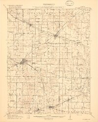
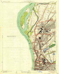
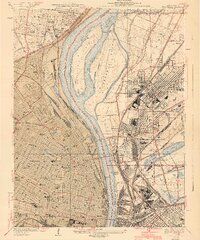
(87)- 1888 Map of St. Louis
 1888 St. Louis1888 Print · USGSCovers Saint Clair County, including St. Louis, Belleville, and other nearby areas
 - 1906 Map of Breese, 1958 Print
 1906 Breese1958 Print · USGSCovers Saint Clair County, including Highland, Breese, and other nearby areas
 - 1907 Map of Breese
 1907 Breese1907 Print · USGSCovers Saint Clair County, including Highland, Breese, and other nearby areas2 unique versions available
 - 1907 Map of Belleville
 1907 Belleville1907 Print · USGSCovers Saint Clair County, including Belleville, O'Fallon, and other nearby areas3 unique versions available
 - 1910 Map of Okawville
 1910 Okawville1910 Print · USGSCovers Saint Clair County, including Marissa, Okawville, and other nearby areas2 unique versions available
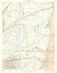
 - 1910 Map of Waterloo, 1956 Print
 1910 Waterloo1956 Print · USGSCovers Saint Clair County, including Belleville, Columbia, and other nearby areas
 - 1912 Map of New Athens
 1912 New Athens1912 Print · USGSCovers Saint Clair County, including Belleville, Mascoutah, and other nearby areas2 unique versions available
 - 1912 Map of Baldwin, 1967 Print
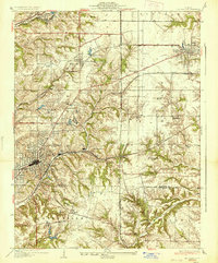
 1912 Baldwin1967 Print · USGSCovers Saint Clair County, including Sparta, Red Bud, and other nearby areas
 - 1913 Map of Waterloo
 1913 Waterloo1913 Print · USGSCovers Saint Clair County, including Belleville, Columbia, and other nearby areas3 unique versions available
 - 1914 Map of Baldwin
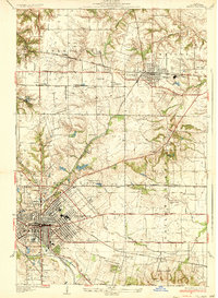
 1914 Baldwin1914 Print · USGSCovers Saint Clair County, including Sparta, Red Bud, and other nearby areas2 unique versions available
 - 1914 Map of Coulterville, 1965 Print
 1914 Coulterville1965 Print · USGSCovers Saint Clair County, including Sparta, Steeleville, and other nearby areas
 - 1917 Map of Coulterville
 1917 Coulterville1917 Print · USGSCovers Saint Clair County, including Sparta, Steeleville, and other nearby areas3 unique versions available
 - 1931 Map of French Village, 1954 Print
 1931 French Village1954 Print · USGSCovers Saint Clair County, including Belleville, East St. Louis, and other nearby areas
 - 1933 Map of Granite City
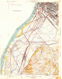
 1933 Granite City1933 Print · USGSCovers Saint Clair County, including St. Louis, Granite City, and other nearby areas2 unique versions available
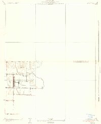
 - 1933 Map of Jefferson Barracks
 1933 Jefferson Barracks1933 Print · USGSCovers Saint Clair County, including Mehlville, Webster Groves, and other nearby areas
 - 1933 Map of Cahokia
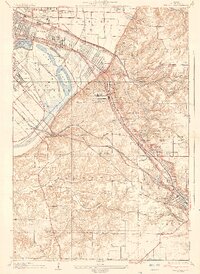
 1933 Cahokia1933 Print · USGSCovers Saint Clair County, including Cahokia Heights, East St. Louis, and other nearby areas
 - 1934 Map of Cahokia
 1934 Cahokia1934 Print · USGSCovers Saint Clair County, including Cahokia Heights, East St. Louis, and other nearby areas2 unique versions available
 - 1935 Map of Lebanon
 1935 Lebanon1935 Print · USGSCovers Saint Clair County, including O'Fallon, Shiloh, and other nearby areas2 unique versions available
 - 1935 Map of French Village
 1935 French Village1935 Print · USGSCovers Saint Clair County, including Belleville, East St. Louis, and other nearby areas2 unique versions available
 - 1935 Map of Granite City
 1935 Granite City1935 Print · USGSCovers Saint Clair County, including St. Louis, Granite City, and other nearby areas2 unique versions available
 - 1935 Map of Monks Mound
 1935 Monks Mound1935 Print · USGSCovers Saint Clair County, including Granite City, Collinsville, and other nearby areas3 unique versions available
 - 1937 Map of Collinsville
 1937 Collinsville1937 Print · USGSCovers Saint Clair County, including O'Fallon, Collinsville, and other nearby areas2 unique versions available
 - 1937 Map of O'Fallon
 1937 O'Fallon1937 Print · USGSCovers Saint Clair County, including Belleville, O'Fallon, and other nearby areas2 unique versions available
 - 1940 Map of Granite City
 1940 Granite City1940 Print · USGSCovers Saint Clair County, including St. Louis, Granite City, and other nearby areas5 unique versions available
 - 1940 Map of Cahokia
 1940 Cahokia1940 Print · USGSCovers Saint Clair County, including Cahokia Heights, East St. Louis, and other nearby areas4 unique versions available
Showing maps 1-25 of 87
Top cities of Saint Clair County
- Belleville historical maps
- O'Fallon historical maps
- East St. Louis historical maps
- Fairview Heights historical maps
- Swansea historical maps
- Shiloh historical maps
See more
Frequently asked questions
- What are the different types of historical maps available for Saint Clair County?
- What is the oldest map of Saint Clair County?
- Where can I purchase historical maps of Saint Clair County for my home or office?
- Where can I download high-res historical maps of Saint Clair County?
- Are there historical topographic maps available for Saint Clair County?
- Is there historical aerial imagery available for Saint Clair County?
- Where are historical maps of Saint Clair County sourced from?