Old Maps of Beulah Heights, Eldorado for Academic Research
Study the evolution of Beulah Heights with 17 high-resolution historic maps. Whether you're teaching, researching, or modeling changes in land use, these maps provide essential visual documentation of urban, environmental, and geographic change.
- Analyze long-term change: Track patterns in development, transportation, and natural features.
- Ideal for environmental or urban studies: Support academic projects with primary historical map data.
- Use in the classroom or lab: Educators and researchers rely on these maps to bring historical context to life.
These maps are a powerful tool for teaching, research, and visualizing how Beulah Heights has changed over the decades.
Beulah Heights, Eldorado maps
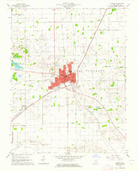
(17)- 1905 Map of Eldorado, 1954 Print
 1905 Eldorado1954 Print · USGSSouthern Illinois rail hubs and prairie settlements thrive at the turn of the century. Genealogists can trace family roots through old stops like Texas City, Gossett, and Francis Mills, or locate early industrial sites like the Dering Mine.
 - 1906 Map of Eldorado
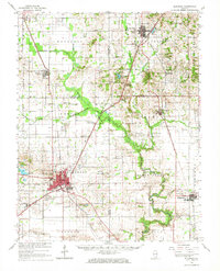
 1906 Eldorado1906 Print · USGSSouthern Illinois at the turn of the century is a bustling web of competing rail lines and river-bottom settlements. Genealogists and rail historians can trace the early footprints of Eldorado, Ridgway, and the milling history at Francis Mills.2 unique versions available
 - 1949 Map of Paducah
 1949 Paducah1949 Print · USGSThe confluence of the Ohio, Mississippi, Tennessee, and Cumberland rivers at the close of the 1940s reveals a region bound by water and rail. Researchers can trace historic river landings, timberlands in the Shawnee National Forest, and the coal-mining infrastructure around West Frankfort and Herrin.2 unique versions available
 - 1950 Map of Paducah
 1950 Paducah1950 Print · USGSThe confluence of the great midwestern rivers defines this mid-century landscape at the intersection of Illinois, Kentucky, and Missouri. Genealogists and historians can trace the rail-and-river economy through the hubs of Paducah, Cairo, and Metropolis or locate family roots near the Wildcat Hills.
 - 1954 Map of Paducah
 1954 Paducah1954 Print · USGSSouthern Illinois and Western Kentucky intersect at the great river confluences during this mid-century era of rail and river industry. Genealogists and historians can trace family roots and commerce through river towns like Cairo, Metropolis, and Golconda, or along the tracks of the Illinois Central Railroad.2 unique versions available
 - 1961 Map of Paducah
 1961 Paducah1961 Print · USGSThe Lower Ohio Valley at mid-century is a landscape defined by its great rivers and newly formed reservoirs. Researchers can trace the riverfronts of Paducah and Metropolis, or locate smaller settlements like Old Shawneetown and Cave in Rock along the banks.2 unique versions available
 - 1963 Map of Eldorado, 1964 Print
 1963 Eldorado1964 Print · USGSMid-century Saline County is defined here by the intersection of three major railroads and a thriving petroleum industry. Researchers can trace family history through sites like Wolf Creek Cemetery, Wesley Chapel, and the settlement of Wasson.
 - 1963 Map of Eldorado, 1966 Print
 1963 Eldorado1966 Print · USGSSouthern Illinois in the early sixties shows a landscape shaped by coal, oil, and the crossing of three major railroads. Genealogists can trace family names at Gholson Cem and Lantham Cem or locate the old Broughton Sch and Gossett Station.
 - 1964 Map of Paducah
 1964 Paducah1964 Print · USGSThe river-and-rail corridor of Southern Illinois and Western Kentucky is captured here during the height of the mid-century industrial era. Genealogists and researchers can trace local landmarks across several counties, from the rail yards of Paducah to the waters of Crab Orchard Lake and Kentucky Reservoir.2 unique versions available
 - 1984 Map of West Frankfort, 1985 Print
 1984 West Frankfort1985 Print · USGSSouthern Illinois at the peak of late-century coal and oil production reveals a complex landscape of industry and conservation. Genealogists and historians can trace rail-served mining hubs like Orient No. 3 Mine and the historic riverfront at Old Shawneetown.
 - 1987 Map of West Frankfort
 1987 West Frankfort1987 Print · USGSSouthern Illinois in the late eighties shows a landscape defined by the coal and river economies. Researchers can trace the extensive Strip Mine works and historic settlements like Shawneetown and Carriers Mills along the Illinois Central Railroad.
 - 1987 Map of Paducah, 1988 Print
 1987 Paducah1988 Print · USGSThe Lower Ohio Valley and the Illinois Ozarks come alive in this late twentieth-century regional survey. Genealogists and local historians can trace river-town roots and state park landmarks from Metropolis to Cape Girardeau and Trail of Tears State Park.
 - 2012 Map of Eldorado, 2012 Print
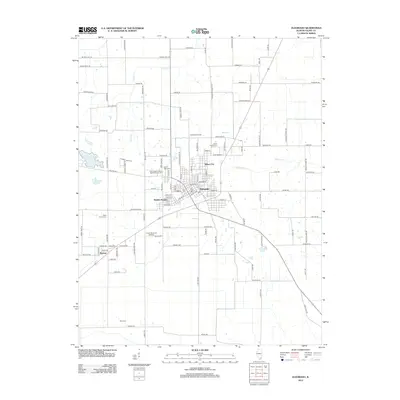 2012 Eldorado2012 Print · USGSCovers Beulah Heights, including Eldorado, Wasson, and other nearby areas
 - 2015 Map of Eldorado, 2015 Print
 2015 Eldorado2015 Print · USGSCovers Beulah Heights, including Eldorado, Wasson, and other nearby areas
 - 2018 Map of Eldorado, 2018 Print
 2018 Eldorado2018 Print · USGSCovers Beulah Heights, including Eldorado, Wasson, and other nearby areas
 - 2021 Map of Eldorado, 2021 Print
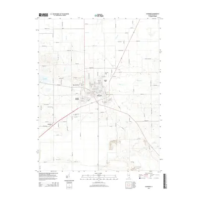
 2021 Eldorado2021 Print · USGSCovers Beulah Heights, including Eldorado, Wasson, and other nearby areas
 - 2024 Map of Eldorado, 2024 Print
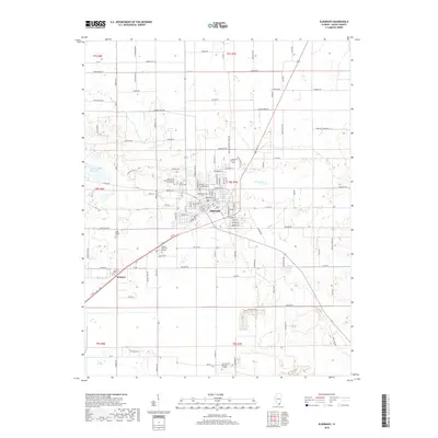
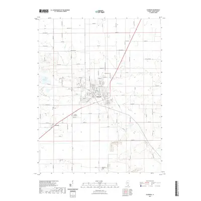
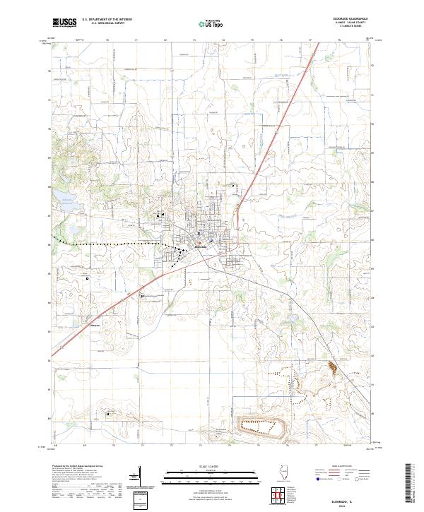 2024 Eldorado2024 Print · USGSSaline County at the present day retains its deep agricultural roots and established small-town centers. Genealogists and historians can locate several family burial grounds like Read Family Cem and Wolf Creek Cem alongside the campus of Southeastern Illinois College.
End of results
Showing maps 1-17 of 17
Top cities near Beulah Heights
- Harrisburg historical maps
- Eldorado historical maps
- Carrier Mills historical maps
- Norris City historical maps
- Ridgway historical maps
- Galatia historical maps
See more
Frequently asked questions
- What are the different types of historical maps available for Beulah Heights?
- What is the oldest map of Beulah Heights?
- Where can I purchase historical maps of Beulah Heights for my home or office?
- Where can I download high-res historical maps of Beulah Heights?
- Are there historical topographic maps available for Beulah Heights?
- Is there historical aerial imagery available for Beulah Heights?
- Where are historical maps of Beulah Heights sourced from?