1940s Maps of Schuyler County, Illinois
Explore 7 historic maps of Schuyler County from the 1940s. These maps offer a rare glimpse into what life looked like during the 1940s — showing old roads, neighborhoods, homes, and landmarks that have changed or disappeared over time.
Whether you're researching your family's past, planning a metal detecting trip, or studying how Schuyler County's landscape evolved across the 1940s, these high-resolution maps are a powerful tool for exploring the history of this region.
- Focus on a specific era: All maps on this page are from the 1940s, giving you a focused view of this time period.
- See what’s changed: Compare century-old streets, trails, and buildings to today's modern landscape using overlays and satellite layers.
- Research with precision: Use these maps for genealogy, historical research, land use analysis, or educational projects.
- View, download, or print: Maps are fully viewable online in high resolution, and can be downloaded or printed for your own records.
Start exploring Schuyler County's history through authentic maps from the 1940s. This is your window into the past.
Schuyler County, IL maps
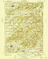
(7)- 1944 Map of Beardstown, 1959 Print
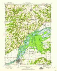 1944 Beardstown1959 Print · USGSBeardstown and the Illinois River valley are shown here in the mid-forties, capturing a landscape of shifting river channels and rural school districts. Genealogists can trace family names through landmarks like Griggs Chapel, McClung School, and Sheldons Grove.2 unique versions available
 - 1946 Map of Augusta, 1957 Print
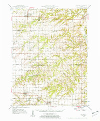 1946 Augusta1957 Print · USGSWestern Illinois farm country at the end of the 1940s is detailed here as the rail-and-river economy transitions. Genealogists can trace family names at Sherwood Cem and Woodland Cem, or locate rural landmarks like Mt Horeb Ch and Timewell PO.2 unique versions available
 - 1947 Map of Vermont, 1979 Print
 1947 Vermont1979 Print · USGSIn the mid-century period, the area around Vermont and Table Grove was shaped by military activity and mining. Local historians can locate the Camp Ellis Military Reservation and historic schoolhouses like Harvey Sch and Cox Sch.
 - 1948 Map of Quincy
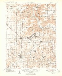
 1948 Quincy1948 Print · USGSThe Mississippi and Illinois River valleys are captured at a post-war crossroads as rail and river travel met the expanding highway system. Genealogists can trace family settlements from Quincy to Hannibal and smaller towns like Vandalia and Jerseyville.2 unique versions available
 - 1948 Map of Vermont
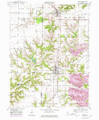
 1948 Vermont1948 Print · USGSWestern Illinois was transitioning into the post-war era when this survey recorded the massive Camp Ellis Military Reservation alongside established farming townships. Genealogists can locate family-named landmarks like Easley Cem and Mud Acre Sch.2 unique versions available
 - 1949 Map of Augusta
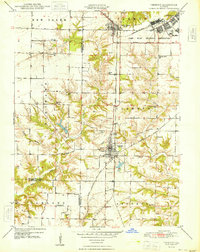
 1949 Augusta1949 Print · USGSWestern Illinois at the end of the 1940s reveals a landscape of tight-knit rural communities and school districts. Genealogists can trace family footprints across dozens of local landmarks like Sulphur Springs Sch, Woodland Cem, and Mound Station Timewell PO.
 - 1949 Map of Vermont
 1949 Vermont1949 Print · USGSFulton County and the surrounding tri-county area appear here shortly after the war, centered on the massive Camp Ellis Military Reservation. Researchers can trace the vanished barracks and rail spurs of the camp alongside rural landmarks like the Little Brick School and Bernadotte Bridge.2 unique versions available
End of results
Showing maps 1-7 of 7
Top cities of Schuyler County
- Rushville historical maps
- Brooklyn historical maps
- Littleton historical maps
- Frederick historical maps
- Huntsville historical maps
- Birmingham historical maps
See more
Frequently asked questions
- What are the different types of historical maps available for Schuyler County?
- What is the oldest map of Schuyler County?
- Where can I purchase historical maps of Schuyler County for my home or office?
- Where can I download high-res historical maps of Schuyler County?
- Are there historical topographic maps available for Schuyler County?
- Is there historical aerial imagery available for Schuyler County?
- Where are historical maps of Schuyler County sourced from?