
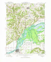
1944 Map of Beardstown
USGS Topo · Published 1959About this map
The Illinois River and its wide, lake-strewn floodplain dominate this 1944 revision, showcasing a landscape defined by the convergence of the Sangamon River just above Beardstown. The river valley is a complex network of backwaters and islands, including Stewart Lake, Crane Lake, and Knapps Island, indicating a rich riparian environment before modern levee and drainage systems fully transformed the basin. On the higher ground, a dense grid of rural institutions serves the farming communities, with numerous family and locality-named schools such as Fox Ridge School, Christian Neck School, and Lookout School. The Chicago Burlington and Quincy railroad follows the bluff line, connecting the river towns of Frederick and Browning to the larger upland settlement of Astoria. This survey documents a mid-century Illinois where small-town industry and rural school districts remained the backbone of the social and economic geography.
Find a feature on this map
98 named features on this map. Tap any name to fly to it.
Don’t see what you’re looking for? This feature index may not catch every label — zoom into the map to look around manually.
Map Details
Editions of this 1944 Beardstown Map
2 editions found
Other maps of this area

1912 · Macomb
USGS Topo · 1:62,500

1914 · Macomb
USGS Topo · 1:62,500

1918 · Vermont
USGS Topo · 1:62,500

1921 · Vermont
USGS Topo · 1:62,500

1923 · Rushville
USGS Topo · 1:62,500

1925 · Havana
USGS Topo · 1:62,500

1926 · Beardstown
USGS Topo · 1:62,500

1926 · Rushville
USGS Topo · 1:62,500

1928 · Meredosia
USGS Topo · 1:62,500

1929 · Arenzville
USGS Topo · 1:62,500